Thursday 30 December 2010

Wrekin Orienteers Choc-O - 30/12/2010


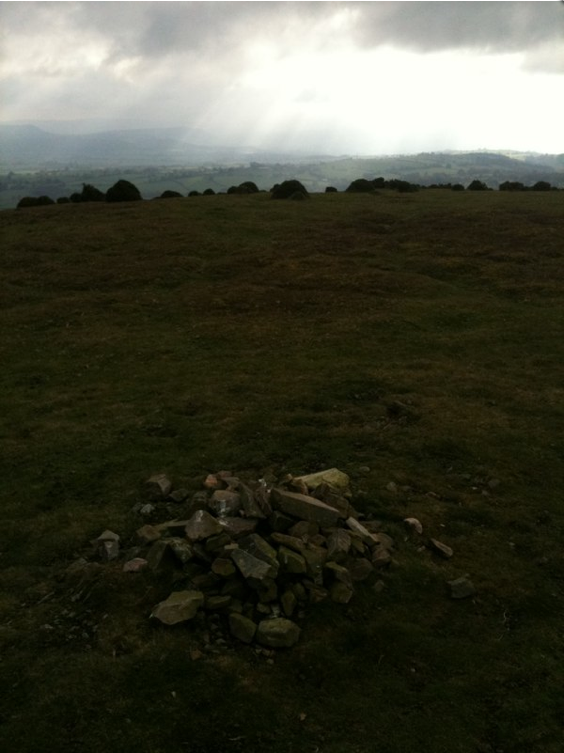
Knackered, after a long run and steep climb to CP5

This was the last run of the year (tomorrow's a rest day), and it was a toughie.

Wrekin Orienteers have set up two semi-permanent (here until the weekend, or maybe next weekend) courses up on the Long Mynd, starting from Womerton. The details are on their website: http://www.wrekinorienteers.co.uk/forms/Choc10.pdf

I will not divulge too many details of the long course route I followed yet (I'll probably add more pics of the controls and details when the courses are taken down), but here are the main lessons learnt.

1. Remember what the controls look like when you're searching for them. I saw the posts for CP2 from around 40m away in the mist, but didn't realise what they were and then hunted around for about 10 minutes trying to find the bloody control.
2. Check routes carefully. I took on too much extra distance on the route from CP2 to CP3, trying to reduce the ascent. If I'd looked at the map carfeully I'd have realised there was a more direct route with little extra ascent.
3. Knowing the ground helps - I ran from CP3 to an obvious CP4 in dense mist without having to do any navigation.
4. Pace distances to navigation waypoints, especially at the start of legs. I went over twice too far on the initial heading from CP4, and ended up on a steep bracken down slope with an extra 0.3 miles of running too, when I should have been running down an easy grassy ridge.
5. Thumb the map - i.e. keep your thumb on your location - saves loads of time when fine navigating.
6. Quick decisions help - I made over 3 minutes on a couple of guys on the short course by moving from CP5 quickly towards a good path in roughly the right direction and then making a route decision on the run.

Hopefully I can put this all into practise on the Kinder Trail if my entry has arrived and there's room...

Today I did 12.1 miles and 1,500' of ascent. For the record I took 2:48:00 from the car park to the final control. It was nice to see many others out walking and running, mainly on the short course. I met Lawrie Jones and Brian Clough at the penultimate checkpoint - nice to meet you both and thanks for taking the photo of me.

The total distance run this month is 120.3 miles (up 15 miles on last month) and this month's climbing was a paltry 15,950' (down 2,160' on last month). The reduction in climbing is down to illness necessitating more runs from home; the increase in distance is probably partly due to doing easier miles. Best innovation this month - the Tuesday night runs from Church Stretton.

PS: Choc-O is so called becuase there are chocolates at the final CP and its O-rienteering.

Wednesday 29 December 2010

Stretton Club Run - 28/12/2010


The post-Christmas run was just me and Mark Agnew yesterday night.

We picked our way up through the Rectory Wood (higher route - icy) and on up Townbrook Valley on melting snow with some ice patches. I found the going quite tough higher up and struggled a bit generally. We then went up to Boiling Well and onto the Portway, which was very slushy.

From the Portway we headed onto Haddon Hill, but lost the path in very poor (5 to 10m) visibility. From the point where we lost the path (just south of the north west top of Haddon Hill at SO 435956), we got disorientated surprisingly quickly, crossing the col between the two tops in an easterly rather than southerly direction. At this point we realised the fall of the land was on the wrong side of us and tried to relocate. Neither of us had map or compass, so we had to rely on the (poor) GPS in my phone. We headed south expecting to hit the steepening ground at the top of the slope down to Carding Mill Valley, and when we reached this we turned east and popped out right at the corner of the golf course fence (SO442953). A GPS track of our wondering in this area is at the top of this item.

From here we had a safe navigation handle (the fence) which we knew would lead us across Bodbury Hill and Stanyeld to the path above the golf club house. The descent of Stanyeld was extra slippery and more dodgy than usual.

When we got back to the car park and realised I'd dropped the car keys somewhere, so Mark kindly helped me search back in a few obvious areas, but didn't have much success. A very kind Mrs Agnew took me to Shrewsbury for the train to Telford and a cab home, and I retrieved the car this afternoon with the spare.

So the run was a good learning experience - keys need to be VERY secure (much better than in the clippy thing on my OMM bum bag), and the Mynd is a pretty confusing place in 5m visibility however well you know the route (I've run over the spot we lost the path three times in the last four weeks). ALWAYS take map and compass in poor visibility - we knew it would be murky and should have had one.

Todays stats were 7.1 miles and 1,200' of ascent. The Kanadia TR3 shoes go on impressing - I think the grip is better than the TR2s were when they were new.

Monday 27 December 2010

Pace Run from Home - 27/12/2010

Just a quickie today. I thought I'd try some speed training, but conditions (rain, slush, ice) waren't too good for intervals, so I went for a pace run, aiming to do a fast 5k.

This was my usual route around the block, the first mile is across and along the edges of fields, then half a mile on partially cleared tarmac, and a mile and a half on icy unsurfaced road, before a warm down along icy tarmac road.

I made it to 5k in around 27:10 (pretty fast for me) and then jogged the last half mile back home.

Total distance 3.6 miles, 60' of ascent, 31:20.

Sunday 26 December 2010

Lilleshall, Boxing Day - 26/12/2010


Very cold looking Lilleshall Hill. It wasn't that dark really.

I was going to do the Davil's Chair Dash, but woke up with a pretty thick head and bad guts (the former due to a cold, the latter being the inevitable result of sprouts and stuffing). So I chilled in the morning, tidied up yesterday's debris, and headed out around the village just after two.

I varied the usual route a bit, going through Cheswell Grange to the Red House, then up through the clay pits to the incline and on to Lilleshall Hall. From here I headed along the golf course drive and down Abbey Lane, turning back into the village. I cut through the Churchyard and up Lilleshall Hill, where I took another pic, similar to one of Friday's.

Finally I headed home via the clay pits, Red House and Cheswell Drive.

I kept it really steady all the way today, hoping that I'd not slow down the recovery from my latest cold. That said, I felt pretty good and averaged not much over 10 minutes per mile. The total today was 11.6 miles and 640' of ascent.

This week's been busy, I've been under the weather, and I only got out three times, so I'm satisfied with 25.5 miles and 2,140' of ascent. I should be able to up the mileage and climbing this week, especially if I can finally start to beat the cold. I'm planning to get out for the club run on Tuesday night (probably around 7 miles), then run again on Thursday morning (hopefully the Wrekin Orienteers Christmas Choc-O course on the Long Mynd - around 9 miles) and then it's the Morning After race on Saturday (5 miles). I'll have to get out on Sunday for a longer one (ideally at least 9 miles).

The four week rolling total is 102.1 miles (up 1.5 miles) and 13,280' of ascent (down 1,450'). I really need to start building some more climbing into the routine before the longer steeper races start in March.

Lilleshall, Christmas Eve - 24/12/2010


Tiny bit chilly on top of Lilleshall Hill

I'm still struggling with colds and what-not, but wanted to get out after I'd finished work and got the last few bits of Christmas supplies in.

This was a good steady run round the village, with a few efforts on the short uphill sections. I took a couple of pictures on Lilleshall Hill, twenty minutes or so after sunset.


7.7 miles, 340' ascent in 01:20. The new Kanadia TR3s were very comfortable, and it's nice to have some trail shoes with decent grip again.

Tuesday 21 December 2010

Stretton Club Run - 21/12/2010

I almost didn't go over to Church Stretton tonight when I saw the forecast for heavy snow starting at 6pm over there, but I'm glad I ignored it - we had a great run about tonight on fresh powder snow.

We went up through the Rectory Field and then up onto Ashlet. The traverse over to Yearlet was good, but the path on up to Boiling Well I found it hard to get into a rhythm because of the snow. The run over to Haddon Hill was fine, and I managed not to fall over in the col between the two tops tonight!

The descent from Haddon Hill to the golf course fence was sublime on fresh powder, slip sliding and galloping down. We came down the wider of the two ridges from here, which was slippery with some ice under the powder, but the view of Cardingmill Valley was amazing: we stopped twice to turn torches off and just gawp. This is why I run on the fells - you just get to amazing places at times and in conditions you would never experience otherwise...

A quick dash across the Burway and down through the Rectory Wood finished the run off nicely.

Happy Christmas everyone!!

6.2 miles and 1,160' in about 1:27.

PS: This was probably the last serious run for my over-worn Kanadia TR2s - the TR3s arrived today and I'll use them once I've had chance to check out the fit around the house.

Sunday 19 December 2010

Lilleshall Frosty Run - 19/12/2010

Very frosted tree quarter of a mile from home

Today it was time for a long gentle run, and I woke up to a winter wonderland after yesterday's snow, with the temperature around minus eight.

I ran from the house today to save driving, so set off for a tour of the village.

Another tree with hoarfrost on the farm lane

Telegraph poles, mist and sun at Cheswell Grange

In the woods near New House Farm

Looking north towards Pitchcroft

Finger post at Willmoor Lane

Looking back down the Incline (former canal)

Up by Abbey Lane

The Hill, from Wellington Road

After 8.8 miles, scenic as it was, I was not managing to stay warm and we needed to try to get out and about in the afternoon, so rather than put a fleece on, I called it a morning. There was only 400' of ascent today, but it's been a big climbing week before today. I had a great time out there though.

Just a few thoughts for the guys who were out overnight on Friday night trying to do winter BGs in pretty tough conditions. I cannot even start to comprehend how you could set off with sufficient drive and self confidence that you could get more than one leg donw, let alone push through as far as Bowfell. Awesome. Better luck with the weather next time guys...

My weekly total is 29.3 miles and 5,150' of ascent. The four week rolling total is 100.6 miles and 15,280'. I could do with upping the distance and the climbing a bit if I'm seriously going to have a chance at a BG in 2012, but the racing prep seems to be coming on well.

Friday 17 December 2010

Stretton Skyline Part Deux - 17/12/2010

Climbing towards Caer Caradoc

Took Friday afternoon off - it was gorgeous sunny day with a thin carpet of fresh snow. I decided to do the second "half" (more like two-thirds) of the Stretton Skyline route I'd started on Saturday but had to cut short.

It all felt very comfortable and routine, taking things steady over Caer Caradoc and the Lawley.

Looking back from the Lawley towards Caer Caradoc and the Stretton Valley

The traverse across the fields to Dudgeley Farm was quite tough with all the meltwater from last week partly frozen and the field surfaces very rough. I'd decided the aim today was to try to run the whole route except the short steep pulls up Caradoc, at the bottom of the Lawley, and on the short really steep bit of road climbing out of Gogbatch. I took it easy up the path from Dudgeley into Gogbatch and then managed to run the entire ascent to High Park and the top of Mott's Road.

The descent into Cardingmill Valley was a little slippery, so I eased off a little, but managed a quick mile or so once on the road.

11.1 miles and 2,470' of ascent in 2:20:37, considerably quicker than the race time. If I can tie it all together, last week's time and this would take me under 4 hours (I did the race in 4:16) and I'm certain that in a race I could take another 5 to 10 minutes off that. It's really nice to be feeling like I'm making progress.

NB: My trusty Kanadia TR2s are pretty much dead - the uppers are both cut on both sides behind the toes, so I've ordered some TR3s. I hope they are as good - the TR2s have been super comfortable.

Wednesday 15 December 2010

All round the Wrekin - 15/12/2010

I managed to fit in a quick run tonight between work and the office Christmas do. Starting at Forest Glen, I headed up the spur left of the scree gully to Halfway House, and then descended Beeches to the Rifle Range.

From there I ran round the Wrekin, across the col between the Wrekin itself and Little Hill, finishing down the main drag, with a warm down loop round what I call Big Buckatree Pool.

The was very fine snow falling throughout the run. My new Petzl Myo headtorch is a huge improvement on the old Tikka Plus - thanks, Mum!

4.2 miles and 1,180 feet (from the 1:25k map contours). The GPS in my iPhone only recorded 484 feet of ascent though - strangely it gives a much better track in the x,y sense than it does for altitude where there's tree cover.

Stretton Club Run - 14/12/2010

Another club night at Church Stretton. We had more people out this week (12) but not such magical conditions (dull and slightly drizzly).

We ran what I'm told is the route of the "Morning After" race, which I'll try to get to on New Year's Day.

Starting, as usual, at the Co-Op car park, we ran up through the Rectory Wood to the Townbrook Valley reservoir, and then on across the Burway down into Cardingmill Valley. We went on up the path around the end of Stanyeld and across the golf course to climb the south face of Nover's Hill. A descent into the Batch followed by a short climb up Cwmdale brought us back onto the golf course and the Stanyeld path. We went back into the town past the finish of the Skyline on the cricket field.

I had a good chat with Helen Skelton about the Newport & District Fell section and her (rapid) progress since she took up fell running. It was nice to chat with a few of the others too.

Not a very heavy evening this week, with only about 5.2 miles and 1,100 feet of climbing.

Sunday 12 December 2010

Cannock Chase Fast 5k - 12/12/2010

A quick run on the way back from seeing my brother's family in Leicester.

Mum's given me a new Petzl Myo headtorch for Christmas, which (sorry Mum) I opened early because I really need it now!!! I thought I'd try it out...

I started at Beaudesert and ran across to Castle Hill, doing a couple of laps of the fortfications here and returning. I felt strong climbing - there's no need for walking now - last time I was here was in the Spring and I was still having to walk sections...

3.4 miles and 520' of ascent in 33:10.

This week's totals (not helped by resting from Wednesday to Friday) were 22.6 miles and 4,200' of ascent. The four week total goes up, to 101.7 miles and 15,480' of ascent.

Next week's aim is to do a couple of mid-distance easy runs with good ascent, and a decent weekend long slow run. If I can get back to the 30 miles and 5,000' mark that'd be good.

Truncated Stretton Skyline - 11/12/2012


The wonderful path down past Callow with Ragleth Hill right in front.

I thought I had the day to myself so had planned originally on trying a Gill Harris Challenge run, but then didn't get up particularly early, so realigned my training idea for the day to a steady paced Stretton Skyline. With all the running I've been doing recently I should ba able to improve on my race time of 4:16 from early September.

I set off at a nice steady speed up Cardingmill Valley. There's still some ice on the paths, particularly by the Lightspout waterfall (I scrambled up the heather here). Just at the turn into the side valley I got a call that I was needed back in Telford, so I decided to cut the session short after Ragleth Hill which'd get me back to town in time.

I kept running right the way on the climb up to Pole Bank, making this point in 34:23, just inside the cut-off, but with some comfort. I took it steady coming down the Callow path too, stopping to take a couple of pictures.

Centre frame are Caer Caradoc and the Lawley, ascents 3 and 4 on the Skyline

I ran the ascent of Ragleth to the stile, except for the steepest 20 yards, and hiked the rest pretty quickly and with no stops. The time to the checkpoint here was 01:23:12, three minutes outside the race cut-off and the easily the fastest I've done to date. If I keep training I'll have no problems here next year. A quick and committed descent got me to Sandford Avenue in 01:37:12.

Distance today 7.9 miles and 1,670' of ascent. I also jogged just over a mile from the car on Watling Street to the race start, so call it 9 miles.

Tuesday 7 December 2010

Stretton Club Run - 07/12/2010

Another really excellent evening run tonight, mostly on snow, with the odd bit of ice.

Eight of us met up in the Co-Op car park at Church Stretton. We headed out up onto Burway Hill, trying to stay on the ridges to avoid the worst of the black ice on the busy paths in the batches.

We followed the path on up to the top of the road and then onto the Portway, across to Haddon Hill. I had a minor spill in the col between the two tops but luckily rolled and was straight up and running again. The drop down from Haddon was a bit icy - I whacked through the heather and soft snow in preference to the path.

We wound our way down gently through the golf course using their tracks to reach the path which winds round the end of Stanyeld into Cardingmill Valley. Andy D had a nasty spill on the black ice here. We picked our way carefully back down to the road and jogged back to the car park.

I really enjoyed this night out, feeling reasonably good all the way round. The mudclaws seemed to give me less grief than on the Wrecker - maybe the preventative Compeed is the answer.

7.3 miles, 1,200' of ascent, lots of the running on ice and some soft snow.

Monday 6 December 2010

Awesome Iced Wrekin Night - 06/12/2010

Sometimes it just takes your breath away...

Not the running (there was too much ice for much of that) but the amazing variety of nature. Tonight I was treated to ice crystals suspended and glinting in the night air, the tips of tree branches so hoar frosted that they almost shone, a temperature inversion so noticeable I could feel it getting warmer as I plodded up and much colder as I jogged down, and creamy mist hanging over most of Telford like dry ice.

It made the effort of dodging the black ice worth it...

A very slow 2.9 miles and 710' of ascent, but an amazing experience out on the fells.

Sunday 5 December 2010

Cardington Cracker Marshalling - 05/12/2010


Steve Cale, leading Andy Davies narrowly at Comley

Still feeling a bit rough from the cold I've had this week, so I decided to help out and marshall at this race.

The RO asked me to look after the road crossing at Comley Farm, so I jogged over from HQ at Cardington, arriving at about 11:05, which gave me ten minutes to get sorted out.


Runners descending the Lawley toward me at Comley

The runners come off the Lawley down a farm lane with a sharp left hand bend about 30 yards before the road crossing and this was absolutely black ice, so I stood on the corner for the quicker runners, shouting warnings about the ice and asking them to take care on the road crossing. As the field went through I reckoned the road was the greater hazard for the slower runners so I moved down there after a bit. I managed to take photos of many of the runners, and they are posted here.

When the last couple of runners came through I decided to follow them through to the next checkpoint and collect the flags and signs up. The next check was at the road under Caer Caradoc and was manned by a lady and her daughter, so I thought I'd carry on with the back markers and remove the flags on the ascent of Caer Caradoc.

Caer Caradoc from Comley - you can make out runners near the top

At the top one of the back markers decided to call it a day, so he went down with Chris, the summit marshall, by an easy route, and I continued on down the race route to collect more flags.

Collecting flags on the summit of Caer Caradoc

At the bottom, I picked up the path through Cwms and jogged back over the col to the road at Willstone and back into Cardington.

I ended up running 7.2 miles and 1,510', but mostly at a very slow pace, following the tail enders and carrying a fairly heavy sack.

My total distance (24.7 miles) for this week is ok considering most of it has been wiped out with a head cold, but I haven't been able to get the climbing in (only 2,340' this week, about half the quota). Next week should be better!

The rolling four week total includes a couple of poor weeks and is the worst it's been for some time at 96.3 miles and 14,470' of ascent. BUT... the Christmas break is coming up soon, and I may have a go at the Gill Harris round on Saturday if the weather's ok.

Saturday 4 December 2010

Lilleshall Hill - 04/12/2010

Almost a monochrome Monument

Well, yesterday was a complete write off - you know how it is on the worst day of a cold. Today I'm with a cough and a bit bunged up but I don't have the headache and runny eyes any more.

I decided this morning that the Cracker was probably a write off so I'll have to settle for 200% on the Mercia Champs. However, I'd like to put my bit back for the year so I rang Paul Sanderson and offered to marshall. I'll be standing at Comley Farm watching the road crossing there from about 11:20 until 12:00 (hopefully that'll be the last runner). I may then sweep through part of the remainder of the course.

This decided, I thought I'd go out for a bit of a run today, just to keep things ticking over and get some fresh air. I set out to run for an hour around the village.

I was aiming for an easy pace but was presently surprised to be doing 10 minute miles (despite slush, ice, and slippery trails) and feeling pretty good. I did the last 1.5 miles in the minimal neoprene beach shoes. I almost regret the decision not to run at Cardington, but I think I should look after myself just this once.

7.0 miles, 260' in 1 hr 10 min.


Short snowy run - 02/12/2010

That's be the Wrekin on the skyline

Just the same circuit as yesterday, but in reverse!

Felt worse today - on the downward slope with the cold I think. Hope it's gone in time for the Cracker.

3.50 miles, 70', 36 minutes.

Wednesday 1 December 2010

Pace Run in the Snow - 01/12/2010

Last couple of hundred yards across the field

Aim today was two-fold: firstly just to get out, with a bit of a head cold, sore throat thingy going on. Secondly to do a steady and fairly easy pace run at the kind of speed I'd do in a longer race, but without the hills.

Just ran around the fields and lanes near home. 3.5 miles; 60' of ascent (well, it is pretty flat if you don't go over Lilleshall Hill way); 34:25.

PS: Last month's totals were 105.3 miles and 18,110' with two races (Time Trial and Wrekin Wrecker), compared with 131.9 miles and 23,860' for September, also with two races.

Monday 29 November 2010

Around the Wrekin - 29/11/2010

A short headtorch recovery run, starting at Forest Glen, and going anticlockwise around the Wrekin, passing between the Wrekin and Little Hill (so the shortest option). I had to be a little careful down the last section on the "main drag" which is icy in parts.

I deliberately kept this very steady. I wanted just a gentle shake out after the Time Trial and I'm being careful not to overdo it this week before the Cardington Cracker. The conditions underfoot helped me keep a steady pace. By the end of the second mile my aches from yesterday had gone.

I really want to keep things fairly gentle this week so I'm aiming to get another couple of runs at around the six miles mark, each with no more than 1000' of ascent in either Tuesday or Wednesday and Thursday or Friday. I wasn't fresh enough this week to give the Time Trial everything and had to back off a lot on the ascent to Stiperstones when I could have been running if I'd been fresher. This can't happen in the Cracker - I've got to improve on my 63% from Ragleth Inn to get my score in the Mercia champs up as high as I can.

3.5 miles and 440' of ascent today (both probably underestimates, particularly the ascent - my GPS didn't even register the switchbacks on the back of the Wrekin tonight). Time was 43:39 for the record, or 12:26/mile.

Sunday 28 November 2010

Time Trial - 28/11/2010

Team Mercia - Paul Flinn and yours truly starting
Photo by Colin Williamson of Mercia and Shropshire Shufflers
(more of his time trial pics are here)


An excellent morning's run from a very cold Little Stretton to an equally chilly Stiperstones.

The Time Trial is a point to point with starts a minute intervals. We parked up at the Stiperstones Inn and took the coach back to Little Stretton, where we joined the queue and registered. Our start time was 10:10, giving me just long enough to get a Compeed over the blister from the Wrecker and then get over to the start.

We went up Ashes Hollow fairly quickly (for me) running pretty much all the way. Paul kindly let me navigate and in return I let him take it easy (he's a lot quicker than me). I didn't mess about with alternative routes at the top, just blasted out onto the road and used the short linking path to get onto the Bridges road.

Paul Flinn near the Shooting Box on the Long Mynd

We passed John and Geoff Sproson, organisers of the excellent Devil's Chair Dash, on this section. A little way past the Shooting Box, a good path leaves the road and cuts the corner down towards Ratlinghope. A few hundred metres steeply down the road led to a T junction where I nearly came to grief skating about on black ice. We cut down to the river where we met Pauline Richards, and then continued on past the turn to the Bridges pub (sadly shut at the moment).

On the next section, a short climb and then a fairly level road section to the Hollies, I felt quite low, probably as a result of overdoing the run on Friday. I had to walk some sections that were not at all steep. Soon enough we were off the road and jogging and hiking up onto the Stiperstones ridge.

The descent was pretty slippery and I felt best attacked fairly hard. I always seem to fall less when I'm pushing downhill. We passed another pair on the lane about 300m from the finish.


I was fairly pleased with the run, but it wasn't up to the standard of the previous week, despite the harder conditions. The total distance was 9.0 miles with 1,730' of ascent; our time was 01:40:23 for a 74%. We were fourth male pair out of twelve.

This week's totals (with maybe too much intensity if not too many miles after the Wrecker): 24.0 miles; 3,590'.

Friday 26 November 2010

Championship Race Entered - 26/11/2010

This confirms my entry for my first ever Championship race. I wonder if I can get in the top 40 M40s and score a point? Probably not.

One thing to note - this is an amazing sport - the entry above me in the list is none other than fellrunning superlegend WENDY DODDS! How many other sports do you get to be in the same event as someone who's won almost every English Champs age group section she's been in?

PS: ran home from work - felt good tonight and this was quite quick for an easy run: 6.4 miles, 170 feet of ascent, 58:30.

Thursday 25 November 2010

Edale Skyline - 2011


This is absolutely the highest I will ever appear on any list relating to this famous race. Entries now open. I've got work to do to make sure I stay fit enough to get round to Mam Nick in time (done once) and add a bit of speed in case of adverse weather conditions.

Almost can't wit 'till March, but I need the time to get some fast miles in!

Wednesday 24 November 2010

Kinder Western Edges - 24/11/2010


Not sure about that expression! Self portrait at Kinder Low

Well, a couple of days and a big Compeed have sorted out the damage from the Wreker, so it was out again this afternoon for a quickie on the way back from inspecting broken bits of canal in Manchester.

I drove round the M60 and out to Hayfield, parking up at the Bowden Bridge car park where the famous 1932 mass trespass started - kind of the home of the Right to Roam.

I ran up along the banks of Kinder Reservoir.

Kinder Reservoir

The ascent of Williams Clough is nice and steady, although with a rough path. There are steps at the end of the valley and that's the only bit I walked, although I was deliberately taking it as steady as I could. My route turned right and climbed another short steep section onto the edge of the plateau. A mile on from here is Kinder Downfall.

The light was no good for the classic downfall view, so here's one of the north side with Kinder Reservoir nestling in the valley.

Sunshine just emerging from beneath the clouds south of the Downfall

It's a mile and a quarter of undulating running on a rough path south to Kinder Low. I stopped to take a quick photo or two, but it was a bit chilly to linger as a breeze had got up here.

Trig point at Kinder Low with hoar frost. Ringing Roger on the skyline.

The route back to Bowden Bridge needed a couple of quick looks at the map, but is straightforward. I followed the main path down to the point where the Brown Knoll and Jocob's ladder paths meet, and turned right past Edale Cross initially up a short steep rise and then down a very rough cart track over Oaken Clough. The rough path continues on down to the River Sett, where a short section goes through a field with Highland Cattle to meet a paved road which can be followed back to Bowden Bridge.

Felt fairly controlled, not too tired after Sunday, but a little sore in the achilles and had a sore right shin in the car later. Good stretches after though (forgot on Sunday).

8.6 miles, 1,690' of ascent in 2h 1 min. A very steady pace but that included several minutes of stops and I was actively trying to take it easy and run at recovery pace.

Sunday 21 November 2010

Wrekin Wrecker Race - 21/11/2010

Recovering from the final ascent and preparing for
a very steep few hundred feet of downhill
Photo courtesy Al Tye (http://www.fellrunningpictures.co.uk)

Just back from another great morning's running - thanks to Newport & District Runners, who certainly put on a well marshalled event. The Wrecker has a pretty convoluted route, looping two and a half times round the Wrekin. It's 8.1 miles and 2,400' (AM) but visits every single rough gnarly bit of the hill.


Route and elevation / pace chart. The spike on the pace line is the very steep ascent of the Goaty path. The profile doesn't do the switchbacks on the runout at the end any justice at all. My GPS reads well under on distance, particularly under tree cover.

I started well enough (the start was from the Rifle Range this year) and put in a storming descent of the scree gully form Halfway House, overtaking at least 10 and maybe 15 runners on the way down. I was very glad I put on my Mudclaws as it's so slippery down there. I think I might have slightly overdone it because I felt very jaded on the next mile to the start of Goaty. This ascent is brutal, but easier when there are people to follow and you find the path.

As I reached the top something which turned out to be Steve Cale streaked past at almost supersonic speed, having already done the next climb. I love the descent of the BMX and passed three or four more. It's a superb single track which is often very slippery at the top. From the bottom the path climbs up Beeches which is steepish but runnable. However when I got back to Halfway House I felt very tired and had to hike most of the rest of the way back to the summit.

The final big descent is also very steep and I passed another couple of racers and caught the group in front of me, overtaking them on the way off Little Hill. It's single track for the first 200 yards so I waited and rested and then had them on the wider section lower down.

I had a very good runout, following Delwyn Williams who set a good pace and only walked a couple of the very steepest bits on the switchbacks. It must have been good because I stretched out between 15 and 75 seconds gap in a mile on the group I'd passed on the Little Hill descent. The finish was at the gateway onto the road, very welcome...

Nice to see and chat with Rick Robson (in the first mile - he must have lit the afterburners after the top of Heroes because he finished 15 minutes ahead of me ); Keith Campbell, a colleague of mine who made a very fine fist of his first (I think) fell race and gave me a scare when I looked round at the top of Goaty and he wasn't far behind; and John Nightingale (Lightning of these parts) who's been on the beer not the trails otherwise I wouldn't have beaten him.

The presentation was fun, and I had another good chat with Steven Cale - an all round nice guy who always has time for the also rans like me...

This is a hard race, and I was pretty satisfied with 1:31:24 for a 70%.

8.1 miles and 2,400' giving a weekly total of 30.4 miles and 5,350' and a rolling four week of 106.9 miles and 19,620': up 1.1 miles but DOWN ten whole feet :-(

Supposed Recovery Run - 20/11/2010

I wanted to get out and stretch my legs after doing a lot of jobs around the house and just to keep moving before the Wrekin Wrecker. So the aim was a gentle run around the village. I didn't have enough discipline I'm afraid and ended up enjoying being out too much. I got a tiny bit lost round the fields at the back of Willmoor Lane. I followed a few margins around to reach the main road at a stile just south of Pitchroft Lane, then came back via Cheswell Grange.

5.1 miles, 200', 49min.

Long Mynd - 18/11/2010

Looking down the valley between Yearlet and Ashlet

Finished work early on Thursday and took a bit of leave time partly to get some daylight training in over on the Mynd.

I ran in fairly constant rain up from the town via the bottom of Carding Mill Valley and the Burway to Burway Hill, and then around the head of Townbrook Valley and up to Ashlet. I think I've finally found a good way down into Ashes Hollow. Double back from the top heading north, and find the top of the re-entrant about 300m away. I actually went about 700m and went down the main valley, but the re-entrant looks goood from the bottom. Much better than the gorse further along the west face or the really steep south ridge.

I then headed up Ashes Hollow right to the top - this dragged and I felt weak but kept running (just about...). As I topped out of the hollow, the rain finally stopped. I continued on up to the top of Pole Bank where a tiny gap in the cloud opened and I was bathed in sunshine for about a minute!

Sunshine and dramatic light, Pole Bank

On over the summit of Pole Bank and past the Shooting Box to Haddon Hill (always forget this has a short but steep ascent between the two tops), Bodbury Ring and finally Stanyeld. I fell on the way down Stanyeld, but as usual had no trouble and was up and running again very quickly. Must find some comfortable shoes with a bit more grip though now the winter's here. The path round from Stanyeld to Carding Mill Valley is superb and very fast...

10.1 miles, 1,790' and 2hr 09min.

High Peak Trail - 16/11/2010

I was in Matlock for an interview for a new project for Derbyshire Council, and managed to get in a run as it got dark before heading home. I parked up at the Middleton Top visitor centre and ran the final bit of the High Peak Trail I'd not done - Middleton Top to High Peak Junction.

This goes down two steep (about 1 in 8) inclines to reach the canal in the Derwent Valley, with a fairly level section in between. When I got back to Middleton I topped the distance up to six miles and then swapped into the minimalist "almost barefoot" shoes and did another mile.

Nice running on a good trail: 7.1 miles, 960' in 1h 17min.

Monday 15 November 2010

Stretton Training - 14/11/2010

I had been intending to do the Roaches Race but circumstances conspired against and I popped over to Church Stretton for a long run instead.

I started with the first two acents of the Stretton Skyline - Pole Bank and Ragleth Hill. Felt pretty strong, ran well and was within myself all the way round. The descent of Callow was particularly pleasing. I'm really attacking the steeper bits now and reckon I could take at least a minute off the Ragleth Inn race pace from August just at training speed.

I got back into Church Stretton eager for a bit more, but didn't want (or have time) to go round the whole Skyline so I popped up through the Rectory Wood and climbed Townbrook Valley. This is pretty much relentless and the last half mile to the col west of Yearlet ramps up considerably, the whole climb being sustained and climbing about 720' in only a mile and a half. Again I ran all of this (some effort required towards the end) and managed to keep going on up to the summit of Ashlet fairly easily.

I wanted to try to recce a better way of Ashlet and into Ashes Hollow for the Gill Harris, so tried heading just east of south from the top and going down the fenceline to Ashes. Once the fence is joined, it's gnarly, steep and very slow going for nearly half a mile (although there are sketchy bits of path aroun 50 yards right of the fence). Now convince the best option is to double back towards the col with Yearlet and go down the valley between the two. Rather than going up the east spur of Grindle and then on to Nills I think from Ashes a better approach may be to take the footpath marked on the 1:25k OS map up onto Nills and then do Grindle. Anyway, forewarned is forearmed or whatever...

I also managed to find my way onto the path from the ford at the bottom of Ashes Hollow to the bottom of Cunnery Road - this avoids any road bashing between Little Stretton and Church Stretton, at the cost of a couple of short ascents (each around 120'). A nice jog back down the Rectory Field and through town to the railway bridge finished the morning off.

13.7 miles, 2,800' of ascent in 2:53:15 (would have been probably 5-10 minutes faster if I came off Ashlet via a less deperate route).

It's been a bit of a disappointing week in terms of time out etc., but then I reckon I could have done with a light week. Total this week is 17.2 miles and 3,190'; and the rolling four week drops by 16.2 miles and 1,780' to 105.8 miles and 19,630'.

Hill Intervals - 09/11/2010

The one and only midweek session this week - rubbish, due to being way too disorganised.

I did two "circuits" up and down Redhill Way near the Donnington Asda, late on in the evening. The first was a warm up, and on the second I did three hard 90 second efforts on the climb and jogged back down to warm down.

Pace on the efforts wasn't particularly consistent (08:00; 06:56; 08:30), but I did do 90 second recoveries in between UPHILL. I had sore shins afterwards. This was the first occasion I'd run entirely on tarmac or in my road shoes for some time.

Overall pace was almost exactly 10:00 per mile (some very gentle jogging to warm down). Distance 3.7 miles, ascent 390'.

Gill Harris Recce (2) - 07/11/2010

Long Mynd Ponies near Boiling Well

I spent a lovely day out on the Stretton hills doing a recce for the Gill Harris Challenge mentioned in a previous post.

I parked up on the Mynd at Boiling Well, just in case I needed to return to the car for supplies or to bail out. The aim today was a recce of the southern two thirds of the Gill Harris Challenge Round.

I dropped down Townbrook Valley to the Square in Church Stretton, then ran up the Burway Road past the cattle grid and hiked up Burway Hill.

Devil's Mouth from Burway Hill
(I think the checkpoint properly is the top of Devil's Mouth)

From here I used the lovely trod to skirt Devil's Mouth to the south, and then took the path around the head of Townbrook Valley and picked up good sheep trods direct to the summit of Yearlet.

Cairn on Yearlet, looking north

Ashlet is a short run away on good paths.

Callow from the summit of Ashlet

From here I aimed to drop into Ashes Hollow and then climb to Grindle. There are no good descents from Ashlet summit itself - even the gentler eastern slopes lead to a horrible final 100m of descent into the Hollow. Today I tried down the west side and very rapidly got slowed down by the very steep ground and extensive gorse. The best answer is to go back north along the path 200m then head west into a re-entrant that leads down into the pretty valley between Ashlet and Yearlet, then to follow this south into the Hollow. One to try next time.

A spur just north of a stream leads straight up toward the summit of Grindle.

Looking back down the spur on Grindle
to the west and south faces of Ashlet

The last couple of hundred metres are a bit heavy going through heather.

Cairn at the summit of Grindle

I'm not 100% sure where the next top, Nills, actually is. I opted for the higher of the two mounds east of Grindle - this certainly ties in with the grid reference given in the article about the round on the Mercia website.

Summit of Nills, looking towards Yearlet and Ashlet

I then picked up a good path heading round the top of Small Batch, crossed the main path up from Little Stretton and jogged up to the top of Callow.

Callow, looking across Nills to Yearlet and Ashlet

Weather closing in on Callow

From Callow I decided to sacrifice an increase in distance to reduce the climbing - lazy, and a bad choice. I should have dived off across to Packetstone Hill instead of running back up the ridge to Round Hill, never mind, I know for the real deal.

Summit-ish (it's vague) of Round Hill 

I got back on the main path up to Pole Cottage (another navigational mistake costing lots of extra distance - I should have cut across the top of Callow Hollow). Picking up the road, I headed south for three quarters of a mile and then out along the next ridge to Minton Hill, another vague rise in a sea of heather, but fortunately close to the path.

Minton Hill, looking towards Pole Cottage and Pole Bank


Looking across to Yearlet, Grindle and Callow

From here it's five minutes down the path to Packetstone Hill.

Shooter's Knoll from below Packetstone Hill

Another short jog mostly down leads round a few rocks and up a short rise to Shooter's Knoll. 

Strange object in foreground, Shooter's Knoll

I retraced my steps 100m to the head of a little vally north of the top of Shooter's Knoll and descended this into Minton Batch. Following the batch down past a very scruffy looking farm, I crossed the stream at a footbridge and took the bridleway up past a cottage and through a wood into a steep pasture. Aiming for the trees works here, and a gate leads into forestry.

View back to Shooter's Knoll from the top of the pasture

I followed the forestry tracks up from here to reach the Knolls trig, which is 150m east of the path as it leaves the wood. From here I ran directly along the Port Way (and it's little alternative at the glider club, the Starboard Way, back to the road. A long slog took me past Pole Cottage and up to Pole Bank.

I then headed past Boiling Well to the top of Long Synalds (between the Burway Road and the path), and cut back past the car to the Shooting Box top. By now I was heading away from the car and I decided to call it a day.

The recce was useful, and I'm settled on the following order for an attempt at the round:

Burway Hill; Yearlet; Ashlet (descend to Ashes Hollow)
Grindle; Nills; Callow (down to Callow Hollow)
Packetstone Hill; Shooter's Knoll (down to Minton Batch)
Knolls; Minton Hill (cross top of Callow Hollow)
Round Hill; Pole Bank; Long Synalds; Calf Ridge; Shooting Box; Wild Moor; Haddon Hill
GH Memorial Post; Plush Hill; Castle Hill; Novers Hill; Bodbury Ring; Stanyeld (see previous recce)

The total distance today was 18.2 miles and about 3,500' (my phone ran out of battery so the GPS track stopped a bit before I did). The weekly total was 30.2 miles and 5,540', giving a rolling four week total of 122.0 miles and 21,410' of ascent (down 0.4 miles and 590' on last week's rolling totals).