Monday 26 September 2011

More Hike Recce - 25/09/2011

On top of the world (well the Stiperstones anyway) in my Mercia top -
bring your own sunshine!
I did a little more recce for the Hike yesterday, but this is really into the finessing stage now.

First effort was to start in White Grit and climb Corndon Hill, then check out the wide right descent route Andrew and Prue had used earlier in the week. I ran a couple of variants at the top of this but have settled on following the fence round the corner and then just going straight down the path at the second waymarker. I passed a couple of groups of three mostly walking, also out on reccies.

At the bottom turning left through the gate leads to a metal gate in the corner of the field and avoids the need to electrocute oneself...

The second recce was really just being sure of the effort required on the road. I started at Bridges and ran to Stiperstones summit (mostly runnable, I only walked briefly about three times on the steepest sections). You can stay on the verge or run in the fields for about half the distance. Walking the last section up to the Stiperstones checkpoint is probably advisable, given the roughness of the path.

Coming down I ran two nine minute miles fairly easily: I doubt this will be the case on Saturday!

I walked into the Bridges pub and Terry (one of the Hike organisers) bought me a pint! Shortly afterwards one of the walking groups I'd seen earlier on Corndon turned up and we had a nice natter. See you all on the big day, folks!

Stats were 9.3 miles in total and 2,220 feet of climbing in almost exactly 2 hours. This week's total (I've started keeping count again) was 46 miles and 8,500' of climbing.

Sunday 25 September 2011

2 more Hike reccies - 21/09/2011

No wonder Newport runners don't win fell races if they do this on every
summit! Lisa, Andrew and Prue having fun on Corndon Hill. Don't ask how
many times I had to get them to do this before I pressed the shutter release
at the right moment!
These were the final long recce runs for the Hike.

The first run was with Em. We left her car at Stiperstones and went over to Bank Farm in mine. We ran through Easthope Wood and Snailbeach (stay at the wood's edge, across the road, old railway and then sloping footpath to the road) and then on up the road to Tankerville. It's noticable how much easier the uphill road bits are when you've got a bit of company and are chatting away.

Then it was across the fields and back onto the road to the Shelve checkpoint, and down through the woods and fields to the A488. At the bottom of Corndon I actually found the path this time! It heads sharp right just after the gate and is clear, leading straight through the bracken up steeply to the summit.

Em jogging up the last section of the Corndon climb
We turned and followed the fence to the sharp corner where we made a direct descent onto the grassy alp, although I didn't get it quite as bang on as last time... Just after Woodgate Farm we stopped for a really nice flask of sweet coffee and a bacon and egg buttie - thanks Em!

The trip over the small hill from Little Cefn Farm gets easier each time I do it - the keys are the pointless stile in the big cow pasture and the muddy area by a drinking trough where you cross the stream and fence.

We ran up the road past the Nind turn, and then walked for a while to get to the gate to Black Rhadley. In view of the time we missed the final ascent of BR out, but Em knows where it goes now. I tried an alternative approach to linking to the Stiperstones car park, going up the wide gravel roadway past Nipstone Rock and then turning left onto a path through the woods. This took the same time as my previous option, is slightly longer, but uses a little less road and is easier, especially in the dark.

We got back to the car park in good order, having done 15.1 miles and 2,870' of ascent in 3hrs 16mins. For 11.5 hours running time for a 12 hour hike, this section (excluding the final Black Rhadley climb) should take around 3hrs 34mins: we were taking it pretty easy so we need to remember to go out sloooow at the start.

I took a break, chatting with John and Geoff at the Stiperstones Inn, then having a half and some crisps and nuts at Bridges, before meeting Andrew, Lisa and Prue from Newport for the second recce. The plan was to run to Shelve and then pick up the route of my run earlier in the day, over Corndon and back to Stiperstones.

The trip down to Shelve was pretty quick (two nine minute miles) and we continued on down to the main road at a fairly decent pace, before trogging along the roads to White Grit. I felt a little tired here, but perked up as soon as the Corndon ascent started, and even managed to run some of it...

Summit furniture on Corndon Hill, waiting for the others!
Lisa powering to the top!
On the descent Lisa and I went down my way, Andrew and Prue went further over to the right. Lisa and I ended up at Woodgate first, but it seemed obvious that the right hand route was faster and, indeed, it turned out that Andrew and Prue had waited for us...

The passage over from Little Cefn was straightforward although again we parted ways near the A488. This time my route past the newly re-roofed barn seemed faster.

We started up the road past the Nind turn, and I was feeling a bit tired by now, but then Andrew took us up "the trail" around the north side of Black Rhadley Hill, which made a change. I was struggling a bit to run on the uphills, but still feeling ok. More tired than weak I think. The trail makes a handy short cut and I was pleased not to be on the road - we only had half a mile to do before the Nipstone Car Park. I bonked a bit on the way up from here but felt much better after some sweets and was able to run the rest of the way back to the car park...

This second run of the day was a mere 13.7 miles and 1,890' of climbing, done in 2hrs 47mins. Again for 11.5 hour Hike running time this should take 3hrs 6 mins, so we were well up above the required pace.

I finished the day having done 29 miles (36.5 if you count Tuesday night's run) feeling pretty strong and with plenty in my legs, which bodes well, I hope. No running until the weekend, just a light gym session with my stepson.

Townbrook on Tuesday - 20/09/2011


Tonight's excitement centred around the Townbrook Valley. 20 of us headed up through Rectory Woods and up the valley to reach the col between Yearlet and Long Synalds where we regrouped. The next leg took us to Boiling Well, where there was a conflab as one or two had forgotten their head torches and it was starting to get dark. We sorted it out and decided to stick to easy ground, heading down the track towards Medlicott (at 8 min/mile pace!), before turning sharply back on ourselves to climb the Long Mynd Hike trod up to Pole Cottage. From here we headed down via the green path.

Tom Naomi and I actually stopped at the top of the wood and did some warm down stretches.

I felt good on this one and was at or near the front most of the time, which was a little alarming given what I had planned for the rest of the week...

Stats at the top of the map; actual running time was more like 1hr 26mins.

More LMH Recce - 18/09/2011

JT on the road in Gogbatch
With the Long Mynd Hike less than two weeks away I was keen to check out the Church Stretton part of the loop and make sure I'd got it sussed.

JT and I set off from Stretton on a fairly chilly Sunday morning to do the first and last few miles, climbing Caer Caradoc, the Lawley and up High Park to Pole Bank before cutting off across to Pole Cottage and descending into Minton, crossing the A49 and finishing with a climb up Ragleth Hill.

JT was feeling a bit grim but got a pasty down himself at the Spar and we started running just across the main road. We walked most of the way up Caradoc, and then took the descent steady too (I was in my Peregrines which aren't the grippiest and JT's trailies have done about 1,000 miles and have no grip left). Crossing onto Ragleth Hill I felt quite lively, although JT was still not up to much. A big shower hit us near the top and the soaking did us both some good - strange how adverse weather can sometimes get you into it a bit more.

We made our way over to Dudgeley and Gogbatch, where the pasty kicked in and John started to get going. I liked his variant route climbing up the spur rather than the road to get out of the batch and up towards High Park.

We split at the finger post: JT went the low route and I took the higher path to see which was quicker to the top of Mott's Road - conclusion was the higher route (I only just got to Motts after JT and he's quicker than me).

We ran on fairly quickly over Pole Bank and on to pick up the last section of the Hike route from Pole Cottage. I like the descent to Minton - I'd not been all the way down before, just on the upper section when I did my Gill Harris round.

The path down to Minton - JT is about 100 yards in front...
The road to Little Stretton wasn't great though, and I felt out of energy going up Ragleth Hill. JT ran on and I followed, meeting up on Sandford Avenue before running back to our vehicles by the School where Hike HQ will be.

We had a nice morning out, covering 16.5 miles and 3,500' of climbing in 3hrs 26mins.


Sunday 18 September 2011

LMH Recce - 16/09/2011

Stormy skies over Corndon Hill from the Stiperstones

I managed to finish work a little early on Friday afternoon after a couple of late evenings earlier in the week, so I headed out to the Stiperstones car park to finesse the recce I'd done on 31st July. I had a few new pointers from friends who've done the Longmynd Hike, so I bore these in mind as I headed round.

I wanted to do the Stiperstones - Earl's Hill - Bank Farm - Shelve section again just to get it off pat.

The first mile across the Stiperstones is rough and almost unrunnable, and I certainly plan to walk most of this on the day - it'd just be too easy to ruin everything by turning an ankle up there. This time I stopped and took a picture or two...

Running up to Manstone Rock and the trig point
Running down the ridge past Blakemoorflat
I headed straight along the ridge to Blakemoorgate and through the middle of the band of conifers there, before making a bit of a mess of negotiating the field above Upper Vessons Farm. Staying on the main track here might lose 30 seconds over an ideal line, but it's pretty hard to find that ideal line, and rough if you don't.

From the start of the road, I'm unconvinced about the field crossing to Habberley. There's a narrow section along the edge of a maize field (will it have been harvested in two weeks' time?) and the biggest field has recently been cultivated and will be a nightmare if it's wet. Probably best to use the road in the wet but the fields if its dry...

I think I've got the ascent of Earl's Hill off, after a friendly reminder as to where the path starts (right on the LH bend in Habberley, not by the pub) from a local.

Looking south from Earl's Hill with another shower coming in...
Coming down, this time I retraced steps to Habberley and then took the road to Bank Farm, which seems both shorter and easier, although climbing on the road is a bit of a drag.

From Bank Farm this time I stayed low, skirting round the edge of the woods under Maddox's Coppice, past Coppice Farm to Snailbeach. This is better and easier than going over the top. In Snailbeach I didn't have the best line - keeping left just in the woods and staying above the workings looks to be more direct than my route via Snailbeach Farm and Lower Works Road.

From Snailbeach to Tankerville is a pretty grim two mile slog along the road, mostly steadily uphill. This is one of the tiresome bits of the route, along with the climb to High Park and the ascent of Black Rhadley (both on roads and uphill). At least this time I found the public footpath towards Shelve (starts at an unpromising hole in the hedge just before a "Pennerley" sign.

The next bit over the hill towards Shelve is straightforward as long as you trust yourself to find the stiles - they appear as you crest rises in the middle of each field. The last bit up to the Shelve checkpoint is uphill, but not too bad - it's fairly short...

I ran back along the road to the Bog car park and then up the waymarked path to cut off the hairpins, and finished with half a mile of road back to the car park.

16.4 miles with 2,500' of climbing in 3:27: I very comfortable taking just under 12:40 per mile on average.

Saturday 17 September 2011

Shrewsbury XC Training - 15/07/2011

We had a Mercia committee meeting at Collegefields in Shrewsbury on Thursday night. Keith, Paul and I went for a run beforehand, round the balancing ponds and public open space between Collegefields and the bypass.

i reckon we probably did about three miles, with some very short but stiff ascents. Not a bad place to run, given Keith can run from his door there.

Bury Ditches Recce - 13/09/2011

Moonrise over Bury Ditches Hill Fort
This was a rare trip away from Church Stretton for the Tuesday Night Group. Dave and Chris had offered to take us for a recce run round the Bury Ditches Hill Race. This will be run from Lydbury North on Sunday 25th. A lot of the lower section of the route is on private land...

17 of us met in the car park of the Powis Arms, and eventually set off just after seven. The route starts with a fast level section of drive and crosses Walcot Pool before climbing steadily through a couple of fields to Lower Down. 300m of road leads to a track across another couple of fields and into the woods. There's another kilometer of steady but easily runnable climbing to a bench where the route turns left for a final, gentler climb to the hillfort.

Gra, Emma, Darran and Em
Phil, Gra, Helen and Em
Testing the bench

The light was fading as we emerged onto the grassy ramparts, and a nearly full moon had just risen in front of us - another of those magical hill running moments.

The descent is fast and furious on a good path, crossing the car park and road after 600m before heading down another 1.2km to Lodge Farm, where the route doubles back onto another track for a serious sting in the tail, as the track climbs 60m in just 400m horizontally.

From here it's easier though, across two fields to come out at Lower Down again, then hard and fast down the outward route to finish by the pub.

We all had a good run tonight, mostly treating it as a series of fairly hard efforts, so the pace at the front was a bit silly at times, and very silly when John and Jamie started sprinting up hills! Thanks to Dave for organising and also to whoever laid on the chip butties in the pub afterwards...

Thursday 15 September 2011

Arthur Skyline - 11/09/2011

Another DNF, but very intentional this time.

I wanted to run a reasonable chunk, maybe all, of the Stretton Skyline, having done the 26 mile Wistanstow Walk the day before, just to get the idea of the kind of effect all the miles on the hike will have.

I set off in the early start at 10:30 and trogged up to Pole Bank with Gareth in front, but not always quite on the same line. There's a better way out of Lightspout Hollow, Gareth! I was running with Prue up as far as the road, but she went ahead on the climb to Pole Bank so I went through there third of the early starters with Naomi, Dave, and Maria behind me.

Prue made it harder for herself on the descent, following Gareth over Round Hill instead of skirting round it, and then staying on the main path instead of using the trod on the short climb from Barrister's Plain. They were still ahead of me as I came down the slopes of Callow to the welcome site of Al photographing and Em and Archie handing out Jelly Babies (and very nice ones too).

Naomi nearly caught me while I chatted but I was soon off down the rest of the hill (hot right heel pad again) and through Little Stretton to the climb of Ragleth Hill. I caught Prue on the way up, and then Gareth on the way down, but the achilles and ankle sprain were a little uncomfortable so I decided to knock it on the head at Sandford Avenue rather than risk injuring myself.

I hadn't seen, but apparently Steve Cale had just been through before us, so I got caught about 300 to 400 yards further on than last year. Not too shoddy considering last year I was pushing myself and this year I mostly jogged.

I was reasonably happy to have got seven or eight extra miles in for the weekend and also that I was climbing really strongly, and on balance dropping out was the right decision - the priority right now has to be total focus on the Longmynd Hike.

I walked up and had a post run massage from Di in the Sports and Social Club, then went on to the finish and CMV where I took some pictures of the runners coming in. Steve won by a mile again, and Andy Davies finished impressively 2nd overall, 1st veteran, and beat Pete Vale. There were a lot of other happy runners, notably John Taylor of Newport who has now finished two races consecutively (2 more than me at present), Noel Hogan of Newport (who looked dead), Glyn from Maldwyn who had a great run and only just missed the three hour mark despite the wind on High Park, and not least Prue and Naomi, who both went comfortably under four hours.

Well done to all...

Sunday 11 September 2011

Wistanstow Walk - 10/09/2011

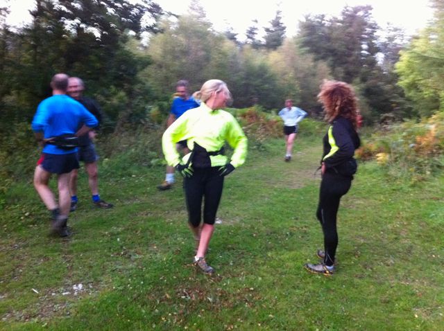
A rather disorganised start as I realise I haven't checked to see if anyone
knows where they're going, Em laughs, and Drew just looks strong...
Photo courtesy Al Tye http://www.fellrunningpictures.co.uk/
Despite being named the Wistanstow Walk, this was very definitely a run for us!

The Walk is a Long Distance Walkers Association (LDWA) event, organised by Phil Clarke (also of Mercia Fell Runners). I'd entered as practise for the hike and Em wanted to see if she could do a marathon (the route was about 26.5 miles).

We set off from Wistanstow at just after 8:30, running with Em's colleague Drew and heading gently up a road and lane to reach a footpath which dropped down through a little wooded dingle to Horderley, where Al Tye was waiting to take our pictures as we crossed the bridge over the River Onny. Climbing out of the village to the west we reached the first "SC" (self clip) checkpoint and clipped our tallies (2 miles, 28 min).

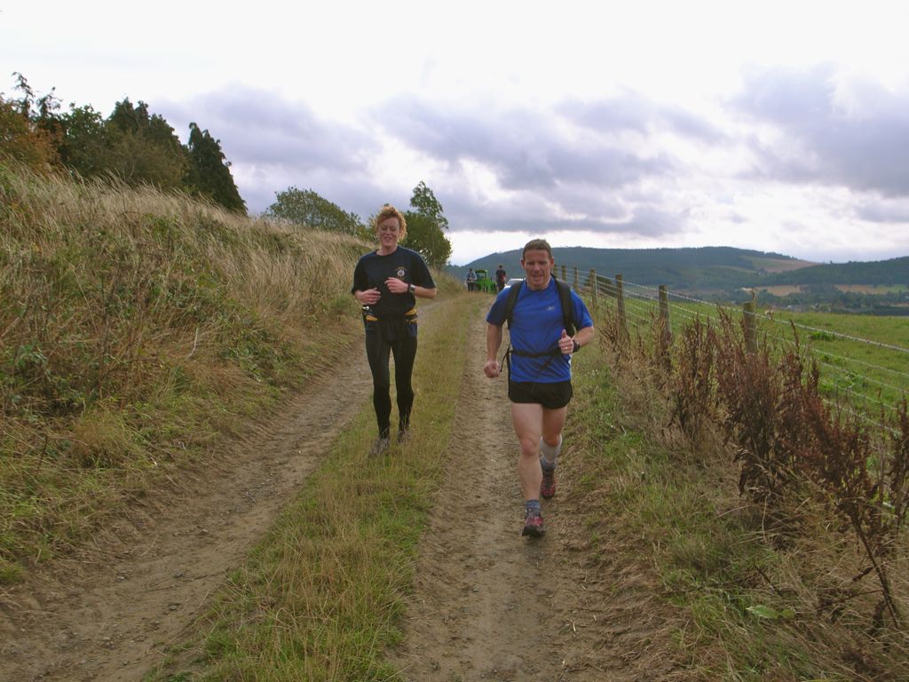
Em and Drew on a farm lane about a mile into the route
The three of us at Horderley Bridge, two miles down, 24 to go!
Photo courtesy Al Tye http://www.fellrunningpictures.co.uk/
The next leg took us across fields and along the edge of a wood, down a peculiar little ridge and then about a 1km section of road to Edgton. We joined up with three guys from Stretton including Dave who marshalls some of our races, and spent the next 10 miles or so leapfrogging them. At Edgton the outward and inbound routes divided. We headed south then south west, climbing gently to skirt the pass through a wood before dropping down a steady slope into Kempton, where we crossed the river to reach the first manned "CP" (checkpoint), at 6.5 miles, in 1 hr 24 min. This was the back of someone's car, but there was a very welcome cup of squash to sustain us on the next leg.

The climb out of Horderley
Em at about mile 4, with the south end of the Long Mynd behind
This climbed steeply up Clunton Hill, passing through another section of wood before dropping down and passing through Clunton. Em was on home ground now, having used the next section of the route before on horse rides to the Welsh coast. Drew was struggling a bit with an ankle injury he kept aggravating and we didn't run much despite easy flatish ground through the woods to SC2 at 10.25 miles (2:16).

The Stretton boys, Drew, Em and Colin Williamson climbing Clunton Hill
Me and Drew, running through Clunton
Photo courtesy Al Tye http://www.fellrunningpictures.co.uk/
Em, a few yards behind us at Clunton
Photo courtesy Al Tye http://www.fellrunningpictures.co.uk/
The next leg was the shortest, dropping down mostly on minor roads to reach a scenic ford and footbridge on the edge of Clun.

Drew, entering Clun
Em, followed by the Stretton lads, on the way into Clun
CP2 (11.5 miles, 2:34) was in Clun Fire Station (the walk is supported by Shropshire Fire and Rescue and in aid of the Fire Fighters' Charity and Wistanstow Under 5s). I adjusted my footwear, topped up the painkilling gel on my ankle sprain (left) and achilles (right), scoffed a quick bowl of fruit cocktail, and we headed off.

On the hill from Clun towards Bury Ditches, we reluctantly bid farewell to Drew and started to run on ahead. The next self clip, SC3 (13.5 miles and just over half way, reached in 3:03) was at the south edge of the woods by Bury Ditches. We ran on down to Acton and then across the A488 before climbing a couple of hundred feet and skirting Blakeridge wood to reach SC4 (15.75 miles, 3:31).

Em with the map out, under Blakeridge Wood, just before CP4. I was pleased
 to have a long break from navigating on the leg from Clun to BC - you lose
 concentration and can make silly mistakes after a while...
The route then dropped down to Colebatch with glorious views north to the upper Onny Valley, surrounded by the Stiperstones and Long Mynd.

Fantastic panorama of the Upper Onny Valleys from above Colebatch
From Colebatch the ground was easier, across fields before quite suddely entering Bishop's Castle and reaching CP3 at the Fire Station there (17.5 miles and 3:56). I had another bowl of fruit cocktail and Em and I both had a cup of weak warm tea which we drank on the run out of town. Fortunately BC youths don't seem to have caught on to torching litter bins so we could dump the cups easily enough.

We climbed across fields to Oakeley Farm and then steeply up through woodland (SC5, 4:20) to reach a path with traversed the north side of Oakeley Mynd about 50' below the top. Coming down we saw Al Tye again, parked up on a farm lane just above Totterton.

Running down from Oakeley Mynd to Totterton: neither of us looking
too tired after 19.5 miles
Photo courtesy Al Tye http://www.fellrunningpictures.co.uk/
We'd been running behind a couple who seemed to be going faster than us an were surprised as they caught us up and passed us on the road to Plowden - they'd had a nav muck-up on Oakeley Mynd somehow and we'd passed them without seeing them. Em started to suffer a bit on this section with sore hips and knees - I'm sure this is what happens to all fellrunners when we run on the road, and nothing to do with the distance travelled! We reached the Plowden checkpoint (21.5 miles and 4:52) pretty much together, with Dick Scroop (Mercia ultra-running legend) just behind us. I had more squash and some kind of jaffa cake on steroids which was unbelievably sweet without being sickly, just what I needed. By now we realised we were going to finish...

The last big climb was a sod though, and started right after we'd made our only nav mistake of the day, going a hundred yards too far down the road as we sorted our bottles etc out from the checkpoint. We seemed to climb up through Plowden Woods for ages, and drop down on the other side very little as we reached Edgton. We made a fairly determined effort on the road section here and had the couple in front of us in sight most of the time as we returned to SC1 (now SC6) at 24 miles (5:29).

We were there with 31 minutes to go before six hours were up, but it was a long two miles back to Wistanstow, with the climb up out of the dingle seeming to take ages, and the final mile of farm track and then road taking it out of both of us. We did manage a decent run down the road to the Village Hall and crashed through the doors together to finish 19th equal in 5 hours 58 minutes.

My GPS made it 26.6 miles in all and surprisingly 4,080' of ascent. I'd felt fairly comfortable all round, apart from having to manage pre-existing aches and pains (right achilles and bruised toe, left ankle sprain) and one new one a soreness at the left edge of the top of the tongue on my right shoe. I used the Saucony Peregrines with new Sorbothane insoles in and these worked well, with no blisters and only the tongue problem, which I'll try to solve before the hike...

A great day was rounded off with beer, hotpot and dancing at a fellrunning ceilidh in Church Stretton school.

LMV Recce - 08/09/2011


Ran a very steady recce of the Valleys with Em today.

Did all of the route apart from the final bit from Callow to Cardingmill Valley, substituting the direct descent from Callow into Little Stretton and a stroll back along the road after a drink at the pub.

9 miles to Little Stretton and 3,400' of climbing (Em's Garmin had 1,950' but that's just crazy, I thought it was so far out I checked the map!).

Tom's Birthday Bash - 06/09/2011


Tonight was a little different for a Tuesday night, with some car pre-placement to ensure we could do a point to point run out to the pub at Bridges to celebrate Tom's 30th Birthday.

We set out across the fields to All Stretton and the up the Batch and Jonathan's Hollow to climb past Gill's Finger Post up to Robin Hood's Butts. We crossed the road and went north past Betchcott Hill and descended Golden Valley in fading light, to follow Darnford Brook for the last two and a half miles past Ratlinghope to Bridges.

A few beers and a good banter later we were back off home. Next week is a recce of the Bury Ditches race.

8.6 miles (very long for a Tuesday run) and 1,180' of ascent in 1:28:25 (10:15 mins / mile).

LMH Recce - 04/09/2011

Another recce for the Long Mynd Hike...

This was really a final practise of the section from Shelve to Stiperstones, and went well, with no route finding problems at all. The only hitch was a huge rain storm just as I left Stiperstones to run back to Shelve on the road. It must have crept up on me while I had my back turned!

I can leave this section now and move on to looking again at Stiperstones - Earl's Hill - Shelve.

13.2 miles and 2,020' of ascent in 2:42:31 for an average pace of 12:21/mile.


Adrian's BG (2nd Attempt) - 02/09/2011

This was the re-run of Adrian's Bob Graham after the first attempt, back in June, had resulted in a completion just outside the time limit when hideous weather had been compounded by some navigational problems on Leg 2.

This was a lighter-weight feeling attempt with only Adrian's wife Clare and Keith R providing some road/bike support and the pacers and navigators dropping in as they were needed.

I navigated leg 1 with Richard R doing the carrying and feeding duties. We were up Skiddaw in a mere 74 minutes, gaining on a large group ahead much of the way, and in fading light I hit the trod down Hare Crag spot on. Unfortunately at around the 7 mile mark I plonked my right foot down in a boggy hole and set my achilles off again. It had almost healed (the left one has), but was irritated by the Ellesmere 10k last month and is obviously still not right.

Rich took over the nav duties as I headed back down to Threlkeld via Skiddaw House. It was a quickish jog down for me, with not too much damage done, so I had time for a pint and a coffee in the pub before jogging over to see them come off Hall's Fell. The group mentioned above turned out to contain Sarah Rowell and Andy Peace, with a Pudsey and Bramley runner going for it. They came through six or seven minutes ahead of Adrian and Rich. I joined them for the run through the village and across the A66 to the meet at the cricket pavilion.

Adrian set off on leg 2 with Andy D and Rich about 15 minutes up on schedule, and with a nephew's birthday party at 10:30 in Leicester I had to set off, reluctantly, down the A591 to try and get a little sleep.

Keith texted me just as I got in to say they were through Dunmail still about fifteen minutes up, but in the morning no news later turned out to be bad news, as really horrible weather had conspired to put an end to Adrian's second attempt at Wasdale.

Never mind, I'm sure he'll be back up there in the spring...