
Looking weird (apprehensive?), 07:09 in the Square
Today I managed to do the Gill Harris Challenge on the Long Mynd, despite some pretty dire weather for the last three hours. My total time was 5 hours 42 minutes, solo and without support. The distance was 21.3 miles and there was 4,910' of climbing.
Most of the route I took is on the previous recce posts:
Church Stretton to Shooting Box
Minton Hill and Round Hill (from the Portway)
Shooting Box to Haddon Hill
Haddon Hill to Stanyeld
The start was almost dark, so I took the Burway Road up to the cattle grid and then headed up the borad shoulder to Burway Hill (16 minutes). From Burway Hill I headed round the top of Townbrook Valley - slow going with a strong wind - and then up to the summit of Yearlet (20 minutes from Burway Hill). A short run round to Ashlet in improving light (7 mins) was followed by a descent which went exactly as planned down a re-entrant and into the valley between Ashlet and Yearlet.

In Ashes Hollow, about to start up Grindle
The ascent of Grindle is one of the highlights of this route, up a spur to a rocky outcrop which is like a stairway to heaven. It's only slightly let down by the last 300m on sheep trods through deep heather (26 minutes from Ashlet).

The summit of Grindle
The next top, Nills, is somewhat of a non-entity, lying just below Grindle with very little reascent. I visited both tops near the given grid reference just to be sure (4 minutes from Grindle)

Ashlet and Yearlet from Nills

Callow from Nills
A good path can be picked up which leads round the head of Small Batch down to the Callow col. This was slower than usual due to the wind. A short ascent leads up to Callow (12 mins from Nills).

Summit of Callow
From Callow, I took a bearing to find the top of the gully on the east face. This leads steeply down to Callow Hollow at the bottom of Sleekstonebank Hollow. Another wonderful spur leads up the right hand side of the gully to the col between Minton Hill and Packetstone Hill, which is easily reached slightly further south (26 mins).

Packetstone Hill - an indistinct summit!
A gentle jog down a good path, forking right after a knoll, leads down to Shooter's Knoll (8 mins). It was all going quite well here, the wind had dropped, but I'd not really noticed bad weather coming in.

Summit of Shooter's Knoll, looking across Minton
Batch to the next big ascent
I descended from Shooter's Knoll directly to the farm in Minton Batch - this is very steep and slippery. A hundred yards down the valley is the footbridge that leads to the long climb onto Knolls. I made this fairly comfortable, a farmer moving straw at the bottom of the plantation being the first person I'd seen since leaving Church Stretton. As I jogged up the last few hundred yards, a gentle drizzle started. The top has a trig point about 100m south of the path (32 minutes from Shooter's Knoll).

The trig point on Knolls, with the first raindrops
I stopped and had half a chocolate bar and a couple of jelly babies, took off a thermal and put on my cagoule. Easy running down to and then along the Portway and past the glider station took me to the top of Minton Batch - I followed the path round to the north of the valley and then across onto the landrover track to reach Minton Hill (27 minutes). The weather wasn't too bad here and I nearly took my cag off, but (rightly as it turned out) left it on.

Minton Hill, looking north west
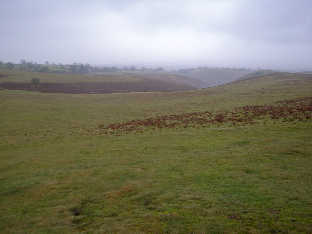
The rain intensified as I jogged up the track to regain the road. After about a kilometer I headed down across the top of Callow Hollow, stopping to refill my bottle as I felt quite dehydrated. Round Hill is pretty indistinct and I visited both tops just to make sure (20 minutes).

Murky weather on Round Hill
I was starting to feel a bit tired here, and the rain wasn't helping. I was encouraged on the way up to Pole Bank by running past a couple of guys on mountain bikes whilst eating the rest of my chocolate bar. One of them kindly took my picture at the top (16 minutes from Round Hill).

That's as much Mercia vest as is coming out!!
I think the rain was getting to me and so I was slower than I'd expected over the next few hills, losing a minute or two on the schedule over each. Long Synalds (10 mins from Pole Bank) is fairly indistinct, but somewhere between the path down to Townbrook and the road. This was the only (daylight) top I didn't get a picture at - it was just too wet.

Finger post near Long Synalds
The next section is almost entirely on the road, over to the Shooting Box top (8 minutes).

Shooting Box
Around here I saw a runner (presumably recce'ing the Long Mynd Valleys Route). Another short section of road leads down towards Wild Mord, which is reached after a short climb through thick heather (7 minutes). This finished the job off on my running tights, from here on they were totally soaked and needed hitching up every ten minutes.

Wild Moor (wet too)
Back onto paths again, and over to Calf Ridge (11 minutes). The initial path is poor, but there's a fantastic grassy path after the Portway is crossed. I reached the top a bit more easily (the remainder of the chocolate bar must have been kicking in).

Calf Ridge, looking on towards Haddon Hill
More grassy paths lead across Mott's Road and uphill through a boggy area to Haddon Hill (8 minutes), where the rain was heavier than ever. At this point I resolved to finish the round: I was quite cold, but the next three legs were mostly downhill and runnable, so I thought I'd probably warm up.

Top of Haddon Hill, wet with sad looking cairns
The next section runs down to the Gill Harris Memorial Finger Post (11 minutes). Gill was a very popular an well loved Mercia Fellrunner, with several wins and record times in the Long Mynd Hike, which passes this spot. She sadly died very prematurely of cancer a couple of years ago - I never had the privilege of knowing her, but I'm sure the Challenge is the kind of memorial she would appreciate.

The Gill Harris Finger Post at High Park
Another easy run leads down to Plush Hill (8 minutes), all of 40 feet of climbing after a mile's gentle descent.
View towards Gogbatch from Plush Hill
I was warming up now, although a kilometre steeply down on the road did make me a little sore. Castle Hill (9 minutes) is reached by a short steep climb on the left hand side of the road - and there's a lovely short ridge leading back down onto the road.

The Lawley and Caer Caradoc from Castle Hill

Looking down to All Stretton from Castle Hill
A short run downhill and a cut through via "The Row" leads to the bottom of Nover's Hill. I was knackered by now, but knew I was on the home straight, so walked up, just putting one foot in front of another. I couldn't really run on top, but the view into Cwmdale to the right is great, and I soon reached the summit (18 minutes from Castle Hill).

Summit of Nover's Hill
The descent is steep and was wet, so I took it gently to avoid a slip. Across Cwmdale, I was on the last decent ascent. This was again a real grind, struggling up a gully and across the golf course, then up another steep section (no path) to reach the top of Bodbury Hill (20 minutes from Nover's Hill). I knew I'd cracked it now!!

Calf Ridge on the left; Haddon Hill on the right

Very very wet, but knowing I'd cracked it!
I retraced steps to the edge of the golf course, and then followed the fence to the final top, Stanyeld (6 minutes).

Church Stretton from Stanyeld
The initial descent from Stanyeld is very steep and there are rabbit holes part way down, so I took it steady until I reached the path above the golf clubhouse. This is a wonderful track back into Cardingmill Valley. All that remained was a kilometre along the road back to the square and a quick photo...

Done it. Wet. Tired. Happy. Don't look it though...
I did well controlling pace and mostly sticking to my schedule (5h 45mins) through the very hilly first part of the route. The middle section along the main ridge of the Long Mynd was much harder than I expected, probably because of the exposure to the wind, and the increasingly heavy rain. From Haddon Hill, I moved better (helps that this bit is mostly downhill) and warmed up again. The final ascents of Novers Hill and particularly Bodbury Hill were hard, done at a trudge! I managed to free up and run to the end from there. Overall I'm pretty pleased with today's effort given the strong winds early on stopped me running some of the flatter bits, and also the effect of the rain.
I think I'd maybe do 20 minutes or so faster in summer. If I was strong enough to do all the big hills at the end instead of the start there would be quite a bit more time to save by going anti-clockwise. That way the descents would all be runnable and the ascents much steeper and shorter on the valleys section of the route, which should save more time.
The split times were as follows:
07:11 The Square
07:27 (0:16) Burway Hill
07:47 (0:20) Yearlet
07:54 (0:07) Ashlet
08:20 (0:26) Grindle
08:24 (0:04) Nills
08:36 (0:12) Callow
09:02 (0:26) Packetstone Hill
09:10 (0:08) Shooter's Knoll
09:42 (0:32) Knolls
10:09 (0:27) Minton Hill
10:29 (0:20) Round Hill
10:45 (0:16) Pole Bank
10:55 (0:10) Long Synalds
11:03 (0:08) Shooting Box
11:10 (0:07) Wild Moor
11:21 (0:11) Calf Ridge
11:29 (0:08) Haddon Hill
11:40 (0:11) Gill Harris Finger Post
11:48 (0:08) Plush Hill
11:57 (0:09) Castle Hill
12:15 (0:18) Novers Hill
12:35 (0:20) Bodbury Hill
12:42 (0:06) Stanyeld
12:53 (0:12) The Square
I had a great day out despite the poor weather, and would highly recommend this challenge to anyone looking for a step up to some of the longer distance routes.
Totals for this week (with several days spent recovering from the Cannock Trigs race) are 27.5 miles and 5,580' of ascent. The four week running total drops back a bit on the mileage front to 112.7 miles (down 1.8) but the climbing improves to 16,620' (up 430')
Well done Jim. Looks an interesting challenge.
ReplyDeleteGood effort. Looks like superb running country. Have a sit down and a beer!
ReplyDeletePaul
Great account Jim - just got the map out and followed the route round. I might have a go some day.
ReplyDeleteThanks guys - I'd encourage anyone who's up for a longish run to give this a go. The first bit particularly visits some places and uses some paths I wouldn't otherwise have found.
ReplyDelete