Tuesday 23 December 2014

Tour de Helvellyn - 20/12/2014

Coming into Side Farm on the way back...
Back to the Tour for a third time. This year I was just aiming to jog/walk round, test a couple of pieces of kit for the Spine race, and enjoy a long day out with Zoe.

It all went broadly according to plan although I think I must have picked up a bit of a virus or something. I'd had a sore throat on Friday and just felt a bit flat all day on Saturday.

For those not in the know, the Tour is a friendly low key event which features a surprising amount of fairly easy running in its 36 to 39 miles (estimates vary, but the normal route is about 36.5 miles and this years' altered route was a bit over 38.5). The course is a lollipop shaped route, with an out-and-back section between the start/finish at Askham and Patterdale, and an anticlockwise loop around Helvellyn which goes out over Sticks Pass, then along Thirlmere, and comes back from Dunmail Raise via Grisedale Tarn and valley. This year the normal route along the east shore of Thirlmere was impassible due to recent forestry works, so the route was amended to follow the very quiet road on the west shore.

Anyway it all went well for me until we reached Legburthwaite at the foot of Thirlmere. Huw and Glen Davies overtook us on the descent of Sticks Pass. I somehow cut my finger slightly in the checkpoint - I couldn't believe the amount of blood this generated, but it was easily patched up. We saw Dick Scroop on the way around the lake. I was struggling to run on the road - I think I just haven't done that much actual running and maybe the new Mizuno Wave Mujin shoes have a little more drop than I'm used to so were causing a bit of trouble, but Zoe is great at keeping going on the easier ground and got me through it.

I felt a bit more lively on the climb to Grisedale Tarn although I was still lagging behind a little, but the descent is fairly steep and quite technical and I managed to get it reasonably together and keep it that way from there on in.

We stopped for a few minutes at the Side Farm control and I sat and had a cuppa (bring your own milk for Joe's events!) and a bit of flapjack before we tackled the Boredale Hause climb and the long run / walk back to Askham. The final section of the event crosses an area known as the Cockpit which is notorious for confusing tired runners and adding bonus miles at the end of the day. I got it spot on in the darkness this time - take careful note of landmarks on the way out, but coming home it's sharp right at the standing stones, aiming well right of the woodland  initially, then follow the path as it comes around to the left and faces the woodland, cross a very distinct grassy crosss path still heading for the end of the wood, then turn right ten yards after the boulder just to the right of the path!

Plus points:

  • coped well with nearly a full Spine load and was able to move much faster than I'll need to on the Spine;
  • virtually no shoulder / upper back pain this trip - a result of switching to an Aarn Marathon Magic pack;
  • Wave Mujins were great with a thin Coolmax liner and thick Smartwool hiking socks - no blisters, but loads of room for swollen feet and much more grip than I had expected;
  • Clothing was spot on for the day - fairly mild but windy with the odd squall of rain - Salomon long sleeved wicking base layer, RAB powerstretch top and Haglofs windproof on top, and just a midweight pair of Ron Hill 3/4 length leggings. Regulated heat well venting with zips and warming with buff and thin wind gloves.
Things to work on:
  • probably didn't drink enough;
  • should have eaten a bit more too, but when moving slower on the Spine this should be ok;
  • a bit of chafing off the velcro fastenings at the bottoms of the front pockets on the Aarn pack.
All in all a fun and useful day out. Huge thanks to Joe and his team - Lindsay, Darren, Stuart, John and those I didn't recognise too... Pics from http://www.nav4.co.uk

What the hell is that in your hand Zoe? Who do you think you are?
At the start...
Santa's little helper at the Swart Back bridge on the Sticks Climb
Dibbing at Swart Beck - almost sunny - a TdeH first!
Santa (John Bamber) and his elf (Stu Smith) - thanks for the pics guys. Lovely
to see John on the way up to Grisedale Tarn - Zoe thought the beard was part of
a Santa outfit!
Back at the shack. We ran in the last three miles fairly hard hence the pose!


Tuesday 21 October 2014

100 Miles Sud de France - 10/10/2014

Running down into Pyrenees 200 an hour into the event
For this year's foreign race I picked the new 100 Miles Sud de France race. It's got a very simple premise. Start at the French Athletics Federation's altitude training base at Font-Romeu (that's where Paula Radcliffe lives) and run east along the GR10 trail to the sea. Nice.

My aim was to run with Zoe at a very comfortable pace with a view to getting some tough miles in before the Spine. We'd be relaxed about it and just see how far we could get.

The first 20km were fairly standard for a continental race, nice easy trails and softish ground which let the 324 runners in the field spread out a bit. We passed the altitude training camp after a mile's steady climb and then it was gently downhill through the resort of Pyrenees 2000 and on more nice trails to reach the Citadel (castle) at Mont-Louis. There we joined the GR10, and a bit of up and down led us to Plan ès, the first feed station. To be honest the food at intermediate checkpoints was very disappointing with just a few cakes and so on, and we ended up relying almost wholly on what we were carrying.

Planès marked the start of the mountainous ground. We slowed to a steady walk and started the warm-up climb. This two-parter took us up 400m to a traversing path at the 1,900m level which went along one side of a valley through very rough and boggy pasture and past a heard of cows. We crossed the river and passed an informal aid station at Refuge de Riberola before descending slightly on better ground to 1,600m and the start of the the big climb to Col Mitja. This started easily enough on a good 4x4 track and we spent the time chatting away to a lovely gentleman from Brittany. Just before dark (so about 4.5 hours in) it started to rain. I guessed from those around us that it might be quite heavy and so we put our cags on and continued up into gathering gloom. After a long climb (the top's at about 2,360m, so there was 960m of ascent here) we were heartened by a small group of local supporters who were whooping and banging drums up on the col.

I was pleased I wasn't hanging about up there as we ran steadily down a rough track into the next valley. I felt a little cold, especially as I was waiting for Zoe occasionally as she descends a little more tentatively than me in the dark. Anyway we were soon down at the Refuge de Ras de Carança, where we were able to get inside out of the rain and put our power stretch fleeces on. There was a little food here (although it was only advertised as a water point) and we got some cheesy biscuits and some Genoa cake down as we hiked on.

The next section was a flattish but very rough yomp on sometimes indistinct paths through trees to reach the foot of the climb to Col de Pal. Bottom to top this was a bit less severe than Mitja, with 470m of ascent. At the top of the col there was another group of supporters, so we thanked them and passed on up - this is one of several places where the GR10 climbs to a col and then carries on at high level, sometimes climbing, across a hillside to cross a ridge. The path was good again here and we had soon crossed Serre de Caret and were descending steeply towards the valley. We weren't making great time as Zoe again struggled with the terrain in the darkness. The descent became less steep as we neared the valley bottom and turned to do the final 3 km to the checkpoint at Mantet. As we crossed the river we stopped to take off our cags. The village seemed quite a long way away up the next hill but in reality we were passing the first building in five minutes. We stopped for a moment to photograph a striking black and yellow lizard which we found in the lane. It must have been cold - certainly the lizard didn't seem up for any rapid movements.

The Mantet checkpoint was another where there was supposed to be food, but again there was really only cake and biscuits. Beggars can't be choosers though. We pushed on and started the short climb (250m or so) to the Coll de Mentet. This seemed to zigzag a lot more than on the race map, and dragged on even though we were going quite well again. At the top we passed a marshall and started down a series of tricky paths which repeatedly (and sometimes slightly confusingly) crossed the road, before we finally joined the tarmac for the last few hundred metres to the "Base Vie" (main aid station) in the village of Py. This was at 43.5km and we'd already done 2,220m of ascent (D+) and 2,970m of descent (D-). I checked the cut-off on arrival and we were told 3:30am - "good", I thought, "we've plenty of time to regroup".

We took a while to strip off wet stuff and change socks etc. I dressed my foot as I had a blister (probably from some gravel - otherwise my RaceUltras were supremely comfortable and surprisingly grippy). We ate a bowl of plain penne with a little cheese and had some noodle soup. Yet again though there were no hot drinks. I was seriously in need of a tea or coffee... We were suddenly brought round as the checkpoint lady told us there was ten minutes to the exit cut-off. This was now 3am! I'm not sure how this happened, but basically we had to get the hell out of Dodge without the brief snooze I'd been looking forward to.

We got out PDQ and started the next section, climbing onto and over a ridge on very rough tracks and then picking up a good 4x4 track to climb the final 2km to the Marailles Refuge. I was out on my feet at this stage, falling asleep whilst still walking (or staggering) upwards. Zoe snapped me back round a few times and eventually I popped a Pro Plus and checked the map. Nearly there, so I just kept plodding. There was a Gendarmerie van at the top (quick scan of the chip in our numbers) but more importantly the refuge was very close by. We got in there but I was too tired to eat. Zoe sat in front of a roaring open fire while I went upstairs and lay down for fifteen minutes. I don't think I slept but I did close my eyes and get off my feet for fifteen minutes which helped.

We grabbed a cup of bouillon each and then started off towards the next checkpoint. Pretty much straight away we were on a rising traversing path which alternately crossed boulder fields and then went through sections with lots of wet tree routes and rocks sticking up from the surface. It was impossible to make quick progress. The gradient eased but even on the level we were doing well to make 3-4 km/h. It got light as we crossed a river barely 4km on from the refuge, having been moving for well over an hour.

We then followed the GR10 on a contouring path around the west side of Pic Canigou. The path was up and down, mostly on either very rocky ground or across boulder field, for the next 5km before dropping down in a beautiful but extremely rough corrie. I had another sleepy spell here and had to resort to another Pro Plus in the absence of any other caffeine source. We made slow but steady progress, leapfrogging a nice French guy who was quicker than us on the flat bits and downhills but much slower on the climbs. Eventually we walked onto a decent 4x4 track and reached the Bonne Aigue checkpoint, just as the morning sunshine hit it. We didn't stop.

On from here there was a steep climb up a ridge to regain the height lost down the corrie. I was going well now and set the pace, leading Zoe and the French dude on up. At just above the 2,000m contour we turned and began to traverse right handed again, on familiarly poor ground, eventually reaching a point where we could see a small lake and the French Alpine Club hut at Cortalets in front of us. We'd discussed the time situation on the way over but felt we should press on in the hope the ground would become easier and we could make the cut-off at the next Base Vie at Arles-sur-Tech. I texted our friends who were supporting us to let them know we would be later than anticipated but were still going.

Fifteen minutes later we arrived at the checkpoint. The staff told us we were the last in the race (actually I knew there was at least one guy behind us). There must have been a lot drop out behind us already as we hadn't been passed by many and there were lots behind us descending to Mantet, but maybe they'd fallen foul of the moveable Py cut-off? The staff were keen for us to drop here, promising transport to the finish would be leaving shortly.

I had a brief chat with Zoe. She wasn't really enjoying the terrain and was afraid that we would not be able to do the 22km to Arles in the 4.5 hours we had available before the Arles cut-off and have a meaningful rest / refuel when we got there. I couldn't really see the point of flogging ourselves down to Arles. It was 2,000m of descent more to put in our legs, and we probably wouldn't be in a state to continue even if we got in and out of the checkpoint in time. I could probably have speeded up a fair bit if I'd gone on alone, but I didn't want to abandon Zoe (I'm the French speaker) and so we decided to drop together. We'd covered 66km (4,000m D+ and 3,630m D-) in around 21 hours. Little more than 3km/h, but then that's perfect practise for the Spine Race! What's more there were a lot of positives to take from the event and no real negatives - I'd be able to train again almost immediately, rather than suffering the usual post-hundred 6 week layoff.

There was a bit of a cock up with vehicles etc., and in fact we would probably have been better to run out to Arles as we had to wait nearly four hours for a lift to Argeles, but otherwise the event was well organised and I would come again. Any miscalculation was mine in underestimating the difficulty of the terrain and the effect that would have on Zoe's pace...

We had a great time in France thanks to Keith and Pauline (Mercia stalwarts) who moved out to Foix in Spring and opened their house to us for the week, also supporting us on the event.


Tuesday 23 September 2014

Update - 23/09/2014

It's been ages since I posted on here - six months in fact.

Since then I raced at Clee Hill and then ran round the Long Mynd Valleys with Zoe, raced the Pendle Champs race and Cribyn.

But four fell races for the year is a fairly low return - mostly because we have been ultra running and mountain marathoning again.

The MM's completed to date are:

2013 RAB - short score
2014 Dark Mountains - short score
2014 Saunders - Kirkfell class
2014 Marmot24

In addition we did the Great Lakeland 3 Day together which is a bit of a crossover between mountain marathon and ultra stage race, with easier navigation but longer days. We managed to complete the Elite route on the Saturday and the Monday, but Zoe's knee was injured midway through Saturday so in foul weather on the Sunday we decided to cut from the Elite to the B course to stay off the highest fells.

In Ultra stuff we DNF'ed the LDWA100 in hideous wet cold conditions on the May Bank Holiday weekend, but neither of us were that bothered as we'd been round it all at Easter on some enjoyable reccie runs. It was a shame for Zoe though, she was moving really comfortably whilst I got so cold I had to stop. Lesson learned - your layering solution has to trap warm air NEXT TO THE SKIN so it's no good wearing a baggy fleece.

We slipped the WOW50 (Wenlock Olympian Walk) in between the Saunders and the Marmot 24, so July was a pretty heavy month) and I found that pretty hard going in pouring rain but on a hot day for the first 25 (including running virtually past our doorstep). The second 25 was in wet fields then on the railway path through Ironbridge, and mostly I just tried to keep up with Zoe. She dragged me round in the end to a 50 mile PB of about 12:10 (we stopped at just on 50 to find headtorches) and an ultimate finish for the 51 miles of 12:30.

Next up we have the RAB (long score this time) which we're treating as a final back to back long run in our training for 100 Miles Sud de France.

I was trying to put together a list of the Ultras I've done now just so I don't forget any!

2011 (Oct) - Long Mynd Hike 50 mile (13:05)
2011 (Dec) - Tour de Helvellyn DNF after 20 miles

2012 (Feb) - Pilgrim's Challenge 2 x 50k
2012 (May) - Ultra Brecon 40 mile
2012 (Jul) - WOW 50 mile (via Lawley and Clee Hill)
2012 (Aug) - CCC (shortened to 87km in horrible conditions)
2012 (Dec) - Tour de Helvellyn 67/148 in 9:05

2013 (May) - Marlborough Downs Challenge 50k in 6:41
2013 (May) - LDWA Camel-Teign Ivor's Dream 100 mile in 33:52
2013 (Jun) - Three Rings of Shap 100k; 35/89 in 19:32

2014 (May) - LDWA Valleys 100 mile (DNF after 43 miles)
2014 (May) - GL3D Elite Day 1 - 50k
2014 (Jul) - WOW 50 mile (via Wrekin and Bridgnorth) 8/97 in 12:30

Monday 27 January 2014

Marmot Dark Mountains - 25 to 26/01/2014

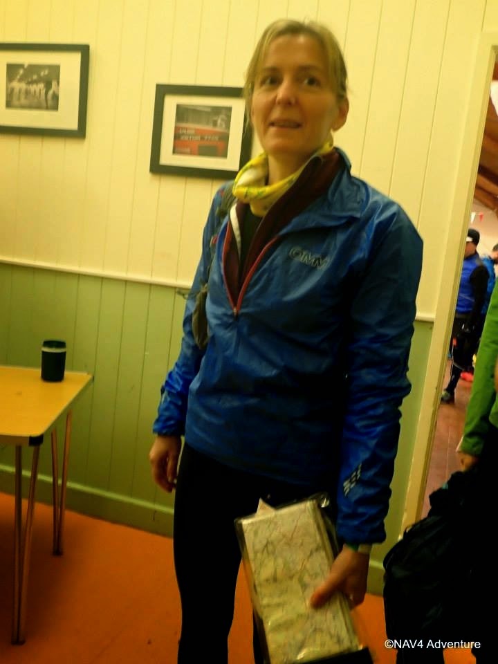
So, Marmot Dark Mountains. Probably the ultimate test of fell running navigation, this event is two day mountain marathon rolled into one night, and just to make it a little more tricky, it's in January.

I’d entered Zoe and myself as a mixed pair in the short score class after hearing about the first edition of the event. We knew it would be a big challenge and had spent a couple of months getting fit (or at least fitter) and doing some navigation practise. My objectives were:

1.       Survive;
2.       Stay out for the full time (or near enough);
3.       Get a reasonable placing (top half in our class).

...but much more importantly to learn a bit more about route planning and also executing navigational legs. I’m a kind of learn by doing (and mostly by making mistakes) person, so most of my preparation was mental practise of the navigation – selecting a leg on a previous event and asking myself how I would navigate it, in poor weather and visibility and in the dark. Really this boils down to what handles (linear features like fences, paths, streams, escarpment edges) I would use to get close to the control, and how I would select my attack points (the feature at which you leave the handle to head off on a compass bearing to the control). Generally this stood me in good stead, although there were controls without decent attack points on the course.

I didn’t do enough route planning practise beforehand. This is specific to score courses and adds an additional layer of complexity to the event. Each checkpoint is assigned a score on the map, and you need to be able to identify a rough route around (some of) the various controls on offer to maximise your score over the event. For Dark Mountains the controls ranged in value from 5 to 40 points. We were warned that the high value checkpoints were high scoring for a reason – remoteness, horrible terrain, or navigational difficulty. Generally on a night event or in poor visibility (or both, as we had for an hour or two) it’s wise to avoid controls which are point features (say a small pond or an isolated building, maybe a cairn in a relatively featureless flat area).

Anyway the event map was handed to us as we started at 22:02, and we went straight to somewhere sheltered to plan our route. There were basically two routes options from the start and these would be the options for the return to the finish too. We opted for the northern option, visiting low scoring controls in an abandoned quarry area which would lead us round to the Pennine Way path north of Bleaklow. We could then use this path to guide us over the summit via another couple of low scoring checkpoints and into an area of mid-scoring controls east of the summit of Snake Pass. The plan was then to cross the Snake Road and head into the valley of Ashop Clough, visiting two mid scoring checkpoints on the north side, or, if there was time, three or four higher scoring checkpoints on the northern edge of Kinder Scout before finishing via the Pennine Way back to Snake Pass and down Doctor’s Gate to the start. This plan survived intact for about the first third of the event!

We reached the checkpoints in the quarry easily enough, walking steadily up the hills and walk/jogging the flatter sections, and got to PK with 25 points in the bag after 1:09, and no navigational errors. We descended NE from the control to pick up the Pennine Way, but had a minor delay as we saw something we thought was the path but turned out to be a track to some grouse butts about 100 yards short of the main path. This was probably the main story of the night for me navigationally – I just kept coming up short, thinking we’d covered more ground than we had. I think it was a combination of the terrain, our pace over it, and the darkness, but we just weren’t making the distance we usually do per stride. Anyway we rached the Pnnine Way and I realised we could take in an extra control, RE, for only an extra 200m of distance by diverting off the path at an obvious fenceline, crossing Torside Clough, and heading for the fence on the ridge just north west of the control. This worked out ok if a bit rough, but we’d climbed into thick mist at around the 550m contour.

I wasn’t too worried by the mist because if we followed our fence about a kilometre we’d meet the Pennine Way again which would take us right to the next control at the 633m summit of Bleaklow Head. We reached the point where the fence should have been adjacent to the Pennine Way, but I couldn’t identify the path. The visibility was around 5m to 10m and we just couldn’t positively ID the path. Instead I got the best fix I could on our location by checking the alignment of the curving fence and set a bearing which should take us straight to Bleaklow summit (the “summit” might be difficult to find as it’s actually just the highest point of a area of land about 2km x 1km all above 615m). This should have been safe as the paths shown approach from NW and NE in a “V” – if we missed the summit but reached a path I could check its direction quickly and identify which way to turn along it. From the map I thought it was around 300m to the control so we paced out 350 paces, then 400. 500 then 600 passed and I started to think we’d overshot. There as a slight clearing in the mist which revealed torches in front of and above us, and so we continued on in the hope these were close to the CP – it’s the highest point after all so going uphill did make some sense. We came out about 50m south of the summit, realised it was that way to the control from the voices around us in the mist, and made it. I have no idea even now, having checked the GPS track, why it seemed so far from the fence to the control. As we came back we met two teams on the B course who were looking for our next control, SR. They’d been looking for a considerable amount of time...

We now had 40 points and had been going for 2hr40. I was pretty shaken by the experience really. We headed south along the Pennine Way which should take us within 150m of the next control, SR, which was at Wain Stones, a location I’ve visited before. The map didn’t show an awful lot of detail for an attack point but it seemed that if we headed around 600m along the Pennine Way there would be a sharp left turn on the path which we could use. We spent a lot of time here walking slowly and trying to ensure we were still on the path – it’s very clear and well defined in daylight, but in very poor visibility in the dark all you can see is peat and heather. We reached what we thought was the attack point and took a bearing to the control, heartened when we heard celebrations from the direction we were headed. But there was no control and Zoe thought she heard the voices say it was a false alarm. We quickly decided we weren’t going to spend lots of time searching for a 5 point control and that orienteering in the mist was almost impossible. Checking the GPS we’d come up short again, turning off the Pennine Way about 200m before we should have.

We now headed down SE on the Pennine Way, stopping frequently to check we were still on the path. We met another pair and checked our locations. I was more sure than they were, and I was right, soon enough we met the Hern Clough stream and then climbed away from it to a knoll at 578m. This was on my map and was my attack point for control PT. It was clearer but still not great visibility here. I was shaken by the difficulty of hitting even low scoring point controls on Bleaklow. This was probably the only point at which I made a genuinely poor decision. We finally accurately knew exactly where we were again 40 minutes after leaving Bleaklow summit. But the checkpoint I was aiming for, PT, was a small pond 750m away. There was only a boundary with a couple of slight angles shown on the map to use as an attack point. What if the mist closed in again? What if the boundary was a broken wall and we walked straight through it? I knew the Pennine Way path got more distinct further down, and that we could access the mid-scoring controls on the north edge of Kinder via Snake Pass and another very distinct section of Pennine Way. And I thought we could extend if we had time, or run up the Snake Road if we were in danger of being late. But from where we were this would mean doing a figure-8 with very little in the way of points along the fast running section of the Pennine Way, or on the run-in.

Anyway we finally got a bit of momentum, dropped down out of the mist and reached control BA (5 more points taking our total to a massive 45!) which was at the crossing point of our figure-8. We stopped for a moment to finalise the re-plan. We’d used nearly half of our time so we’d need to get a shufty on but we could run to Mill Hill, control KM, then along the northern edges as I’d thought up at the knoll (GQ – HK – AQ) and then down from Fairbrook Naze to the river junction between Ashop Clough and Lady Clough (control DY on the footbridge over Lady Clough), with a short section of forest to bring us to the support point, control AI. From there I planned to either pick up PJ and PT and drop into Doctor’s Gate and the final control FE to finish, or to head up the A57 road to the Doctor’s Gate path if we were short of time to speed up the finish.

Progress on the slabs across Featherbed Moss to Mill Hill was fairly quick, although Zoe and I both put our feet between slabs a couple of times where the gaps were hidden by black peaty standing water. Zoe took a nasty tumble at one point and battered her knee. We reached Mill Hill easily enough and dibbed the control, then had a rapid ascent to the next checkpoint, a knoll with boulders at the 600m contour on the extreme NW corner of the Kinder Plateau. Zoe located the control quickly and we moved on having claimed our first 20 pointer of the night, a mere 4hr36 after starting. We were going to have to move quickly now, but the terrain was sapping – there was a generally obvious path, but it ran through peaty hags and there were frequent rocky steps too. Zoe was struggling a little, her confidence dented a bit by her earlier fall and the difficulty of the ground.

We were now aiming for control HK, a stream junction about 100m SE of the Edge, just before an obvious nose contour feature. I guessed 20 minutes of running from the boulders – it was about 2km. We found the stream, there seemed to be a nose. The stream seemed to flow over the Edge in the right direction. We headed upstream to find the control – first 100m then 200m with no joy. It couldn’t be this far in. We came across a little dam of stones across one of the tiny tributaries. We’d been warned to stay off the plateau as there are 600 new dams as part of a National Trust restoration project. They are re-wetting the plateau to help re-establish vegetation lost through years of over-grazing, but for runners in the dark, the bogs this has created could be extremely hazardous. So we went carefully back down the stream and checked another tributary. No control here either. I went back to the very lip of the Edge and realised that the direction of the gully I’d noted earlier had been an illusion. It headed north, not northwest. We were at the wrong stream. Again my distance estimation, this time based on travel time, had proved wrong. We were looking in Upper Red Brook and the control was in Nether Red Brook. There were other clues on the map too, if I’d taken more time to look at it and less time running around searching for the control. When we got to the right stream,, having wasted probably 25 minutes at the wrong one, the control was obvious and exactly as shown.

I checked the time, knowing we were down on where I’d wanted to be. We did have my final ace in the hole – a very rapid in route from the support point – 2.5km of road and 5.5km of easy path. 8km. Even tired and with hills we should be able to make that in just over an hour. I figured we’d need another ten minutes to divert to and find control FE (off the path on the way in) for an easy five points. So we needed to be at AI, the support point, with an hour and a half to go. We were short of time, but not desperate. Any chance of either looping to FY or doing PJ and PT had evaporated though – it was pretty much a race to the line.

We ran as hard as we could for another km along the Edge to control AQ (finally a high scoring 25 pointer!). Now we had 110 points, but we only had 2hr14 left. We hunted for the way off the cliffs of Fairbrook Naze for a couple of minutes, back and fore, before I saw the start of the trod. A little scrambling and we were running down steep ground on a muddy track. It was a bit faint, and it bent to the NE just as shown. We persevered as the path faded just as the map promised, then I set a bearing for 100m W (left) of the river junction we were aiming for. There was a flatter section of moor covered in deep heather and cut by several deep drainage channels we had to scramble in and out of, then the very aptly name “Rough Bank” down to the river.

Zoe came up trumps here, battered by another fall and very tired, but she just waded in and crossed with no real qualms. The control was on the footbridge 100m downstream just as expected. There were taped markers on the next leg up through the forest to the support point. We ran most of this. It would have been pretty under other circumstances but now we were on a mission. We reached the checkpoint and the welcome sight of several marshalls with 6hr26 on our clock. We could make it to the finish without having to push too hard! Somewhere deep in my subconscious though, I had a doubt. I check with the marshall that we could use the road, and was crestfallen to hear the reply – he pointed out the clearly marked uncrossable boundary. The forest itself wasn’t marked out of bounds, but no, if we used the road we’d cross a “barrier” and we’d be DQ’ed. I’d wondered why there was a control at JW, just a hundred metres (and 60m of climbing) north of the support point. Now I knew why – it was to ensure that folks heading north left the forest by the correct route. My heart fell as I tried to explain to Zoe that we’d have to climb to JW (only 5 extra points) and then contour along the edge of the forest and drop back down onto the road. No fast running!

And it was horrible. The climb wasn’t too bad, in fact we gained ground on a pair in front of us, but the traverse was dreadful. There was a faint trod, probably just what had been levelled by the forestry workers erecting the fence. But we were off balance, forced into the side slope by the barbed wire fence. The hillside was rough and tussock and no better further up. This was a dreadful 1.5km, and all the time we knew we needed to push. Eventually it was over. Zoe had another fall heading down to the road and I could tell she was pretty much done in. I didn’t feel much better. To cap it all it was around 4:45, the time when I feel lowest on my overnight runs. We got on the road. Zoe speeded up a bit, as I’d expected. Suddenly I was the one who couldn’t keep up. We dragged ourselves the kilometre up the road to the point we’d divert onto the Doctor’s Gate path which would take us the remaining 6.5km to the finish. We had about 50 minutes. We weren’t going to make it.

We passed control BA at the top of the path, not dibbing as we’d done that three hours earlier before the Kinder loop. Almost straightaway I knew we were really in trouble. I could run this path, but Zoe’s legs were shot. We played tag with another couple of pairs on the way down the steep, rough, boggy track. Eventually they headed off to visit control FE, but for us there was no time.

When we reached the valley bottom we had 3km to cover on better paths but only 16 minutes left. We could travel side by side here, so I let Zoe catch up and started to jog, then run. I didn’t need to tell her how far we had to go or how much time there was, we were going as fast as we possibly could. Through a couple of gates, over a stile. A smoother section of track, and then I could see the factory and the lights around the finish area. We passed two photographers. Then I could see the finish tent.

Finally we had made it in. I checked the watch. Were we on time? Maybe. Maybe a minute or so over, but there wouldn’t be a huge penalty at least. We’d put two 8:30 miles together on a rough farm track, carrying five to ten kilos of kit at the end of an eight hour run. It’d have to do.

The finish staff were brilliant: hot sugary tea pressed into my hand, a brief interview into an iPhone, offers of biscuits and sympathy. Ten minutes to gather myself and then a walk back to the event centre. Zoe seemed more composed and more ready to get back there.

At the event centre, we were greeted by both the course planner and the event organiser. We handed over our dibbers and got the download print out. We'd finished in 8:01:13 and lost 6 points for being just over a minute late! Despite this at the time of our download 119 points was good enough for 3rd of the 12 who finished. 

Equipped with tickets for a free cooked breakfast at Glossop Cafeteria (very nice), we dossed down in a squash court for 45 minutes. Breakfast was good. We stayed for the presentation where Adrian Moir and Ellie Salisbury took the mixed pairs prize (but we got a Marmot hat each), then said our goodbyes and headed off.

Results went up on SPORTident later in the day and we found to our delight we'd finished fifth of the twenty teams, and second mixed pair.

This was a great event and is highly recommended for experienced mountain marathoners. You need to know how to look after yourself in the hills and to have an almost bombproof ability to navigate and to relocate.

Next year I'll be back, and I'll find a better route option and have sussed out the distance estimation... Half an hour with the map in the warm and the dry today identified a 240 point route which was 1km shorter than our 125 pointer. If we'd got even close to that we'd have won.

A big thank you to Shane Ohly and all his team. I'm looking forward to the Marmot 24 already, and I'll hopefully be back for Dark Mountains 2015.

[Pics, map and results to follow…]

RAB Mountain Marathon 28-29/09/2013

Zoe and I had a great time on our first full two day Mountain Marathon, despite Zoe feeling unwell all day on Saturday and not being in great form on Sunday either.
Neither of us had managed much consistent training over the previous month due to a house move falling across two of the three weekend before the event. We were going to have a bit of practise on a short break in Scotland but that landed between the move weekends and we were so shattered all we ended up doing was a single climb most of the way up Ben Cruachan.
Anyway the RAB is a little unusual amongst mountain marathons in only offering score courses, where you get a map with the checkpoints marked and a table with the checkpoint details and point scores for each checkpoint. You have to come up with a route which collects the maximum points score for each day within the time limit.
We arrived at the car park (a field near Stair in Newlands Valley in the NW Lakes) in good time, having stopped the night before at a nearby Travelodge. Registration was at the Stair Outdoor Centre. We got kitted up and sorted out, bought the excellent T shirts and dropped them back at the car and prepared to start.
The start's straightforward, when you're ready go to the staging marshall who will hand you a map and the checkpoints list as you dib in the start control box. Then, with a choice of two paths immediately leading to two different checkpoints, it was straight on the deck for a bit of planning.
Zoe had said she wasn't feeling great so I tried to plot a route which would get us going with some fairly easy running but pick up a reasonable number of points to start. The overnight camp was at Rannerdale and there were really two main options:
(1) work along the north side of Buttermere on the slopes of Dale Head, Hindscarth and Robinson, then cross the Newlands road to reach the overnight camp; and
(2) get over Honister pass to a group of checkpoints between Borrowdale and Fleetwith Pike, then potentially along the south side of Buttermere or over High Stile to drop into Buttermere village and on to Rannerdale.
Possibly incorrectly I felt there probably weren't enough CPs or points on offer with option (1) so the first decision I made was to head over Honister. I could see there were groups of checkpoints along the Maiden Moor ridge and up the valley parallel to it, both leading to a couple of CPs on the shoulder of Dale Head and on to Honister. This wasn't a bad decision, we could have got the same points total staying north of Buttermere with less distance and climbing but (barring one mistake I'll come to) the same number of points than we ultimately ended up with, but we could not have managed to get more, whereas there were plenty of options on the chosen plan to have picked up more points.
So we were looking at options to get over to Honister. It was clear we would do a CP at Launchy Tarn (CP5 - 20 pts) and one on the BG climb below Dale Head (15 pts) on either route before dropping down to Honister. There was a low option, skiting under Catbells and Maiden Moor and climbing the valley up to Dale Head Tarn and then CP5, and a higher option starting with a short sharp climb to a CP just the far side of the Catbells ridge, then over Maiden Moor and High Spy to CP5. The low option would score 80 points to Honister and the higher option 85 points. With the small difference in mind and wanting to stay comfortable and warm to start with, not to mention letting Zoe ease into it a bit, we went for the low option. I missed a little combo which would have meant we could incorporate CP2 into the high option for an extra 10 points at the cost of very little distance and only about 60m of climbing, which might have swayed me to the high option.
I felt this was enough planning and started to move off, taking the low path under Catbells for fast running to our first CP, by a stream in Yewthwaite Combe. There was a little group by this CP so it was easily located and we dibbed and moved on gently down the combe to CP47 above Little Town. I lost us a couple of minutes here as the CP was labelled 147 and I wasn't familiar with the three digit codes used by the SI timing system, so thought it might be a safety control or something else - it was where it was shown on the map but for some reason I thought it wasn't right. Anyway we sussed it out and moved on.
Running up the valley past Low Snab I realised that Zoe wasn't entirely happy. We talked it through and she felt that I hadn't spent enough time planning, hadn't really involved her and hadn't communicated the plan properly. Probably guilty on all three counts, I apologised and we picked up the pace a bit to an easily found checkpoint on a footbridge under Scope End. So much of pairs running is to do with the relationship and mood between the runners in the pair. Zoe had felt like she was just being dragged along, she wasn't feeling too great anyway and not surprisingly she wasn't really moving that well until we got things aired.
The next CP was a cleft / sheepfold under the disused Dale Head Copper Mines. We both did a bit of the nav, checking we'd picked up the correct trod as we crossed the river and climbing diagonally right. We then contoured a little and dropped right in on the cleft, although it took us a moment to realise that it was a mining feature which had been converted into a sheepfold and the control was actually hidden from view until we were right next to the wall it was behind.
The next section was probably the poorest line we got all weekend. We had to cut back across the valley to pick up the main path which would take us up to Dale Head Tarn. The map wasn't brilliantly clear but it does (on very close scrutiny) show a good line up to the west of the crag called Great Gable. We took a more contouring line and ended up scrambling on slippery slabs just under the crag which was very slow. As we worked our way up through the crags a guy ambled up a grassy rake which was on the map but not easily visible from below. On this occasion trying to get back on a path quickly had backfired on us and the much the better option was a direct(ish) line. Anyway once past the crags we found a fairly easy river crossing and got back on the track, following it until we were level with Dalehead Tarn. I took a bearing towards the Launchy Tarn CP, aiming off 100m to the north so we would hit and could follow a fence in towards the CP. Converging with a lot of runners who'd taken the high route, I could have got away with following the crowd rather than aiming off. Five minutes of climbing and we were there.
The next leg over to the CP on the Bob Graham Dale Head climb was pretty fast and straightforward and we were almost bang on the CP, although I have to admit I was lazy here and relied more on the large number of runners around to be able to work out the CP location than on the map and compass. It was a fairly easy run down to Honister. Zoe descended quite quickly, but I realised a bit later there was a price to pay. In the meantime I was struggling with the Speedcross - I'd got my feet wet on the crossing from Launchy Tarn and now on the descent the footbed in the right shoe was moving around and creasing up. Since the RAB I've heard of other people with this problem - it seems like a design faulty and I think I'll test some UHU on them and try to glue them in. I had the same problem for the rest of the MM, but as Zoe generally descends a little slower than I do it wasn't too big a deal, I just had to keep stopping and straightening things out.
From Honister we had the next big route choice. I was working on this on the descent but should have looked at it more carefully on the way up or even at the start. There were five checkpoints between Honister and the next major decision point on our route, Scarth Gap. CP14, on the ridge down from Grey Knotts to Seatoller looked like an outlier, and CP15, near the summit of Grey Knotts, was at nearly 700m.
Kit List:
Terra Nova Superlight Solar 2.2 Tent - excellent: very stable, roomy for the weight, warm (with a foil blanket under the groundsheet) and with two entrances and decent sized porches - thanks to Arthur Clare-Hay for the loan.
OMM rucsacs - I had the Classic 32L and Zoe the Classic 25L. They were just the right size for our kit as neither of us had particularly small packing sleeping bags and the tent pack size and weight were a little heavier than some might use. Zoe had a little chafing but is less used to a rucsac than me. I found mine pretty comfortable and didn't really notice the weight too much.
Sleeping bags - Zoe had a synthetic, I had a North Face down one. Both 3 season and fairly bulky and heavy. It wasn't a cold night but neither of us needed much in the way of clothes and I slept with the zip undone. We could save weight and bulk here quite easily in future.
Sleeping mats - just the mats from the OMM rucsacs which double as the back padding. They were fine.
Stove and gas - a no-name gas burner, a single medium pan from an aluminium pan set, with the handle, lighter and spare lighter and a 250g cylinder (too big I think). Foil for a lid and a windbreak, plastic spoon each, foldable plastic mug each. We ate direct from the dehyde pouches.
Food - three dehydrated main courses, two puddings, two breakfasts. I think we could cut this down by a pudding and a breakfast. Also various cereal bars (Eat Natural, Nutrigrain) and some nuts. Forgot S-Caps which we should really have had, and took too many bars. Some spare bags for feet after sock change / rubbish.
Compass - both on standard Silva Rangers, I could do with a new one with a smoother bezel and a quick settling needle. The event map was supplied with an A3 sealable clear bag which was too big for my taste. Next time I'll bring A4 ones instead and not pick up the bag supplied.
Headtorch - Lenser H7 for me, Alpkit for her. Both light, not really needed much except for late night loo trip.
Clothes (for him) - Quechua base layer, Haglos Stem II Fleece, Craft full weight running tights, inov-8 socks (ok but wear very quickly), Salomon Speedcross 3 shoes (victory of comfort over suitability really, if it had been wet it would have been x-talons), Berghaus Goretex Active Cag (more breathable and warmer than the racing cag), Montane Atomic overtrousers, spare tech T, spare socks (Hilly monoskin trail anklet with x-static which are expensive but hard wearing and very comfy), buff, extremities windstopper gloves. I could have got away with shorts or 3/4 tights but would have had to carry full length tights anyway. Should have gone for a lighter weight pair but I don't have any. I like the "proper" cag for longer days out - the convenience of pockets and extra warmth / breathability over a racing cag far outweigh the extra 100g. The Speedcross would have been a bad mistake if there'd been much wet / boggy steep terrain but I got away with them. After a summer of only intermittent training I just wasn't sure my feet were strong enough for two days in near-minimal fell shoes. I had small blisters on the outsides of my ankles at the end of day 2 from traversing, but otherwise my feet were cushty.
Clothes (for her) - Hoglofs base layer, OMM fleece, Nike tights, Karrimor socks, Speedcross 3 shoes, Haglofs Gram cagoule, Pacamac Overtrousers, tech T, buff, gloves.
Cheat - two pints of milk at mid-camp. We drank one between us as we finished and had the other one with tea and coffee, finishing it in the morning before we set off. The milk lady had brought bottles which was nice because we could wash them out and leave them instead of humping out flattened cartons on day 2. Unlike some others, we did not go to the pub on Saturday night, which is rather against the spirit of it IMHO.