 |
| A rather disorganised start as I realise I haven't checked to see if anyone knows where they're going, Em laughs, and Drew just looks strong... Photo courtesy Al Tye http://www.fellrunningpictures.co.uk/ |
The Walk is a Long Distance Walkers Association (LDWA) event, organised by Phil Clarke (also of Mercia Fell Runners). I'd entered as practise for the hike and Em wanted to see if she could do a marathon (the route was about 26.5 miles).
We set off from Wistanstow at just after 8:30, running with Em's colleague Drew and heading gently up a road and lane to reach a footpath which dropped down through a little wooded dingle to Horderley, where Al Tye was waiting to take our pictures as we crossed the bridge over the River Onny. Climbing out of the village to the west we reached the first "SC" (self clip) checkpoint and clipped our tallies (2 miles, 28 min).
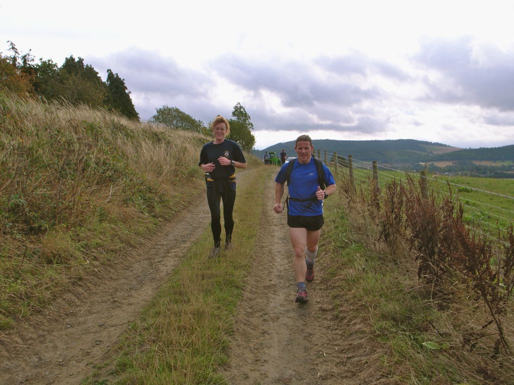 |
| Em and Drew on a farm lane about a mile into the route |
 |
| The three of us at Horderley Bridge, two miles down, 24 to go! Photo courtesy Al Tye http://www.fellrunningpictures.co.uk/ |
 |
| The climb out of Horderley |
 |
| Em at about mile 4, with the south end of the Long Mynd behind |
 |
| The Stretton boys, Drew, Em and Colin Williamson climbing Clunton Hill |
 |
| Me and Drew, running through Clunton Photo courtesy Al Tye http://www.fellrunningpictures.co.uk/ |
 |
| Em, a few yards behind us at Clunton Photo courtesy Al Tye http://www.fellrunningpictures.co.uk/ |
 |
| Drew, entering Clun |
 |
| Em, followed by the Stretton lads, on the way into Clun |
On the hill from Clun towards Bury Ditches, we reluctantly bid farewell to Drew and started to run on ahead. The next self clip, SC3 (13.5 miles and just over half way, reached in 3:03) was at the south edge of the woods by Bury Ditches. We ran on down to Acton and then across the A488 before climbing a couple of hundred feet and skirting Blakeridge wood to reach SC4 (15.75 miles, 3:31).
 |
| Em with the map out, under Blakeridge Wood, just before CP4. I was pleased to have a long break from navigating on the leg from Clun to BC - you lose concentration and can make silly mistakes after a while... |
 |
| Fantastic panorama of the Upper Onny Valleys from above Colebatch |
We climbed across fields to Oakeley Farm and then steeply up through woodland (SC5, 4:20) to reach a path with traversed the north side of Oakeley Mynd about 50' below the top. Coming down we saw Al Tye again, parked up on a farm lane just above Totterton.
 |
| Running down from Oakeley Mynd to Totterton: neither of us looking too tired after 19.5 miles Photo courtesy Al Tye http://www.fellrunningpictures.co.uk/ |
The last big climb was a sod though, and started right after we'd made our only nav mistake of the day, going a hundred yards too far down the road as we sorted our bottles etc out from the checkpoint. We seemed to climb up through Plowden Woods for ages, and drop down on the other side very little as we reached Edgton. We made a fairly determined effort on the road section here and had the couple in front of us in sight most of the time as we returned to SC1 (now SC6) at 24 miles (5:29).
We were there with 31 minutes to go before six hours were up, but it was a long two miles back to Wistanstow, with the climb up out of the dingle seeming to take ages, and the final mile of farm track and then road taking it out of both of us. We did manage a decent run down the road to the Village Hall and crashed through the doors together to finish 19th equal in 5 hours 58 minutes.
My GPS made it 26.6 miles in all and surprisingly 4,080' of ascent. I'd felt fairly comfortable all round, apart from having to manage pre-existing aches and pains (right achilles and bruised toe, left ankle sprain) and one new one a soreness at the left edge of the top of the tongue on my right shoe. I used the Saucony Peregrines with new Sorbothane insoles in and these worked well, with no blisters and only the tongue problem, which I'll try to solve before the hike...
A great day was rounded off with beer, hotpot and dancing at a fellrunning ceilidh in Church Stretton school.
Well done Jim, I finally know what you guys look like, having held one of the gates open near the start, so I will say "Hello" next time our paths cross.
ReplyDeleteIt's just taken me ages to do my write up, I took that many pictures !
Cracking time.