Showing posts with label LDWA. Show all posts

Monday, 15 July 2013

Three Rings of Shap 100k - 15 and 16/06/2013


Image0095
Near the summit of Branstree, above Haweswater
I'd heard about the Three Rings of Shap 100k challenge walk from my friend Roger Lloyd, who'd completed two of the rings in 2011. When Zoe and I discussed the Hundred and she said she'd quite fancy doing it next year (that's not exactly what she said in fairness but never mind...) I checked the entry requirements for next year's Hundred and the first available qualifier was the Three Rings. Given that the others were all on flatter terrain which I might find a little less interesting, and that they were all at the "soft" distance of 50 miles, we decided a week after the Hundred to go for the Three Rings of Shap. You can never say whether you're going to be able to do a Hundred, but 100k to 100 miles is a considerably smaller step up than 50 miles to 100k.

Having registered so close to the event (less than two weeks to go) we didn't have much time for prep other than to book a hotel (the Shap Wells Hotel a few miles away) for the night before and the night after, and to copy A4 maps from my 1:25k OS maps, mark them up, and print the route sheets.

So after a comfy night's sleep, we popped into the Shap Memorial Hall to register (all of one minute to pick up our tallies and let them know we intended to start late) and then back to the hotel for a decent breakfast. We returned to the event centre at about 8:30 and sorted kit, starting at 8:54am.

There were very few behind us (only two runners I think) as we set out on the first ring - a trip out up Wet Sleddale and Mosedale to Branstree and Selside Pike, then down Swindale to Rosgill and back past Shap Abbey to Shap itself. We set a decent rapid walking pace out to the River Lowther and up into Wet Sleddale, climbing above the reservoir with Zoe looking very much the part and doing a lot of the nav work.

Image0092
Across a meadow to the farm in Wet Sleddale - they were liming the field beyond the farm

Image0093
Zoe, looking the part and enjoying it (at Mile 4!)

From road above the reservoir we took a track zigzagging past Sleddale Hall which is abandoned but looks like it may be under restoration. Another 3km took us up to the watershed between Wet Sleddale and Mosedale, where we consulted the map and compass for a few moments to check that the indistinct grass path would lead us down to the bridge in Mosedale. We ran the descent and jogged across the bridge and up to Mosedale Cottage (which has been refurbished fairly recently) where we overtook the first walkers from the main start, a family group of five doing just the first ring.

Image0094
Just before Mosedale Cottage (12km)
The climb to Branstree was relatively straightforward, up a stream to a wall and then along the ridge to the top. Except that I got too near the stream at one point and left my right leg in the most gloopy hole full of brown slop imaginable. Anyway we caught another couple of walkers up at the top and from then on it would be a fairly steady stream for the remainder of the first loop.

We headed along the fenceline to Selside Pike where we caught another few walkers up at the top and from then on it would be a fairly steady stream for the remainder of the first loop.

Image0095
View to Haweswater from between Branstree and Selside Pike
Image0096
Summit of Selside Pike (17km)
Image0097
Pair of walkers near the summit of Selside Pike
From Selside Pike we dropped down across Hobgrumble Gill to a short climb onto Nabs Moor, before descending easy slopes to the top of Forces Falls, the point at which Mosedale runs down into Swindale. The descent from here to the valley of Swindale was beautiful, down a rocky ridge adjacent to a series of waterfalls and plunge pools.

Image0100
Beautiful plunge pools on Swindale Beck

Image0102
View down into Swindale

Image0103
Technical descending into Swindale

Image0104
Zoe running the final section of the descent
A short run along the edge of the beck through moraine led to a lane which turned into the road and led to the first checkpoint at Truss Gap. In a barn by the road were a couple of the Cumbria LDWA stalwarts, logging time, clipping tallies and dispensing superb baked goods. Two currant slices and a piece of cherry cake later and we were on our way up a gentle traversing path to climb above Swindale, passing a farm at Rayside and then recrossing Swindale Beck before joining the road over the River Lowther into Rosgill.

We snuck through a footpath next to an almost abandoned cottage to join a lovely grassy path which ran along the break of the escarpment above the River Lowther, passing close by Shap Abbey to reach the village of Keld, and then followed anothe path through fields past the brilliantly-named "Goggleby Stone" back to Shap and the event centre.

Shap Abbey
Having walked and jogged the first 18 miles and 2,600' of climbing in a bit under 5 hours, we took 25 minutes at the checkpoint to regroup. I redressed my foot which was rubbing quite badly, filled our bottle, swapped the maps and route description and we had a cup of tea.

Duly refreshed we set out on the steady eastward climb which would set us on the way around the second "rivers" ring.  (22 min to start of Zoe's track)

This took us up to Hardendale and over Iron Hill into Reagill and then down to eet the River Livennet at Barnskew. I'd never heard of the Livennet before but it drains quite a significant area north of Crosby Rasenworth Fell between the Lowther and the Lune, and the section we followed was a lovey reach of river. About a third of the way along the river (at about the 8 mile point on the leg) we came to the promised water point...

Image0106
World's most primitive checkpoint - good selection of broken digestives in there, but Zoe
grabbed the only malted milk before I had chance to...
I really liked the minimalist and simplistic approach to resupply here. The next section of the route was really pretty, criss-crossing the River Livennet over a series of small bridges.

Image0107
Stepping stones across the Livennet, about the only place we didn't cross!
Eventually we left the banks of the Livennet and passed through the villages of King's Meaburn and Morland before skirting Cliburn (which looked quite pretty on the descent to the bridge). Leaving the second field after Cliburn there was a big boggy patch (one of very few) and Zoe slipped and saved herself from falling using the stile, which unfortunately was wrapped in barbed wire. We stopped for running repairs with the world's tiniest plaster (the only one left in my first aid kit - must replace them when I use them) and some Micropore. Duly patched up we finished this field section, came out via a farm land onto a road, and then had a real draggy section of a bit over 2km to the checkpoint at Great Strickland.

The checkpoint was in the Strickland Arms (well in the back garden actually). This was at 53.5km: I'm quite glad I didn't realise that at the time, it seemed like we'd already gone a fair way - we reached the checkpoint at 18:16 (09:22 elapsed). We stopped for maybe ten minutes while I patched up my feet again, and partook of the excellent selection of savoury snacks (including mini-pasties - a very welcome first time I've seen these on an event). Just as we were getting ready to leave it started to rain, so we cagged up there and then - I thought it might last a while!

Another 2km of roads led us down and across the River Leith (second of the three rivers this Ring is named for) and on to another of those places where we made a minor navigational error, using the wrong "gate by pylon". Zoe and I had passed a couple of groups of walkers on the road and with a bit of shouted communication we soon sorted it out and found the key bridge over the West Coast Main Line. A zigzag under the motorway led us up to the A6 at Hackthorpe. It was raining on and off, and we wanted to get as far as we could back towards Shap before it set in properly, so I avoided the temptation of another pub, and we headed on uphill through a nature reserve-type area, trending left on unmarked paths through deep undergrowth in the hope that this would bring us out in the right place. We actually came out 200m NE of the gate we'd hoped to be at, but fortunately there was another track through the nettles.

We passed through a gate and a short section of woodland into Lowther deer park. As we came down Round Hill towards Lord Greening's Plantation we could see a big herd of deer off to our left. They seemed fairly unconcerned about the string of walkers spread out over their grazing land. A bit of up and down and a long section with woods on our right led us out of the deer park and across fields to High Knipe. Zoe and I were making good progress, mostly powerhiking but with some running too, and we passed quite a lot of participants on this section.

Shortly after High Knipe Farm, on a section of road, we came to the second unmanned checkpoint on this Ring, at 62km. Again there were biscuits and water. We must have overtaken a good few folks because this time there was a reasonable choice of biscuits left including a chocolate chip cookie!
 
From here we dropped down rapidly to the River Lowther, which we crossed on a fairly bouncy suspension footbridge. We turned and ran upstream with the river on out left for a couple of kilometers to reach Bampton Grange, where we crossed the river and heded along the other side to reach Rosgill - the only point we'd pass twice during the Three Rings.

We passed the cottage we'd been past on the first Ring, then made a second, more serious navigational error, turning left too soon (following someone else who'd done the same thing - never assume the folk in front know where they're going). We sorted it out after a couple of minutes with the map and hopping over two barbed wire fences, continuing uphill towards Shap in increasingly heavy rain. By the top of the next hill it was pouring, and we could see the chap who'd gone too far left was now away over to the right of the route in a field containing the almost aptly-named Thunder Stone. We shouted him, but I don't think he could hear over the rain.

Crossing the lane we made a diagonal beeline across three fields of very wet long pasture which finished off soaking my feet and made sure the repair work I'd done at Strickland would need re-doing at Shap. We followed the Ring One route into Shap from the end of the fields and reached the Hall (70km) at 21:12 (12:18 elapsed time). There weren't too many in the hall this time and we realised quite a few of those there we packing up to go home after two Rings.

We took way too long at the checkpoint really, but I re-dressed my feet from scratch and put new socks and fresh insoles in my shoes to try to keep feet dry for a while. We both ate some proper food too, and changes into a totally fresh set of (dry) clothes. I changed cag from my racing jacket which isn't really ideal for long trips into my mountain jacket which is much better for nights out. We left the hall at dusk, I guess just before 22:00 as the fastest runners were starting to come back in off Ring 3. I was quite pleased to see we hadn't actually been lapped! But I kept remembering the aim here was to ensure Zoe finished and qualified for the 2014 Hundred, and to do so I just needed to keep myself in one piece. So we would be doing relatively little running on the night section!

We started, still in heavy rain, up across the railway and along a stony lane into fields, climbing diagonally to reach a footbridge over the M6. From there we walked through rough fields along the east side of the motorway before I made yet another navigational error and this time decided not to follow the pair in front, but to climb left. Unfortunately it was a hundred yards too soon and we had to drop back down and try again in the next field.

At the top of this climb we crossed the haul road for Hardendale Quarry then followed another haul road down to the hamlet of Oddendale. By now we'd caught up the pair in front, Tony Natale and Andy Carpenter. We passed them on the next section, a long track on a green road gently uphill towards an enclosure called "Potrigg". Just after this we were supposed to fork left, and did so a little too late in the very last vestiges of twilight. Fortunately Tony and Andy shouted us. We then found and followed a nice line across Crosby Ravensworth Fell to reach a critical wall corner. From here the navigation would be straightforward, keeping a wall on our left for 2km as we made a crcuit of the headwaters of the River Livennet.

We then crossed another kilometer of open ground to meet the Orton - Crosby Rasenworth road. I think we were supposed to go straight over here and up past a plantation between this road and the Appleby to Orton road, but we missed it and ended up following the first road uphill to the junction of the two. By now Tony and Andy were in front of us again, and we duly caught and passed them again on the climb to Beacon Hill. We worked together to identify the gate to leave the fell through and dropped down across some fairly indistinct ground into the first of the limestone pavement landscape to try to find the entrance to Great Asby Scar National Nature Reserve.

Once in the reserve we followed a track which curved left after a little while. I'd noted we didn't want to go left when I went through the maps before the event, but went left anyway for some reason. Again Tony and Andy came to the rescue. The rest of the route through the Nature Reserve was straightforward though, and we were fairly soon out onto a farm track which became the road leading to the final manned checkpoint of the event, at Great Asby (86km, arrived at 01:22, time elapsed 16:30).

The checkpoint was brilliant, a gazebo with side panels (is that a tent then?) and a gas heater in the corner of a field. The malt loaf and chees was even better. We stopped ten minutes, and then headed out, passing several other participants on the road down towards Great Asby. These would be the last folks we'd overtake except for Tony and Andy (again!). We hiked up a long farm lane past the entrance to Halligill Farm, and promptly I got confused again on another tricky section. I set a bearing to follow the line of the path marked on the OS, and we ended up in the middle of nowhere at a brand new fence. A hunt around revealed no sign of any stiles. Zoe caught sight of Tony and Andy's headtorches down to the left, and we now realised they'd done the route before, so we made a beeline for them, and caught them up once more in the vivinity of Gaythorne Hall.

We walked together for a while up to a road junction on Coalpit Hill (wonder what they used to do there?) and then down the byway to Bank Head Farm, before we jogged on ahead down into a very sleepy Crosby Ravensworth village. It was now about 3am and just starting to get light as we trotted through the village. The next section was a long slog up a pretty little valley, first on a lane, then on green tracks through fields. We could see Tony and Andy's headtorches some way behind. My torch was off now except to look at the instructions. Zoe was very tired on this section, not so much physically, more just in terms of feeling she needed to sleep. I couldn't persuade her to eat anything or take a ProPlus either. Anyway she rallied as we reached Oddendale. It was her only bad patch really.

From here on back it was a case (largely) of following the outward route, along the quarry road and then around Hardendale Nab, with a slightly different route taking us north of the house at The Nab and down through fields to the motorway bridge. There were some pretty inquisitive horses in the first field and Zoe was a bit worried by them, so we jogged down to the motorway. After the bridge the last two kilometres back into Shap were fairly plain sailing. We arrived back at the Hall at 04:29, 19 hours and 32 minutes after we had started. I have the total distance from GPS as 103.3km.

The hall was almost deserted - there had only been one finisher since 3am. We were checked in and very well looked after with hot quiche making a really satisfacory breakfast! Tony and Andy came in three minutes after us and we were finally able to have a decent chat, having swapped places several times en route. After a while we gathered our stuff together and headed back to the Shap Wells Hotel to get some sleep.

I was pretty satsfied with this event. There wasn't any way our time was likely to set the world on fire, me three weeks after a hundred miler and with sore feet, and Zoe on her first event over 50km. But we finished joint 35th out of 89 starters and 55 finishers, and we achieved the objective of getting Zoe qualified for the Hundred. Not only that but we'd had a great and very varied big day's running and walking and really enjoyed it together.

Wednesday, 19 June 2013

LDWA Hundred - 25 and 26/06/2013

Untitled
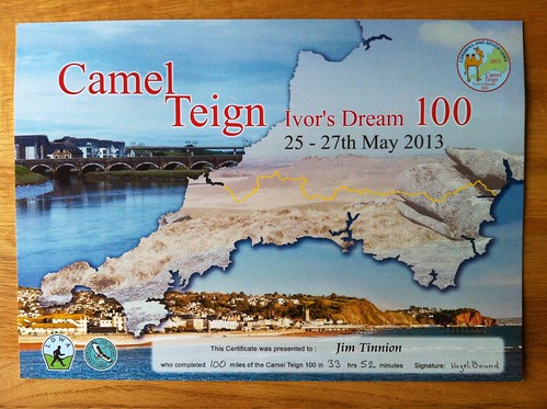
Hard-earned completion certificate!

The LDWA Hundred, or the Camel-Teign Ivor's Dream 100 to give it the full name, was my target event for the first half of 2013. Although I've been taking it very seriously (after all if your first hundred miler doesn't warrant a thoughtful approach what would), I'd not been able to get an consistency into long runs for several months - life just keeps getting in the way. So the prep for this was infrequent 18-25 mile long runs, a single 50k (the Marlborough Downs Challenge) and a lot of dog walking. I felt pretty fit, in fact I'd done pleasingly well on a fitness test three weeks before the event, but I was very aware I was lacking in terms of hours on my feet.

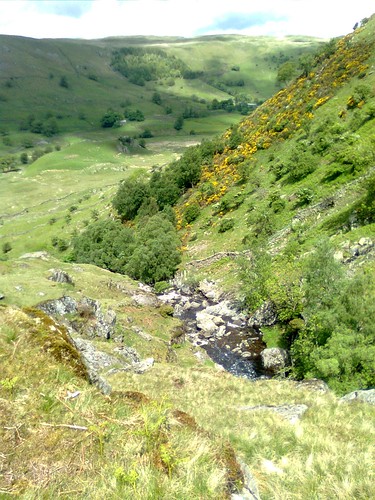
The route was on the face of it very simple, a broadly west to east traverse from Wadebridge in Cornwall to Teignmouth in Devon, crossing from the north Cornish coast to the south Devon coast in the process. The route had diversions from the straight line to take in Bodmin Moor and Kit Hill, and also took a roundabout route into Teignmouth to finish, avoiding Newton Abbot.

As a result of my poor prep, I planned to cut my cloth to suit and to start very conservatively. The first 11 miles were all on the Camel Trail out of Wadebridge and were terribly runnable, so much so that I was scared I'd go way too fast and crash and burn later. I didn't really know the next 20 miles but I did know the terrain on Bodmin Moor. This would bring us to North Hill via Bolventor (home of the Jamaica Inn), where a further moorland section would drop us down into Pensilva.

I'd reccied from there to Dartmeet on the far side of Dartmoor at Easter on the basis that Pensilva would be the point it got dark if things were going not-so-well, and by Dartmeet it would be light.

So, on to the event itself. We arrived in Wadebridge about an hour before my start time (I decided to go for 11:30 rather the 09:30 because I would end up waiting at CP2 for it to open even at a steady walk off the earlier start). I registered and dropped my breakfast bag off with a few goodies to cheer me up when I got to Tavistock.

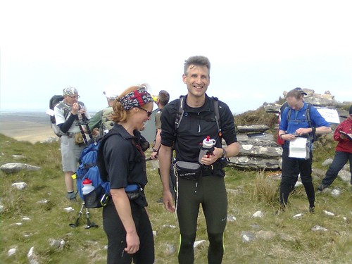
We wandered over from the Town Hall to the start in Jubilee field next to the river at about 11:00 and while most of the 70 or so walkers and runners on this start stood around I took the weight off and lay on the grass for a while in the sun. Then it was starting time and after a couple of brief speeches and instructions we were away. The predicted cavalry charge got underway straight from the off, but I stuck to the plan and walked (albeit at about 13 minute pace) to start with.

Wadebridge - Mile 0


I chatted with Wendy who’d done a 100mile track walking race recently and was telling me about it. She and her other LDWA friend Tara, also around and about, had finished 5th together, the first competitors walking with a “normal gait” apparently – although they can both crack on a bit without having to “do the waddle”. We moved along past pretty salt marshes and long abandoned railway halts to Dunmere. Here there was a drop bucket for the number (presumably to save the organisers recording 500 numbers all at once). There was cake here, and I took a tiny piece of lemon cake.

Camel Trail Wetlands


Dunmere, CP1

The next stage had been rerouted and followed the Camel Trail almost to Blisland, with a manned self clip where we turned off the old railway. I walked with Andrew who’d done quite a few hundreds before and chatted through my tactics, which he seemed to think were reasonable (or maybe he was being polite and not telling me that 4mph on day 2 might be a bit optimistic?) Anyway Blisland soon came and we all took a ten minute break for some refreshments. I filled my bottle and used the loo, took a jam sarnie (left the crusts) and some melon and we were soon on the way again.

The next section went down a steep single track and crossed some interestingly rough scrub land.

Between Blisland and St Breward - Mile 13
Tara leads the experienced LDWA fast walkers towards St Breward

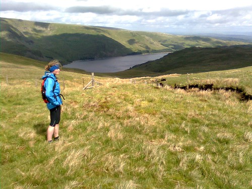
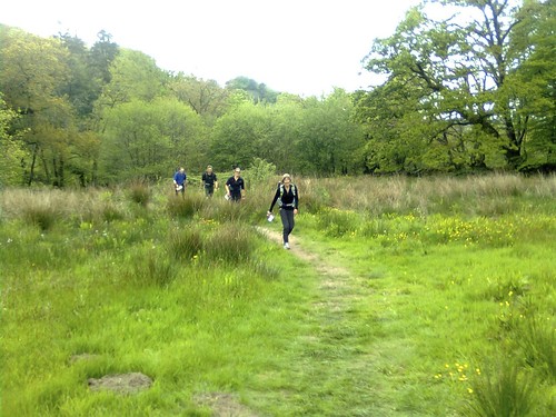
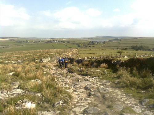
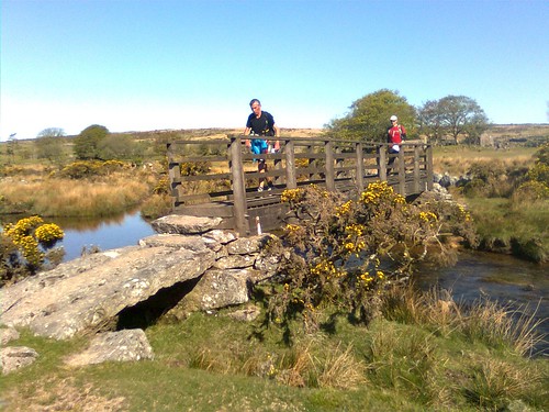
I jogged on ahead of the experienced LDWAers group (Wendy, Tara, Fabrice and Andrew) and promptly overshot the next turn, missing the gate which was supposed to be marked with a waymarker but wasn’t. The guys shouted me (loud enough in the end) and I jogged back from my 300 yard detour and caught them up as we came into the pretty village of St Breward and passed the first pub on the route (gosh that was tough). I was feeling ok and was ahead of the schedule a little here. We were soon climbing up towards the barn at Candra which was checkpoint 3, the last civilisation before Bodmin Moor.

Wendy striding ahead towards Candra - Mile 16
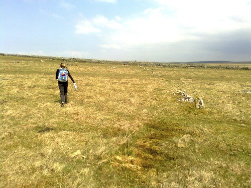
Wendy striding ahead across the west edge of Bodmin Moor


CP3 at Candra - Mile 17
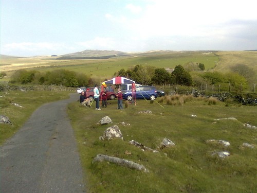
CP3 at Candra (mile 17)

The checkpoint looked like a plague of ravenous creatures had been through – I had a shattered sausage roll and some water and refilled my bottle, and we were away again, still mostly walking but doing a fair clip. I’d agreed with Zoe that I’d text her from Candra if i wanted to change the plan to meet at CP6 and I did this now, as I was sliding around in my new socks a bit and could feel some hotspots developing on my feet. Not good 17 miles into a 100 mile event.

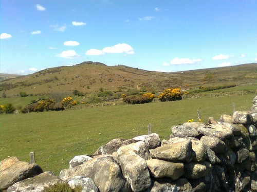
Anyway we continued across the moor to reach the south ridge of Brown Willy, the highest point in Cornwall. Following the ridge up we were passing more and more of the 09:30 starters now. I reached the top a moment or two ahead of Fabrice who I’d been chatting to on the way up about the UTMB races, and walked the thirty yards from the manned checkpoint up to the summit tor (somehow I couldn’t come this close to the top and not go all the way).

Catching 9:30 starters on the south ridge of Brown Willy
Catching 09:30 starters on the south ridge of Brown Willy


Tara on the way up the South Ridge of Brown Willy
Tara limbing towards the summit of Brown Willy

Tara and Fabrice at the top of Brown Willy

Coming off the top there was a short technical descent heading east, and I ran this and then run/walked on my own the remaining two miles or so to CP4 at Bolventor, crossing under the A30.

Running down to Bolventor - Mile 22
Running down to Bolventor - mile 22

This was the first CP with hot food, and I enjoyed a (too) small bowl of penne carbonara and a plate of apple pie and custard. Then I was away again, down the road then up the hill to a plantation before we turned south towards North Hill. I did much of this cross country leg with a fellow Shropshire entrant, Paul from Ludlow. He’d done the Houseman 100 two years ago in our home county, and was moving very well – we both mostly walked a stage which was a mixture of forest track, open moorland and finally lanes. Just before the North Hill Checkpoint, Fabrice, Tara and Wendy caught us up.

Zoe was waiting at CP5 with the socks as promised, so I went fairly quickly through the checkpoint and then to the car, where I changed my socks (but didn’t inspect or dress my feet). This was probably the biggest mistake I made on the whole event, one I’d regret in the second part of the night, and for the whole of the following day! There was a lovely steady climb from the village up onto the moor, where we picked up a former mineral railway. We skipped along the old granite sleepers which were ideally spaced for the ladies, but perhaps a little too close together for Fabrice and me. It didn’t seem to take long before we started the descent to Pensilva with the shadows now notably lengthening. Coming off the hill we could see Callington (CP7) and Kit Hill away in the distance.

Remains of mineral railway above Sharptor - Mile 35
The Mineral Tramway


Descending to Pensilva - Mile 36
Descending to Pensilva - Kit Hill and Callington visible above the plantation


At Pensilva I was again fairly quickly in and out of the checkpoint (37 miles,), and then met Zoe by the car outside. It was 9pm, so I changed into my overnight clothes (t-shirt and shorts off and thermal and thicker tights on – there was already a nip in the air, I was probably walking a little more than I expected and the last thing I wanted was to be cold overnight). Fabrice, Tara, Wendy, Andrew and Paul must all have been away from here before me, and I didn’t see them again (except Fabrice, briefly, at Callington) during the event. I did the next leg on my own, passing a few more 09:30 starters, and running quite a few sections. After a couple of miles I was using my headtorch to check the directions (although I’d been here before on the reccie and did recognise quite a lot of it), and by the end of the trails two miles outside Callington it was on to walk / jog with.

I spent a few minutes in the Callington checkpoint and then went out to the car for a brief chat with Zoe. She made me a nice mug of sweet tea and walked with me up the road for the first three quarters of a mile of the next leg while I drank the tea. Saying farewell for the night I set off along a back lane that would take me up to the start of the Kit Hill climb. Somewhere along here I met Ian Walker who I’d see later on several times. We had a nice chat on the way up Kit Hill, but I felt most comfortable running the descent down a big old inclined plane so left him behind for a while. A section of rough enclosed path led onto a lane which would take me down to the checkpoint at Luckett. I’d been recording a few voice memo diary entries for my friends’ podcast “The Long Run” and did one as I got onto the road. There was a full moon, still red and low in the sky to the south, but enough to light the road sections so I could put my headtorch in my pocket and run without.

At CP8 I stopped for a 15 minute break (I guess) and took some food – mostly savouries and a cup of sweet tea on board. I later found out this was where I’d passed my friend Phil Clarke. He’d been having a rough time with his stomach and stopped here for an hour and a quarter, but he got up and got going again to finish his 6th hundred, this one in 37 hours or so. Leaving on my own again I had a peaceful walk/jog along the ridge on the Cornish side of the Tamar, with an amazing view across the valley which was filling with cotton wool mist to the opposite ridge, clothed in conifers and back lit by the moon. That ridge was in Devon, and soon I’d be at the Horsebridge where we’d cross. Almost halfway!

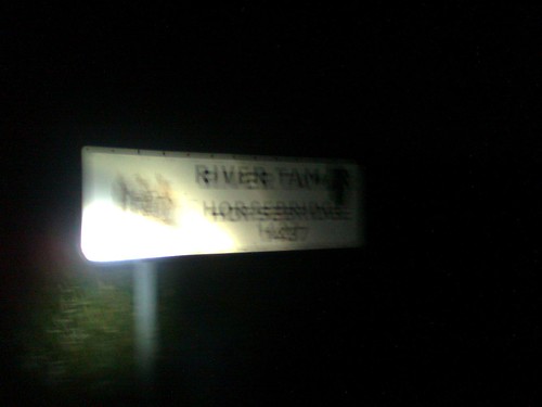
I did another voice recording on the way down to the bridge and then paused to take a very blurry picture of the sign before crossing into Devon. In the right county now!

Crossing Horsebridge into Devon - Mile 50


I was abruptly woken from my nightdream (kind of like a daydream but after dark) by shouts from behind as I’d managed to skip on a section of the instructions and miss a turn. A big thank you to the folks I’d just passed there. There was a steep climb up from the river through some metal kissing gates: the air was full of wild garlic and I was feeling pretty at one with the world. The next section dropped down a road to enter the forestry land around several former mines. I’d accidently drunk water from a polluted stream here on the reccie but didn’t make the same mistake twice. You only need to see a sign with the word “arsenic” on it once I suppose.

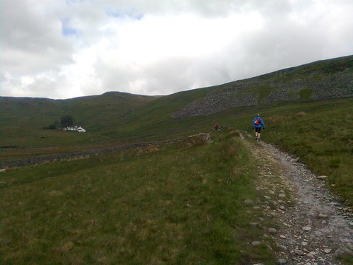
At the end of the long climb through the woods I passed another couple of lads who seemed to be going quite well. We came out onto the road and after a mile crossed the B road. I was back on unknown ground now as I’d deliberately not reccied the run in to Tavistock – it was mostly road and disused railway. I was starting to really feel the soreness in my feet now, and I struggled to keep going at a steady walk over what seemed like a very long drag to the Tavistock checkpoint. I could hear the guys behind me and knew I was slowing down and starting to struggle a bit. Still, the lights of Tavistock and two interesting old viaducts helped me along and through it and I eventually dropped down into the grounds of Kelly College and the checkpoint (55 miles, 15:36 elapsed time).

Coming into big checkpoints after the longer stages (especially when you’ve been solo) is a strange experience: I often find it difficult to “come round” and start interacting with folks again, especially as all the helpers are usually so hyped up and keen to help, to gee you up and help you keep going. Anyway we were led through the whole process, collecting our “breakfast bags” (although I arrived jsut after 3 am), then moving into a changing room where there were bowls and hot water and soap to wash tired (and in many cases, wounded) feet. I got my feet out of my shoes and socks and sure enough there were 50p sized blisters on the balls of both feet. Not a great discovery with 44 miles still to go, but I kind of knew they were there anyway.

I cleaned and tried to drain the blisters. Hint here, a safety pin is not adequate for bursting blisters - much better something that can make a small cut. Next time I'll take a scalpel. I got the one on my right foot sorted and Compeeded up properly, but on my left foot I couldn't really drain it properly and made do, which was a bit of a mistake. I did enjoy a great bottle of chocolate milk from the breakfast bag while doing this though - that was certainly not a mistake. By this time Ian W had arrived and demonstrated the correct technique on his huge blisters using a tiny pair of nail scissors. As he cut into one blister a huge fountain of "juice" erupted from his foot. Not good.

Anyway I moved on, with clean socks, to the refectory where a very nice lady tried hard to persuade me to eat a full cooked breakfast. I wasn't feeling too great and only managed a couple of sausages and a couple of tinned plum tomatoes, washed down with the obligatory sweet tea. I spoke briefly to a guy who was doing the event with his girlfriend. He looked totally out of it, and she was even worse, returning as I left from an extended stay in the smallest room. Doing my best to put the negative thoughts away I handed my breakfast bag back (it would now be taken to the finish) and set off for Princetown.

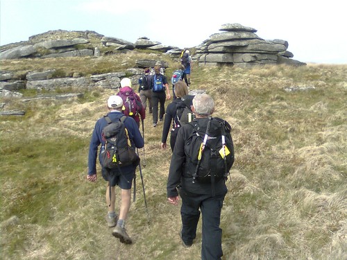
It was still dark but the dawn chorus was underway as I marched the long mile towards Tavistock then up the steep sleepy suburban road to the golf course. Here the light was starting to come, and as I made my way towards Sampford Spiney a group of walkers caught up with me. We leapfrogged for a while and I was amused that a couple were repeatedly getting 50 yards ahead and then going the wrong way so I could catch up. I did tell them I'd reccied the section (it was a bit confusing in places) but they just kept on making the route up as they saw fit. 100 miles may not be so far (thanks for that b****cks, Karl Meltzer) but it's far enough you don't want to make it 110!

Anyway we passed through Sampford Spiney (a beautiful hamlet) and dropped down a steep lane to cross the road and start the ascent of Dartmoor.

Cox Tor and Staple Tors at dawn - Mile 63
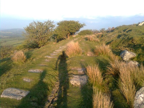
Cox Tor and Staple Tors from the climb to Ingra Tor

This wouldn't be too bad ordinarily, but at daybreak after 17 hours on the go, 64 miles into the event, I was finding it tough. Gradually the other guys around me pulled away and I found myself on my own, doing another Long Run podcast recording, climbing up to Ingra Tor. Not even this brief bit of fell-like terrain could help me and I was grinding desperately slowly upwards. Once I'd finished the audio diary, I got hold of Zoe and asked her to make her way back towards me along the railway path from Princetown. Now I had a mile on the lower section of railway and a short grassy climb to get to her. I jogged a little but mostly staggered along until I reached the upper section of the railway. After only a couple of hundred yards I met Zoe with about a mile and a quarter to go to the checkpoint.

I was really struggling but tried not to let it show too much, as Zoe's steady walk easily outpaced my pathetic attempt at keeping up with a jog / shuffle. Anyway we chatted a little and I found out the cottage was nice and she'd managed a few hours of sleep overnight so that was good. Eventually we passed the fire station and walked into Princetown to the CP at the school. I went in the CP and agreed to meet Zoe at the car 50 yds down the road when I came out.

Inside I came the closest to jacking it in. I pretty much had a complete physical breakdown as I had my tally clipped and sat down (more like fell into) the nearest chair.Various of the team manning the checkpoint fussed around me for a few minutes, asking whether I wanted food or tea or whatever, but I felt I couldn’t take anything. In fact I didn’t really feel much at all, I was just totally done in.

After a few minutes I gathered myself enough to hobble out to the car, and flopped into the passenger seat. Zoe made me sweet tea and I dozed on and off for maybe twenty minutes enjoying the heater. I managed to eat a little fruit and drink a can of Red Bull and Zoe made me patch up my feet again, adding more Compeeds to cover widening hotspots on the balls of my feet. Eventually I got out of the car and started to make my way down the road with Zoe. We got out onto the track towards Hexworthy and I asked Zoe to come as far as the self clip while I finished the tea.

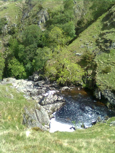
I was starting to feel a little better as I clipped my tally, left Zoe and set off across the moor, catching up Ian (last seen at Tavistock). We kept each other company more or less to Hexworthy and having someone to chat to really helped pass the time. Initially the path went across the moor, then dropped down to cross the River Swincombe.

Crossing the River Swincombe - Mile 70
Crossing the River Swincombe at mile 70. The guy in red is Ian W.

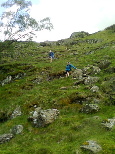
We climbed across another short section of moor before dropping down to a killer Devon stile and onto the road at Hexworthy. There were several other walkers around us as we dragged up the hill to Huccaby Farm Barn (CP11 at the 72 mile mark). I was pretty slow on this leg and I’d spend a very long time at Princetown, so the split time / pace was truly awful for what should have been a fairly easy, mostly downhill five mile leg. I was also still in pretty poor spirits and not really able to eat anything, so I pushed on almost straight away to Dartmeet where I was meeting Zoe again.

Dartmeet’s a beautiful spot, and even in my state it was nice to sit in the morning sun and rest for a few minutes. I was very tired though and still feeling too sorry for myself, and as I rested many other walkers came by. I had a little cry with the frustration at how slow things had got and how crap I felt, but then I started thinking more positively. It was a lovely day, and instead of thinking I still had nearly 30 miles to go I tried to think about enjoying the walk over to Ashburton. I ate a couple of cereal bars which helped, sorted my feet out for what proved to be a final time (I didn’t really want to know after that) and eventually set off with yet another mug of sweet tea, up the big hill and off towards Ashburton.

To my great good fortune I had a chatty spell on the climb and started nattering on to a chap who turned out to be the guy I’d seen at Tavi with his girlfriend. Emma had struggled gamely on to Princetown, but had stopped there, unable to eat and really suffering. Dave had been on the point of canning it too, but the two of them had decided he should go on and finish. Now he was feeling pretty guilty about leaving Emma. Anyway we found we had a common interest in fell running, and started to chat about the various races and events we’d been to. I felt a bit sorry for Zoe who’d dragged all the way to the top of the hill, left out of the conversation and carrying my tea mug. She turned back for the car to go over to the next checkpoint at Ashburton as Dave and I got into our stride with the gallows humour. Here we were, two runners on a great runnable path, totally incapable of running! We plodded on, occasionally stopping to check the nav or look at the view, otherwise just plodding, spinning yarns about the fells and taking the mick about how disastrously broken we each were.

Looking back to Sharp Tor - Mile 75
Lookng back to Sharp Tor - mile 75

Eventually we dropped down off the moor to the River Dart, a little north of New Bridge. We came out at a car park with two of the LDWA old hands just behind us. All of a sudden there was normality, families going for picnics by the river, cars, traffic. We must have been overcome by it all and spurred into action. We saw a lady with a pram ahead of us and knew we had the speed and power to overtake her. We could have been going as fast as maybe 16 minute mile pace! We screamed past the pram and then 100 yards later hit the river. We weren’t where we were supposed to be. We walked round in circles for a bit. I’m sure I saw the lady with the pram looking at us. I’m not really sure what she made of us. Anyway eventually we consulted the route instructions and got it back together. We managed to find the path we should have been on and came out at the bridge just behind the old lags.

We then had a nav wobble through the country park without realising it, as we came out in the right place, again meeting up with our shadow pair, and joining forces up to the self clip near Knowles Cross. A cruel climb up a lane eventually led to a nice descent down right into the heart of Ashburton and CP12 at 81 miles in the Methodist Church Hall.


Dave, me and the two LDWA-ists coming into Ashburton
pic: Steve Clark / LDWA
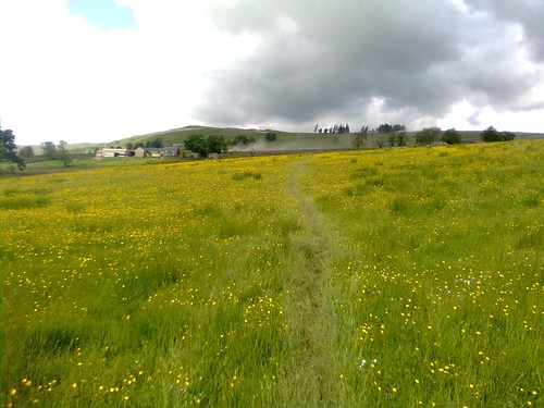
Dave and I had a good eat here, but I caught Zoe on the hop a little as she’d been back to our cottage to sort out her kit so she could walk the last few miles in with us, and I hadn’t text her early enough to let her know we were arriving. For once I was ahead of schedule, even if it was a very revised one. After a good rest and some food, I met Zoe outside while Dave paid a visit to the conveniences. On we went, this time walking as a four for the first few miles with the same pair of guys we’d been keeping pace with since Dartmeet. The route followed a pleasant path above the River Ashburn for a while and then climbed fairly steeply up to Owlacombe Cross on Ashburton Down. This was a rough and stony path but somehow the company and the food were working, I’d managed to find a way to ignore my complaining feet, and we went at a good speed up the hill. Down from the cross towards Sigford we followed a very pretty Devon Lane before turning to follow Langworthy Brook across fields full of buttercups to Goodstone Woods. This was a much better spell for me and I even had energy to take a photo while Dave took a nature break just before the woods.
LDWA old hands near Sigford - Mile 85
LDWA old hands about to enter the woods of doom near Sigford. We couldn't keep up, even
when Dave wasn't on a nature break (you owe me several sheets of loo roll mate).

It was a different story once we were in the trees - a very tough and slow mile and a quarter with lots of slippery roots, mud, and stream crossings took us first down the main valley and then up a side valley to emerge at Coombe Farm. Foolishly we were thinking that must be the worst over for the leg, but we were soon grumbling again as the route continued to climb up yet another stony track to the summit of Ramshorn Down. I hadn’t copped this as a significant hill from my look-throughs on the map and route description, and Ramshorn is not by any means high, but it was a real effort. At least there was a reward though as we caught our breath at the top. I looked up and saw first the deep blue sea itself, then a town lying in a valley at the edge of it which I slowly realised was Teignmouth. WE COULD SEE THE FINISH! We just stood and looked for a minute or two, both quite overwhelmed by it I think. It looked downhill. Not too far now (probably 14 miles by our route, but it looked much closer in a straight line). We were going to make it. It was four o’clock on the second day (although I had no idea of this at the time – I’d dumped the Garmin and stopped looking at the clock on my phone long since). We had the rest of the day and all night if we needed it, WE WOULD FINISH!

This put a bit of a spring in our step (mentally at least) and we were soon down the long descent into Liverton – the descents were starting to hurt now, particularly in my quads. I checked with Dave and his were totalled too. Every so often one of us would feel it and go a bit sideways and the other one would start to take the p***.

The checkpoint at Liverton was amazing. It was in someone’s garden, in a marquee. There was amazing stilton and broccoli soup. And mini cheddars. Lots of mini cheddars. I ate a lot. We sat around chatting. I drank tea, Dave drank full strength coke. Life was good. Then we realised we had to start again: Zoe would be waiting for us at Chudleigh Knighton. But for that 20 minutes of heaven, Teignbridge and District Scouts we salute you!

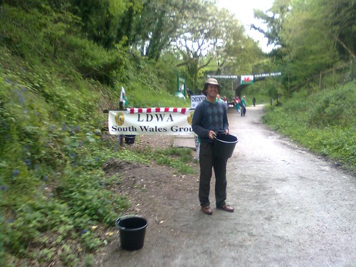
The next leg was barely more than a 5k. It was also pretty much flat – a few fields, a track through a wood and past an industrial estate, and then the bog. Actually in the daytime it wasn’t too bad, we stayed on the marked route and were soon walking into Chudleigh K. In the night apparently it was altogether different and many finishers would relate how they’d only made it thanks to “Swampy” – one of the “Irregulars” (a rogue group of the LDWA if you can grasp that concept) who’d spent the night mostly alone in his bog, making sure that the occasional stragglers didn’t succumb to the mire by guiding them in to the checkpoint.
Zoe was waiting for us (she’d been waiting since we left Liverton I think) but we went inside and ate anyway. Prodigious amounts of pizza topping on toast in my case. Pints of coke for Dave.

Then we were off, in almost a gaggle. We crossed the River Teign (the last of the major river crossings) and then the A38. Ian had reappeared and we came across him plodding along assisted by his friend. Ian was wearing a pair of crocs. He was totally b****red but there was no way he was stopping! We climbed through fields up to a cottage at Gappah which Zoe and I had driven past on the Friday afternoon, doing our car reccie of the final sections. There was a long section of road above Chudleigh next to Ugbrooke Park (all we could see was the typical high forbidding estate wall), before a fast but quad mashing descent on more road down to pass the lakes and landscaped gardens of Ugbrooke House. Then we were climbing again, up towards Ideford, crossing under the A380. We were a mere six miles from the finish now, and very close to the last wayside checkpoint.

And here began a horrible sting in the tail. I’d been flagging up the hill, Zoe was chatting with a couple of other walkers and I’d been dragging along behind. Now we started along a lane to the checkpoint. It was surfaced in sharp angular stones about 2 inches in diameter. My feet were destroyed. I tried to pick a line through the stones, walking on the flatter bits and the odd bit of hard mud rather than risk flaying my feet. But it wasn’t working. The path steepened downhill and I just had to plough on and grin and bear it. Eventually we reached a cross tracks at a bridge and the checkpoint was 50 yards off to the left. We nearly missed it but fortunately Dave and a few other guys we’d been walking with had found it.

I sat down for a moment or two, but I didn’t want to stop. Now I just wanted to get the job done. Dave agreed and off we went, together with another guy (Paul Keech I think), a lady who looked out on her feet (Sue Tarr) and Zoe. After a hundred yards of relative smoothness the path went uphill, and was even worse, if that were possible, than the section before the checkpoint. I dropped in with Sue and tried to find a decent line. After 500m we were out onto a road, but still climbing. Our little group stretched and flexed but stayed broadly together, Dave and Paul out front, Zoe bridging the gap and Sue and I at the back. Having Sue to “look after” was at least taking my mind off how bad I felt. Soon we were off the road again and still climbing, this time on a retted washed out track with sections of intact old tarmac. I picked my way uphill on an endless climb. The gradient eased and we passed into woodland. The map said it was 500m to the top, but it felt like for ever. Eventually we came out onto the golf course and passed the trig point at 247m. It would be downhill (almost) all the way now.

And my quads were shot. The road dropped 700 feet in a mile – there are fell races with less descent. Cruel, cruel, cruel. I dared not run. I’d fall forwards and hurt myself or my quads would seize altogether or cramp. I’d finish in an ambulance. So it was a painful but quick walk down to the outskirts of Teignmouth. The sun was setting and it was just starting to get dark. Somewhere here we passed the 100 mile mark, meaning there was a mile to go. Finally the gradient eased. Sue had gathered herself enough to check her watch. She’d started at 09:30 and was desperate to finish inside 36 hours. Would we do it? Probably...
We pushed on fast through the streets of Teignmouth. Paul had dropped a little behind on the way down from the golf course. Sue was still with us. We climbed a short hill and turned to see first Dave’s girlfriend Emma, and then the gates of the Community College with a marshall. Dave and I crossed the road and ran it in, following seemingly endless tape to pass through a cloakroom into a large, brightly lit hall. People were sitting eating. A round of applause started. Someone showed us a desk in the corner which was the finish. My tally was cut from my rucksack and I’d done.

Dave and I stood there. He hugged Emma. I hugged him.

Sue arrived and got her own very deserved round of applause, then Paul a few minutes later. Ian? Ian made it too, an hour later than us. Those last ten miles must have been epic for him.

I ate, chatted to Janet from our local Marches LDWA group, and staggered up the road to the car. Zoe hadn’t come into the hall – she doesn’t like crowds and didn’t want anyone to think she’d done the event. I said my thank yous to her later.

And I'll say my thank yous to all of the people who made it possible now, particularly to the Devon & Cornwall LDWA and the Teignbridge and District Scouts. Thank you all so much. I had the experience of my life.

Sunday, 26 February 2012

South Shropshire Circular - 25/02/2012

In the lead group, traversing after SC2
This one wasn't exactly a target "event" on my list, I more intended it as a steady long run, but sometimes it doesn't work out quite that way.

The SSC is a Marches Area LDWA event which has a very strong following amongst local fell runners. Noel, Sandy and Terry had all raved about it, so I was pleased to remember to get an entry in on time and have a place for this year's event. The format uses a different area each year, with the route only being disclosed on the morning of the event. Each participant is given a route card with directions when registering. This also has the locations of each checkpoint on it. This year there were eight, six self clips (orienteering style checkpoints) and two manned checkpoints with water and sustenance.

The 25 mile / 3,600' course started from Cleobury North and took in a lovely traverse around the north end of Brown Clee and then up to the summit, then a further traverse under Abdon Burf down to the main road. Crossing this, the route up Titterstone Clee (there was a faster going around the hill option, but no self respecting fell runner would do that, would they?). A fast descent down to Cleeton St Mary led to a rolling section through fields and farmyards and on to the second manned checkpoint. From here a steady climb would take us to the top of Abdon Burf, and then down a beautiful descent, both picturesque and fantastic running, and a tough level 2km road section before the final drop back to Cleobury North and the finish.

I had a good start, feeling strong, and ran with the lead group until the first manned checkpoint. A quick bottle fill here saw me away as the front runner - something which has NEVER happened to me before in an event. I managed to hold on for at least a mile before the ultimate winner (or at least the guy who was first home - it's not a race) passed me as we moved onto the open hillside. Nigel Glaze and I navigated off the top together, and located the next self clip fairly easily, but we got caught by a couple of clever folk who spotted that the "around" option was going to be quicker than the "up and over". Never mind, it was a great view...

Walking to the start with Terry Davies (pic by Em) 
10 yards to SC2 at the top of Brown Clee - Lawrie Jones in front
Descending from CP2 - thanks to everyone coming up who
gave me a shout.

Weirdly finding myself in the lead, I thought I'd better take a pic for the
record. On Callow Lane after CP1.

Arriving at the top of Titterstone Clee, a few seconds before Nigel Glaze.

A short bit of disused road led to a rough boggy moorland section and the descent to Cleeton St Mary. The others from the lead group started to pass me here, and my poor patch continued across fields as I dropped off the back of the group, only to be saved when everyone went the wrong way at a farm about a mile short of CP2. This brought the field back together and helped me as I lost only a minute or two when some lost four or five. They soon pulled away on the farm track though, and by CP2 must have had a couple of minutes. I got some energy on board, refilled the bottle quickly and got going, although it was slow going...

Just after the farm where we all got a bit lost!
After a mile or so I had another problem as I'd lost visual contact with the guy in front of me (who was the guy who won, again). I didn't trust the instruction to turn half left after the Old School House and thought I must have missed it, so stopped at a crossroads the instructions didn't mention, and lost two or three minutes reading my map. This section was all uphill, and after a grim clayey muddy slime fest up a byway, we crossed the Ludlow - Bridgnorth road and started up Abdon Burf. I was still struggling, but round a bend the track straightened and steepened, and ahead I could see the lead group again.

This spurred me on and I climbed fairly hard right the way to the top, catching a guy called Richard who'd come up from Wiltshire to run, and nearly catching my friend Adrian Donnelly. On the way off the top I could see Noel, JT, and Dawsy too, maybe 300m ahead. I followed Adrian down to a lovely grassy descent through landscaped parkland, and flew this, passing Ad after a bit. There was a sting in the tail as the route cut left onto a fairly level tarmac estate road, Ad got a better line onto it, came out 50 yards in front, and I had jelly where my legs should have been. I kept pushing on, but the jelly was turning to lead, and I just couldn't catch him. However I held Richard off and ended up finishing in 4:32.
Twenty yards to go! (pic by Em)
JT, Noel and Dawsy coming in to finish. (pic by Em)

As I handed my tally over to the finish officials, I looked around and was very surprised to see so few people "home". In fact I was told I'd finished 7th. There was no sign of my three mates who'd been ahead of me at the top. Richard arrived shortly after me, then Noel, JT and Dawsy - they'd had a nav nightmare on the way down from Abdon Burf.

Anyway I had an unexpectedly good result after a poor third quarter to the event, but I've learned something: you have to get in a good position in the race, but not to panic when things don't go so well because if you keep pushing on as best you can, things sometime go badly for other folk as well, and at different times. You have to be there and thereabouts to capitalise though...


Sunday, 11 September 2011

Wistanstow Walk - 10/09/2011

A rather disorganised start as I realise I haven't checked to see if anyone
knows where they're going, Em laughs, and Drew just looks strong...
Photo courtesy Al Tye http://www.fellrunningpictures.co.uk/
Despite being named the Wistanstow Walk, this was very definitely a run for us!

The Walk is a Long Distance Walkers Association (LDWA) event, organised by Phil Clarke (also of Mercia Fell Runners). I'd entered as practise for the hike and Em wanted to see if she could do a marathon (the route was about 26.5 miles).

We set off from Wistanstow at just after 8:30, running with Em's colleague Drew and heading gently up a road and lane to reach a footpath which dropped down through a little wooded dingle to Horderley, where Al Tye was waiting to take our pictures as we crossed the bridge over the River Onny. Climbing out of the village to the west we reached the first "SC" (self clip) checkpoint and clipped our tallies (2 miles, 28 min).

Em and Drew on a farm lane about a mile into the route
The three of us at Horderley Bridge, two miles down, 24 to go!
Photo courtesy Al Tye http://www.fellrunningpictures.co.uk/
The next leg took us across fields and along the edge of a wood, down a peculiar little ridge and then about a 1km section of road to Edgton. We joined up with three guys from Stretton including Dave who marshalls some of our races, and spent the next 10 miles or so leapfrogging them. At Edgton the outward and inbound routes divided. We headed south then south west, climbing gently to skirt the pass through a wood before dropping down a steady slope into Kempton, where we crossed the river to reach the first manned "CP" (checkpoint), at 6.5 miles, in 1 hr 24 min. This was the back of someone's car, but there was a very welcome cup of squash to sustain us on the next leg.

The climb out of Horderley
Em at about mile 4, with the south end of the Long Mynd behind
This climbed steeply up Clunton Hill, passing through another section of wood before dropping down and passing through Clunton. Em was on home ground now, having used the next section of the route before on horse rides to the Welsh coast. Drew was struggling a bit with an ankle injury he kept aggravating and we didn't run much despite easy flatish ground through the woods to SC2 at 10.25 miles (2:16).

The Stretton boys, Drew, Em and Colin Williamson climbing Clunton Hill
Me and Drew, running through Clunton
Photo courtesy Al Tye http://www.fellrunningpictures.co.uk/
Em, a few yards behind us at Clunton
Photo courtesy Al Tye http://www.fellrunningpictures.co.uk/
The next leg was the shortest, dropping down mostly on minor roads to reach a scenic ford and footbridge on the edge of Clun.

Drew, entering Clun
Em, followed by the Stretton lads, on the way into Clun
CP2 (11.5 miles, 2:34) was in Clun Fire Station (the walk is supported by Shropshire Fire and Rescue and in aid of the Fire Fighters' Charity and Wistanstow Under 5s). I adjusted my footwear, topped up the painkilling gel on my ankle sprain (left) and achilles (right), scoffed a quick bowl of fruit cocktail, and we headed off.

On the hill from Clun towards Bury Ditches, we reluctantly bid farewell to Drew and started to run on ahead. The next self clip, SC3 (13.5 miles and just over half way, reached in 3:03) was at the south edge of the woods by Bury Ditches. We ran on down to Acton and then across the A488 before climbing a couple of hundred feet and skirting Blakeridge wood to reach SC4 (15.75 miles, 3:31).

Em with the map out, under Blakeridge Wood, just before CP4. I was pleased
 to have a long break from navigating on the leg from Clun to BC - you lose
 concentration and can make silly mistakes after a while...
The route then dropped down to Colebatch with glorious views north to the upper Onny Valley, surrounded by the Stiperstones and Long Mynd.

Fantastic panorama of the Upper Onny Valleys from above Colebatch
From Colebatch the ground was easier, across fields before quite suddely entering Bishop's Castle and reaching CP3 at the Fire Station there (17.5 miles and 3:56). I had another bowl of fruit cocktail and Em and I both had a cup of weak warm tea which we drank on the run out of town. Fortunately BC youths don't seem to have caught on to torching litter bins so we could dump the cups easily enough.

We climbed across fields to Oakeley Farm and then steeply up through woodland (SC5, 4:20) to reach a path with traversed the north side of Oakeley Mynd about 50' below the top. Coming down we saw Al Tye again, parked up on a farm lane just above Totterton.

Running down from Oakeley Mynd to Totterton: neither of us looking
too tired after 19.5 miles
Photo courtesy Al Tye http://www.fellrunningpictures.co.uk/
We'd been running behind a couple who seemed to be going faster than us an were surprised as they caught us up and passed us on the road to Plowden - they'd had a nav muck-up on Oakeley Mynd somehow and we'd passed them without seeing them. Em started to suffer a bit on this section with sore hips and knees - I'm sure this is what happens to all fellrunners when we run on the road, and nothing to do with the distance travelled! We reached the Plowden checkpoint (21.5 miles and 4:52) pretty much together, with Dick Scroop (Mercia ultra-running legend) just behind us. I had more squash and some kind of jaffa cake on steroids which was unbelievably sweet without being sickly, just what I needed. By now we realised we were going to finish...

The last big climb was a sod though, and started right after we'd made our only nav mistake of the day, going a hundred yards too far down the road as we sorted our bottles etc out from the checkpoint. We seemed to climb up through Plowden Woods for ages, and drop down on the other side very little as we reached Edgton. We made a fairly determined effort on the road section here and had the couple in front of us in sight most of the time as we returned to SC1 (now SC6) at 24 miles (5:29).

We were there with 31 minutes to go before six hours were up, but it was a long two miles back to Wistanstow, with the climb up out of the dingle seeming to take ages, and the final mile of farm track and then road taking it out of both of us. We did manage a decent run down the road to the Village Hall and crashed through the doors together to finish 19th equal in 5 hours 58 minutes.

My GPS made it 26.6 miles in all and surprisingly 4,080' of ascent. I'd felt fairly comfortable all round, apart from having to manage pre-existing aches and pains (right achilles and bruised toe, left ankle sprain) and one new one a soreness at the left edge of the top of the tongue on my right shoe. I used the Saucony Peregrines with new Sorbothane insoles in and these worked well, with no blisters and only the tongue problem, which I'll try to solve before the hike...

A great day was rounded off with beer, hotpot and dancing at a fellrunning ceilidh in Church Stretton school.