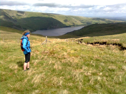
 |
| Near the summit of Branstree, above Haweswater |
Having registered so close to the event (less than two weeks to go) we didn't have much time for prep other than to book a hotel (the Shap Wells Hotel a few miles away) for the night before and the night after, and to copy A4 maps from my 1:25k OS maps, mark them up, and print the route sheets.
So after a comfy night's sleep, we popped into the Shap Memorial Hall to register (all of one minute to pick up our tallies and let them know we intended to start late) and then back to the hotel for a decent breakfast. We returned to the event centre at about 8:30 and sorted kit, starting at 8:54am.
There were very few behind us (only two runners I think) as we set out on the first ring - a trip out up Wet Sleddale and Mosedale to Branstree and Selside Pike, then down Swindale to Rosgill and back past Shap Abbey to Shap itself. We set a decent rapid walking pace out to the River Lowther and up into Wet Sleddale, climbing above the reservoir with Zoe looking very much the part and doing a lot of the nav work.
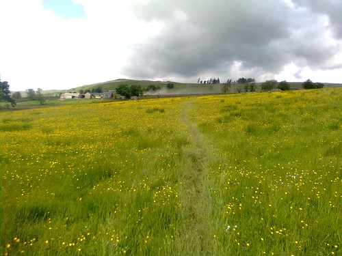 |
| Across a meadow to the farm in Wet Sleddale - they were liming the field beyond the farm |
 |
| Zoe, looking the part and enjoying it (at Mile 4!) |
From road above the reservoir we took a track zigzagging past Sleddale Hall which is abandoned but looks like it may be under restoration. Another 3km took us up to the watershed between Wet Sleddale and Mosedale, where we consulted the map and compass for a few moments to check that the indistinct grass path would lead us down to the bridge in Mosedale. We ran the descent and jogged across the bridge and up to Mosedale Cottage (which has been refurbished fairly recently) where we overtook the first walkers from the main start, a family group of five doing just the first ring.
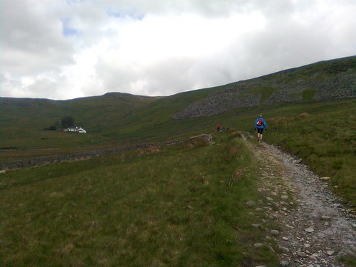 |
| Just before Mosedale Cottage (12km) |
We headed along the fenceline to Selside Pike where we caught another few walkers up at the top and from then on it would be a fairly steady stream for the remainder of the first loop.
 |
| View to Haweswater from between Branstree and Selside Pike |
 |
| Summit of Selside Pike (17km) |
 |
| Pair of walkers near the summit of Selside Pike |
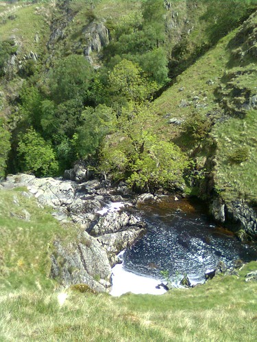 |
| Beautiful plunge pools on Swindale Beck |
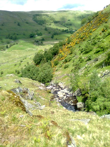 |
| View down into Swindale |
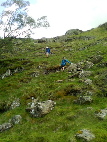 |
| Technical descending into Swindale |
 |
| Zoe running the final section of the descent |
We snuck through a footpath next to an almost abandoned cottage to join a lovely grassy path which ran along the break of the escarpment above the River Lowther, passing close by Shap Abbey to reach the village of Keld, and then followed anothe path through fields past the brilliantly-named "Goggleby Stone" back to Shap and the event centre.
 |
| Shap Abbey |
Duly refreshed we set out on the steady eastward climb which would set us on the way around the second "rivers" ring. (22 min to start of Zoe's track)
This took us up to Hardendale and over Iron Hill into Reagill and then down to eet the River Livennet at Barnskew. I'd never heard of the Livennet before but it drains quite a significant area north of Crosby Rasenworth Fell between the Lowther and the Lune, and the section we followed was a lovey reach of river. About a third of the way along the river (at about the 8 mile point on the leg) we came to the promised water point...
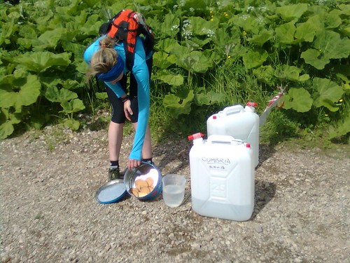 |
| World's most primitive checkpoint - good selection of broken digestives in there, but Zoe grabbed the only malted milk before I had chance to... |
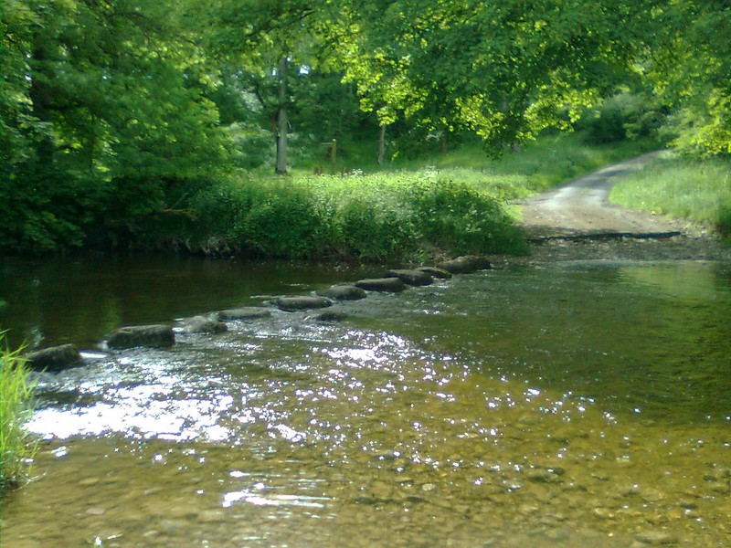 |
| Stepping stones across the Livennet, about the only place we didn't cross! |
The checkpoint was in the Strickland Arms (well in the back garden actually). This was at 53.5km: I'm quite glad I didn't realise that at the time, it seemed like we'd already gone a fair way - we reached the checkpoint at 18:16 (09:22 elapsed). We stopped for maybe ten minutes while I patched up my feet again, and partook of the excellent selection of savoury snacks (including mini-pasties - a very welcome first time I've seen these on an event). Just as we were getting ready to leave it started to rain, so we cagged up there and then - I thought it might last a while!
Another 2km of roads led us down and across the River Leith (second of the three rivers this Ring is named for) and on to another of those places where we made a minor navigational error, using the wrong "gate by pylon". Zoe and I had passed a couple of groups of walkers on the road and with a bit of shouted communication we soon sorted it out and found the key bridge over the West Coast Main Line. A zigzag under the motorway led us up to the A6 at Hackthorpe. It was raining on and off, and we wanted to get as far as we could back towards Shap before it set in properly, so I avoided the temptation of another pub, and we headed on uphill through a nature reserve-type area, trending left on unmarked paths through deep undergrowth in the hope that this would bring us out in the right place. We actually came out 200m NE of the gate we'd hoped to be at, but fortunately there was another track through the nettles.
We passed through a gate and a short section of woodland into Lowther deer park. As we came down Round Hill towards Lord Greening's Plantation we could see a big herd of deer off to our left. They seemed fairly unconcerned about the string of walkers spread out over their grazing land. A bit of up and down and a long section with woods on our right led us out of the deer park and across fields to High Knipe. Zoe and I were making good progress, mostly powerhiking but with some running too, and we passed quite a lot of participants on this section.
Shortly after High Knipe Farm, on a section of road, we came to the second unmanned checkpoint on this Ring, at 62km. Again there were biscuits and water. We must have overtaken a good few folks because this time there was a reasonable choice of biscuits left including a chocolate chip cookie!
From here we dropped down rapidly to the River Lowther, which we crossed on a fairly bouncy suspension footbridge. We turned and ran upstream with the river on out left for a couple of kilometers to reach Bampton Grange, where we crossed the river and heded along the other side to reach Rosgill - the only point we'd pass twice during the Three Rings.
We passed the cottage we'd been past on the first Ring, then made a second, more serious navigational error, turning left too soon (following someone else who'd done the same thing - never assume the folk in front know where they're going). We sorted it out after a couple of minutes with the map and hopping over two barbed wire fences, continuing uphill towards Shap in increasingly heavy rain. By the top of the next hill it was pouring, and we could see the chap who'd gone too far left was now away over to the right of the route in a field containing the almost aptly-named Thunder Stone. We shouted him, but I don't think he could hear over the rain.
Crossing the lane we made a diagonal beeline across three fields of very wet long pasture which finished off soaking my feet and made sure the repair work I'd done at Strickland would need re-doing at Shap. We followed the Ring One route into Shap from the end of the fields and reached the Hall (70km) at 21:12 (12:18 elapsed time). There weren't too many in the hall this time and we realised quite a few of those there we packing up to go home after two Rings.
We took way too long at the checkpoint really, but I re-dressed my feet from scratch and put new socks and fresh insoles in my shoes to try to keep feet dry for a while. We both ate some proper food too, and changes into a totally fresh set of (dry) clothes. I changed cag from my racing jacket which isn't really ideal for long trips into my mountain jacket which is much better for nights out. We left the hall at dusk, I guess just before 22:00 as the fastest runners were starting to come back in off Ring 3. I was quite pleased to see we hadn't actually been lapped! But I kept remembering the aim here was to ensure Zoe finished and qualified for the 2014 Hundred, and to do so I just needed to keep myself in one piece. So we would be doing relatively little running on the night section!
We started, still in heavy rain, up across the railway and along a stony lane into fields, climbing diagonally to reach a footbridge over the M6. From there we walked through rough fields along the east side of the motorway before I made yet another navigational error and this time decided not to follow the pair in front, but to climb left. Unfortunately it was a hundred yards too soon and we had to drop back down and try again in the next field.
At the top of this climb we crossed the haul road for Hardendale Quarry then followed another haul road down to the hamlet of Oddendale. By now we'd caught up the pair in front, Tony Natale and Andy Carpenter. We passed them on the next section, a long track on a green road gently uphill towards an enclosure called "Potrigg". Just after this we were supposed to fork left, and did so a little too late in the very last vestiges of twilight. Fortunately Tony and Andy shouted us. We then found and followed a nice line across Crosby Ravensworth Fell to reach a critical wall corner. From here the navigation would be straightforward, keeping a wall on our left for 2km as we made a crcuit of the headwaters of the River Livennet.
We then crossed another kilometer of open ground to meet the Orton - Crosby Rasenworth road. I think we were supposed to go straight over here and up past a plantation between this road and the Appleby to Orton road, but we missed it and ended up following the first road uphill to the junction of the two. By now Tony and Andy were in front of us again, and we duly caught and passed them again on the climb to Beacon Hill. We worked together to identify the gate to leave the fell through and dropped down across some fairly indistinct ground into the first of the limestone pavement landscape to try to find the entrance to Great Asby Scar National Nature Reserve.
Once in the reserve we followed a track which curved left after a little while. I'd noted we didn't want to go left when I went through the maps before the event, but went left anyway for some reason. Again Tony and Andy came to the rescue. The rest of the route through the Nature Reserve was straightforward though, and we were fairly soon out onto a farm track which became the road leading to the final manned checkpoint of the event, at Great Asby (86km, arrived at 01:22, time elapsed 16:30).
The checkpoint was brilliant, a gazebo with side panels (is that a tent then?) and a gas heater in the corner of a field. The malt loaf and chees was even better. We stopped ten minutes, and then headed out, passing several other participants on the road down towards Great Asby. These would be the last folks we'd overtake except for Tony and Andy (again!). We hiked up a long farm lane past the entrance to Halligill Farm, and promptly I got confused again on another tricky section. I set a bearing to follow the line of the path marked on the OS, and we ended up in the middle of nowhere at a brand new fence. A hunt around revealed no sign of any stiles. Zoe caught sight of Tony and Andy's headtorches down to the left, and we now realised they'd done the route before, so we made a beeline for them, and caught them up once more in the vivinity of Gaythorne Hall.
We walked together for a while up to a road junction on Coalpit Hill (wonder what they used to do there?) and then down the byway to Bank Head Farm, before we jogged on ahead down into a very sleepy Crosby Ravensworth village. It was now about 3am and just starting to get light as we trotted through the village. The next section was a long slog up a pretty little valley, first on a lane, then on green tracks through fields. We could see Tony and Andy's headtorches some way behind. My torch was off now except to look at the instructions. Zoe was very tired on this section, not so much physically, more just in terms of feeling she needed to sleep. I couldn't persuade her to eat anything or take a ProPlus either. Anyway she rallied as we reached Oddendale. It was her only bad patch really.
From here on back it was a case (largely) of following the outward route, along the quarry road and then around Hardendale Nab, with a slightly different route taking us north of the house at The Nab and down through fields to the motorway bridge. There were some pretty inquisitive horses in the first field and Zoe was a bit worried by them, so we jogged down to the motorway. After the bridge the last two kilometres back into Shap were fairly plain sailing. We arrived back at the Hall at 04:29, 19 hours and 32 minutes after we had started. I have the total distance from GPS as 103.3km.
The hall was almost deserted - there had only been one finisher since 3am. We were checked in and very well looked after with hot quiche making a really satisfacory breakfast! Tony and Andy came in three minutes after us and we were finally able to have a decent chat, having swapped places several times en route. After a while we gathered our stuff together and headed back to the Shap Wells Hotel to get some sleep.
I was pretty satsfied with this event. There wasn't any way our time was likely to set the world on fire, me three weeks after a hundred miler and with sore feet, and Zoe on her first event over 50km. But we finished joint 35th out of 89 starters and 55 finishers, and we achieved the objective of getting Zoe qualified for the Hundred. Not only that but we'd had a great and very varied big day's running and walking and really enjoyed it together.
Much different weather from last year:
ReplyDeleteLess than one Ring of Shap
The plan was that I would meet Kevin near his place in the Peak District and we would drive together to the Lake District. As planned, he picked me up at the railway station and we drove there, chatting happily in his car. We arrived around 10pm, just in time to squeeze our sleeping bags onto the rare spots left on the floor, between other competitors already well installed.
It rained heavily all night but it seemed to calm down in the morning. Good breakfast and off we went in dry weather although the ground was extremely drenched under foot. This dry weather was not to last long because after a ten minute walk the rain was back with a vengeance.
Having checked the forecast online, I had put my rain jacket on straight from the start so I didn’t have to stop. I was wearing only a thin microfleece underneath to avoid having to undress after a few miles. The rain and wind intensified rapidly. A diversion had been put in place at the beginning because the footpaths were flooded but still we were more or less walking in deep water most of the time. After less than an hour I was completely frozen and it was pouring so hard that it was out of the question to remove my rain jacket just for one minute in order to put on the fleece that was in my rucksack. I accelerated thinking that walking fast would keep me warm but no, the strong icy wind gusts, throwing the horizontal rain at me made it still colder and colder.
I had long ago given up trying to place my feet on the shallower puddles of water. Stepping in some hidden holes, I was sometimes knee high in the water, if not more. I had also given up reading the route description or even trying to guess, reading my GPS where I had input the track, if I was still on the right route. My glasses were fogged up by the rain, I couldn’t see anything anymore, especially since the mist was wrapping itself all around me. I was just going straight uphill, as fast as I could, thinking that I had no choice but to keep going, since it was now too late to go back. After a long climb, by miracle, I thought that I detected the shadow of a construction further on. It was probably a mirage as I couldn’t imagine that anything like a hut would exist in this desolate landscape but yes, there it was. The only problem was that to reach it we had to pass a tumultuous stream made boisterous by the torrential rain, not knee high anymore but almost waist high this time, at least for me, since I am only 5ft high.
Entering the hut was bliss. Three or four gigantic Northerners were there and, seeing that I was shivering, they kindly moved to place me near the fire, wrapped me in a foil blanket and one of them brought me a burning cup of tea. I removed my rain jacket to put my fleece on and after 10 or 15 minutes I was feeling much better but they told me that they were medics and that I was in a state of severe hypothermia. They suggested that I rest a bit so I took a bit of food out of my rucksack and ate. Then I felt fit to go on, anyway I had no choice. While I was recovering beside the fire, two girls had climbed on a hillock to get a signal and called HQ to report that someone was experiencing hypothermia.
We started off together. It seemed that the rain had slackened a bit and the mist started to lift. My morale came back double quick. When we reached the checkpoint I felt fit to finish the First Ring but the news had reached the marshals and, if initially they agreed to let me finish the challenge, by the time I drank a cup of tea, they changed their mind and insisted that I stop there. Although the rain was now back, stronger than ever, I felt so disappointed at having to be rescued 6 miles from the finish. I felt strongly that, gathering all my will power, I would have been able to walk two more hours to finish the First Ring and get my certificate.
The next day we heard on the news that one month of rain had fallen in 24 hours. But still, I am so ashamed of being a "soft Southerner”.