Showing posts with label Ultramarathon. Show all posts

Monday, 2 March 2015

Spine Race Part 2 - Match Analysis!


I thought I'd finish the second part of the blog first - the blow-by-blow commentary can wait a little while longer (besides I need to get the photos sorted), but this was always going to be a learning experience and the more interesting and important stuff is really the review of the race.

What went well

General approach / plan

Reading people's blogs from previous years, it's clear that most drop outs, even if they actually happen later in the race, can be tracked back to serious mistakes on day 1 or day 2. If you get past halfway in good order you're going to be pretty unlucky (or have to do something really dumb) not to finish.

My race strategy was therefore to take it steady and protect myself as much as possible until the very last stage (by that I mean the mountains after Byrness) where I would let myself race unless conditions or my condition meant that wasn't possible. So I planned to sleep and eat plenty and to "run" really within myself. Most importantly, I wouldn't worry about being near the back or about what anyone else was doing, I'd just concentrate on the factors I could control. In general this worked well - I noticed that I was stopping to brew up and eat quite a bit more than many of the other racers, but this meant I could maintain a decent pace when I was moving and keep warm more easily.

But the key thing about your strategy is how you deal with the mental aspect of the race. I was very determined and organised about this and it really paid dividends. First, you have to understand very clearly why you are doing the Spine race and what you want to get out of it. Be disciplined with this and make it an aim which is always positive. Process related goals are best (i.e. ones which are about how you do the race rather than about end result). This stops you thinking about how unbelieveably bloody far it is to the finish, and replaces that with something useful as you are actually in the process of slogging your way north.

For me, I just love being out in the wild. Lots of overnight runs and events, often alone, have left me comfortable navigating and moving on rough ground at night and more able to focus on where I am and how fortune I am to be there. I decided that whenever it got tough I'd think about how much better it would be to be wherever I was than to be sitting in the office at work!

I had a rough time for a while when I was very tired and conditions weren't great after Great Shunner Fell. I worked it out in the end just after Keld, got myself back in my happy place and realised I was going to be ok. The four hours or so this took were pretty raw and emotional, but I was ready for that too and I came out of it much stronger. I started to realise that all I had to do was keep going (over and above the basics of keeping warm, on track and safe which by this point most racers will have "got"). In my head I knew from here on that I would finish, it wasn't negotiable, the only way I was stopping was if someone from the event tapped me on the shoulder and told me either I was out of time or I was too injured to continue.

Luck can seem to come into the Spine a lot of the time. We had a couple of weather holds which were "lucky" (no, they weren't - conditions were really too bad for folks to be moving about in any safety on the hills and getting a break because conditions had got that bad wasn't lucky because we'd already been through some very testing weather as it deteriorated). Was I "lucky" to be able to stop at Lothersdale pub to get dry? No, I'd checked opening hours and spoken to the landlord to see if he would be doing food all day. Was I lucky to get going again after the bad spell in Swaledale? No, I worked through what was happening (really tired, cold, moving very slowly) and eventually did something about it (I stopped and ate a lot of sugary snacks followed by a proper hot meal and lots of caffeine). In the end the only real luck I had was meeting Burts on the Ladybank road midway between the wall and Bellingham when I was in another low spot, but even then I'd already mentally solved the problem by deciding I was going to find some shelter by the road and stop and cook some food. It was just nice to have someone else to chat to and do the cooking!

On the Spine, you make your own luck, and you do that by having the right skills and experience, the right gear, and the right attitude.

One more thing! I'm a keen Blogger and do Facebook a lot too. But not on the Spine. Whilst it was amazing to know people would be tracking and posting supportive messages and so on, I decided to take Joe Faulkner's advice and not let myself be distracted by any of that. Sometimes good wishes from home and friends can just make you want to be back there and I didn't want to risk it. I took a cheapo PAYG phone purely for comms with the race team and Zoe. I only messaged Zoe once, from Middleton, to say it was going ok, until I saw her on Friday morning near the A69. Otherwise I just stayed in my own moment. That was a really great piece of advice and something I'll do again. It's hard enough to keep your head in the right place with the distractions the race will put in front of you without adding a load more.

Feet and foot care

I'd listened carefully at the training weekend and spent a lot of time in November and December sorting out what to do. In brief, I went with a two layer sock solution, wearing a thin coolmax liner sock and a variety of thicker wool outer socks to suit the conditions, my footwear, and the size of my feet. I tried this out on the two longer reccies I managed and so I knew what worked over 50 miles of bog and slabs and was able just to buy more of it. I also tried drymax socks in various types which have worked well for others but were a dead loss for me. I wore a set of cloth gaiters almost throughout and they kept almost all the grit and vegetation out of my shoes. All I had in my socks at the end of each leg was a large dose of silt. I changed from racing shoes to more comfortable shoes in a half size larger at Hawes. I'd tried both first...

In addition to getting the socks and shoes sussed, I got the foot care spot on - at every checkpoint I took everything off and washed my feet as best as I could (I had wet wipes in the drop bag but generally was able to use a sink or bowl of hot water and a luxury hot shower at Middleton). I then talc'ed each foot up and put the liner socks for the next stage on whilst I slept. Result was no trench foot and no blisters whatsoever. That's right, no blisters.

Kit / clothing

I had my kit pretty sussed out by the time I started and only had two major mistakes with equipment - but I got enough of it right that I could deal with both of them.

Your kit has to:
  • Keep you warm - primarily warm enough to stay alive, but ideally warm enough to function well, make reasonable forward progress and be able to make decisions;
  • Keep you comfortable - it's all relative, but I mean this in the sense that it's obviously easier to progress forwards if you don't lose large amounts of skin from contact points or get muscle cramps or back pain or whatever;
  • Give you flexibility - you need to be able to "tune" your clothing and your strategy to suit the conditions and your state.
Ideally your kit needs to be as light as possible while its doing fulfilling these functions. When considering weight, I'd disregard the weight of what you will normally be wearing or carrying in you hands - it makes little difference whether your cag is 250g or 450g. Weight on your back does make a lot of difference to the comfort and speed you can move.

My full kit list with reasons will be in another post - I'll only listed the things I actually used or carried and I guess 60% of what was in my drop bag never got used.

The two things I'm going focus on here are your clothing and your carrying system. These make the most difference while you're actually moving. I didn't really test my sleep system in the race as my only bivvy away from a checkpoint was effectively under cover, in the ladies loos at Malham.

Clothing wise, I went for a wicking base layer (ideally crew neck and long sleeved) with a powerstretch (i.e. closely fitting) mid layer on top. I wore synthetic briefs (I don't like boxers!) and winter weight running tights on my legs. On top of that I had my waterproof shell which I wore all the time on this race. In my bag I had a Primaloft top which I ended up wearing most of the time. Most critically I had several means of micro adjusting my temperature - three weights of hand wear and three different hats (the most I wore together was two of each). I wore a buff from a local race organised by my best ultra-running mates throughout - every time I looked at it I had a little lift remembering the crack we've had. The knack in UK cold conditions is not to break a sweat - keep your base and mid layers reasonably dry and they will keep you warm and happy - so I concentrated a lot on moderating my pace on the climbs and adding buffs, hats, and thicker gloves on any slow flat or downhill sections to keep warm.

Sorting feet at Hawes. Almost full race kit still on -
thermal, powerstretch mid-layer, primaloft and shell.
In my pack I carried a dry set of base layer (heavy-ish weight thermal top and longjohns) in case I took a dunking and needed to get my skin dry quickly, a spare fleece (used on the colder sections later in the race when I was feeling it) and spare socks. Everything in my pack was sorted into a variety of dry bags - different sizes and colours.

I started out intending to use my OMM 30L Classic mountain marathon pack, and both my longer reccies were done with this and a small front pack. I had everything sussed - everything had a place, it was all accessible when I wanted it and I knew where everything was - but I was getting a lot of pain in my shoulders and my lower back. The Spine load is heavier even than a solo mountain marathon load, the stages are twice or three times as long as a big MM day, and you're going out five, six, or seven days in a row, not two. In the end I just don't think the OMM worked for me for this event, so I switched approach.

After the second reccie I popped across to Kendal for a chat with Charlie Sproson, and came away with an Aarn pack. This has big pockets on the front which help balance the load so it pulls back less on your shoulders, and a great system of straps which works like a series of ropes and pullies to keep the load much more stable as you move your upper body around. I bought the pack there and then and, because I'd run out of reccie time, I did the Tour de Helvellyn race on the last Saturday before Christmas with (almost) full Spine kit in the new pack. This gave me the chance to suss out where to put everything and spend a reasonably long day adjusting and grooving the system and getting used to the pack.

My only problem with it during the event was an uncomfortable few hours from Bellingham to Byness after a marshal picked the sack up by the back adjuster strap, unbeknown to me, and managed to throw the adjustment right off. I didn't know what was wrong with it until I stopped at Byrness and had a good fiddle around. The same guy also took my mitts to somewhere unknown to dry them at Byrness, even though I didn't want them moved, and then wasn't around to show me where they were when I wanted to leave so I ended up racing around trying to borrow some. Anyway, apart from 8 hours on the last day, I had no back or shoulder problems at all during the event.


What went less well

Sleep / CP Strategy

The strategy was to sleep as follows:

  • tent outside CP1 at Hebden Hay;
  • tent again somewhere around Horton;
  • one of the shelters between the A66 and Middleton, or in the CP at Middleton;
  • in the CPs at Alston and Bellingham
This was a pretty flawed strategy in hindsight. The late start and the very poor weather on the first leg meant it was after 5am when I got to Hebden. I was too tired and cold to want to sleep outside: I found a bed in a dorm but it was very noisy and I probably only managed 30 mins sleep in a 2 hour lie-down. The weather and underfoot conditions on the second leg were tough again and it was 2:30am when we got to Malham Village in rapidly deteriorating weather. We'd been told that the mid-way CP at Malham Tarn would just be a single room so we decided to try to sleep at Malham. Good result, I managed 2½ hours' decent sleep in the ladies' loos with the Germans while Stephen and Iain had a reasonable if smelly kip next door  in the gents.

I really cocked up at Hawes later in the day, I stopped for six hours and managed maybe an hour of sleep. The CP was a large single room and there was a lot of noise. I should have sorted myself out, eaten, and headed out to bivvy in Swaledale somewhere. Middleton was fine, plenty of dorms which were quiet, it was just a shame I got woken up a couple of times to be consulted about getting a group together for the next leg. Because of the extended weather hold we all got loads of sleep at Alston, although I had some sleep in the bank from Middleton and would probably have gone straight through and on to Greenhead if we hadn't had the hold.

I slept well at Bellingham by avoiding the large hall and crashing on a sofa in the staff room - thanks for putting up with the stench and the snoring guys. I even managed to sleep with my feet right up which probably was the difference later on when I had to cram them back in my shoes. I intended to get 45 minutes sleep at Byrness but I was the last runner there (although several hours ahead of some who were in front of me from the restart due to our arrival times at Alston). I didn't want to delay the MST team deploying to sweep the course and I knew there were guys sat in the first mountain hut too who wouldn't be that comfortable so I had a decent rest and left in time to make it up to Byrness Hill at last light. Because I ate steadily all night and had proper meal and coffee stops at both huts I was easily able to keep going all the way to Kirk Yetholm.

Sleep summary:
  • CP1: 30 mins
  • Malham: 150 mins
  • CP2: 60 mins
  • CP3: 240 mins
  • CP4: loads
  • CP5: 120 mins
The weather stops didn't help me in terms of my time as I had banked sleep at Malham (four hours lost compared to those who were at the CP during the stop) and at Middleton (when I could have gone straight on to Alston if I'd known we were going to be held there - another four hours) but I wasn't in touch enough with forecasts to be able to second guess Stu Westfield's safety decisions - I doubt any racers were.

Next time I'd take a "do not disturb - wake me up at ____" sign for the checkpoints. I'd have a different and more flexible plan for sleeping, and I wouldn't sleep until Malham - I now know what to do when the sleep monsters strike and would be more prepared to take a small risk.

Support

Predominantly I did the race unsupported, which was absolutely the right way to go. My partner came up to Northumberland and was able to offer limited support from just before Greenhead to Byrness. It was great to see her at Lambley briefly and helpful to meet at a couple of places along the wall just after I'd had problems with my right knee. The weather was really foul on the wall and it was nice to be able to jump into a warm car for ten minutes and be fed soup. She was also able to bring me a cheap pair of waterproof gaiters when I needed them (see below).

But the problem with support is that you quickly become dependent on it, and the final time I nearly came off the rails was on the crossing from the Wall to Bellingham, when Zoe had to text me to let me know she couldn't make it to Ladybank. I felt crestfallen and defeated until I pulled myself together. In the end I decided I'd make a drink and a dehyd meal up when I got to the road. Andrew Burton saved me the effort, coming to the rescue as he'd been out to support Joe and Mark and not yet moved on.

I think the importance of staying on an even keel mentally / emotionally probably outweighs the physical advantages of support on this event, for me at least. For a more easily / reliably supportable event (better weather, better roads, more predicatable timings) I would consider running supported, but not for a future Spine run.

Kit mistakes 

Both my fault, not the kit!

I bought an eVent jacket specifically for the Spine. It's a brilliant piece of kit - light, very very breathable, equally waterproof fully adjustable hood, etc. The only drawback is the storm flap behind the zip which isn't wide enough and gets caught in the zip on a frequent basis, and the fact that it stopped being waterproof in a massive rain/sleet storm as we crossed Ickornshaw Moor on day two. I'd done two 18hr+ reccie trips, Tour de Helvellyn and a few other days out in it since buying it. I'd covered it in mud and sweated a few buckets into it towards the end of T de H. Not to mention the first 30 hours of the Spine itself which were pretty demanding conditions. Basically I'd filled the pores in the membrane and worn the DWR away, so the jacket was wetting out and not breathing well anyway.

I was "lucky" with this one. It helped that I was wearing the right stuff underneath so I was (just about) warm enough even when everything got soaked. It also helped that we got to Lothersdale in improving conditions and I was able to dry all my kit in the pub. We bivvied at Malham as the weather was turning really foul on the second night and had a free 40 minute stop at CP1A at Malham Tarn early on the third morning after a soaking coming up from the village so again I could get everything dried off. After intermittent but driving rain up Fountains Fell, day 3 turned into a fairly nice day (apart form the immensely strong wind), so I could make it to Hawes and my drop bag, and switch to my back-up cag. The lesson is that nothing, save possibly Paramo, stays waterproof for long in the conditions we find ourselves racing in, so you need to (carefully) wash and re-proof your waterproofs regularly and definitely before any major events.

I wore the wrong gaiters on the high crossing from Middleton to Alston. We started just after a fresh dump of snow and it was incredibly windy and very cold up at Cow Green. Cloth gaiters are fabulous at keeping grit and other debris out of your shoes but very very rubbish when the are wet and then freeze solid. Shortly after that the (over-ample) tongues on my Speedcross shoes also froze solid, banging into the front of my ankles every time I took a step. The result was that I was in pain and slowed by that and by having to stop to try to break up the ice a bit every few hundred yards.

You will make more mistakes towards the end as you get tired. I dropped a glove and my balaclava, and I forgot to put my waterproof gaiters on for the final leg over the mountains despite Zoe's effort in getting them. The knack is to make few enough mistakes early on when your brain is still working well that the ones you make later don't matter so much.

Groups

Generally being in groups didn't work very well for me. I walked in company three times. The first, from Lothersdale to Hardraw was very helpful. Stephen and Iain went at a sensible and steady pace. If one of us stopped we could easily jog for a few minutes to catch back up. Having read Allan Rumbles' excellent and throughtful blog on this I was wary of forming a permanent alliance, especially as John and Iain clearly already knew each other well, and three's a crowd too, right? But we were together for a tough 30 hours and we decided to leave Hawes together. I dropped a mitten near Hardraw and didn't notice for quarter of a mile, but I decided to go back for it (good decision). I thought I might catch them up over Great Shunner but I made a nav error at the fell gate and lost a few more minutes and that was that. I had a few minutes of feeling down when I realised I wouldn't catch them but Great Shunner in a snow storm at 2am was too magical a place to be down for long.

A good group, working well - Iain, Stephen and me - all laughing despite
having been racing for 52 hours already. Pic from Cam End © The extremely
excellent Mick Kenyon of Racing Snakes - used with permission
Having been very tired at Keld, I planned on a good sleep at Middleton but was woken twice to be advised of other people's plans for the next leg. I'd rather have got a good kip, thanks. But Carl did do a good job of pulling a decent group together to do what was clearly going to be a challenging leg to Alston. I was just pretty tired and I didn't want to go as fast as three of the guys. When we regrouped (which was obviously making the quicker guys cold) I twice offered to drop off the back of the group and make my own way. I was pushing too hard to keep up and not eating or drinking enough, and was very glad to see MST2's big Merc camper at the top of the Cow Green road. We all scrambled aboard and were given hot drinks. I said I wasn't going to go on with the group and to my surprise, two of the other five also wanted to wait a bit and recover before pushing on to Alston. Carl, Ben and Phillip went on after a 20 minute stop and Alan, Mike and I stayed for another hour, sleeping a little and drinking and eating (which was what I'd have been doing on the way up if we'd moved a minute a mile slower). So pushing for 10 miles had cost me probably the best part of an hour, and it was good that the MST truck was there otherwise I might have been in no fit state to continue by the time I got to Alston. As it was in the smaller group we all had our own troubles on the way over to Alston - Alan was just very tired having done Horton to Middleton in one push and then gone almost straight back out again, and Mike was struggling with very badly blistered feet which meant he couldn't go fast enough to keep his legs warm. We stopped at a farm at Garrigill for half an hour for mike to get warmed up. At a steadier pace though, we got there in the end all feeling pretty reasonable, and the group with Alan and Mike ended up being quite a positive one.

I had a nice couple of hours coming out of Bellingham with Joe and Mark - I know Joe quite well and felt very comfortable chatting away and Mark I've met before a few time and I think we find each other interesting, if very different! Again though I felt I was pushing a little more than I wanted to so I took a 15 minute rest when we met Zoe on the Gibshiel Road and felt better for it. I went on steadily for a bit and was caught by the Germans (Andreas and Michael) before the start of the Redesdale Forest section. Again we had a nice hour or so together, joking our way through the forest and even running some sections. Together these guys got me through to Bellingham in good spirits.

I travelled around 80 of the 255 miles in groups and the rest on my own. Groups made the time pass quickly, but I was less in the moment, and struggled a lot dealing with (my perception of) the group's needs - not really what I'd resolved to do in terms of not worrying about what others were doing.

My "best bits" were all on my own: the epic first night hailstorm on Blackstone Edge; Great Shunner Fell and the section from above Keld where I got myself sorted through to Middleton, and the final "run-in" over the Cheviot where my nav was spot on and I had an absolute ball yomping across the dark mountains, pausing at the huts for food and cameraderie, and passing maybe ten other racers on my glory leg, revelling in the realisation that the overall plan was coming together: not only was I going to make it, but I was going to do it in style, out on the fells where I feel most at home.

IF I do the Spine again, (and I probably will in time), it'll be as a solo effort, with no support - those were the bits where I enjoyed myself most, learned the most, and was most me.

Why did I finish?

I was reasonably well prepared, physically and in terms of my kit. I wasn't as fit as I wanted to be, but then who ever is, and as Allan Rumbles has pointed out, you get fitter as you go along on this race! My experience of mountaineering, hillwalking and above all mountain marathoning gave me most of the skill set I needed to look after myself. But above all, I had the right attitude. When it came down to it, I wanted to keep going. A lot. Not to finish, but because I was really, genuinely, enjoying myself. That meant I could hang in there when it was all going wrong, and come out of each difficulty actually feeling stronger and better equipped to keep going.

This race ultimately is about just that. It's not about finishing, or times, or hard running. It's about doing what you need to do to keep going. For me that was having the right attitude, and enjoying everything the race could throw at me.

I had the most awesome experience, for which I'd like to thank everyone who made it possible.

Postscript

I'd thought about the race right up to the point of finishing. I never really gave much of a thought to what happens afterwards. It's changed some folk's lives, I know that for talking to them. For me though, I feel a little calmer and a little clearer about what's important to me. The time in the hills was what I treasured the most from the race. Future decisions will be shaped towards making sure I can enjoy more of that and share it with Zoe too. I will have some memories of some amazing moments: the feeling I had sat on the summit rocks of Schill 6 miles from the finish at 3:30am, just being still, on my own in that immense landscape, enjoying the moment, will live with me for ever - I'm almost welling up thinking about it.

The physical aftermath is pretty much as I expected - swollen feet and ankles that took three weeks to go down, a deep physical tiredness that has only just passed, and reduced strength and flexibility which I should have copped earlier but which has caused a few niggles and now a minor calf pull.

Mentally I was totally unprepared for three weeks of my subconscious trying to sort out what I'd just put myself through. Waking up two or three times every night from endless Spine racing dreams with something having suddenly gone badly wrong? What was that all about - I'd finished the thing hadn't I? Maybe just the stress and tension I felt during the event dissipating?? I don't know really, and the dreams have stopped now. Emotionally I might be a little more in touch with myself, but much stronger too. I'm starting to refocus into the present and the future, starting to be able to look towards the next big events that life might bring...

Tuesday, 23 December 2014

Tour de Helvellyn - 20/12/2014

Coming into Side Farm on the way back...
Back to the Tour for a third time. This year I was just aiming to jog/walk round, test a couple of pieces of kit for the Spine race, and enjoy a long day out with Zoe.

It all went broadly according to plan although I think I must have picked up a bit of a virus or something. I'd had a sore throat on Friday and just felt a bit flat all day on Saturday.

For those not in the know, the Tour is a friendly low key event which features a surprising amount of fairly easy running in its 36 to 39 miles (estimates vary, but the normal route is about 36.5 miles and this years' altered route was a bit over 38.5). The course is a lollipop shaped route, with an out-and-back section between the start/finish at Askham and Patterdale, and an anticlockwise loop around Helvellyn which goes out over Sticks Pass, then along Thirlmere, and comes back from Dunmail Raise via Grisedale Tarn and valley. This year the normal route along the east shore of Thirlmere was impassible due to recent forestry works, so the route was amended to follow the very quiet road on the west shore.

Anyway it all went well for me until we reached Legburthwaite at the foot of Thirlmere. Huw and Glen Davies overtook us on the descent of Sticks Pass. I somehow cut my finger slightly in the checkpoint - I couldn't believe the amount of blood this generated, but it was easily patched up. We saw Dick Scroop on the way around the lake. I was struggling to run on the road - I think I just haven't done that much actual running and maybe the new Mizuno Wave Mujin shoes have a little more drop than I'm used to so were causing a bit of trouble, but Zoe is great at keeping going on the easier ground and got me through it.

I felt a bit more lively on the climb to Grisedale Tarn although I was still lagging behind a little, but the descent is fairly steep and quite technical and I managed to get it reasonably together and keep it that way from there on in.

We stopped for a few minutes at the Side Farm control and I sat and had a cuppa (bring your own milk for Joe's events!) and a bit of flapjack before we tackled the Boredale Hause climb and the long run / walk back to Askham. The final section of the event crosses an area known as the Cockpit which is notorious for confusing tired runners and adding bonus miles at the end of the day. I got it spot on in the darkness this time - take careful note of landmarks on the way out, but coming home it's sharp right at the standing stones, aiming well right of the woodland  initially, then follow the path as it comes around to the left and faces the woodland, cross a very distinct grassy crosss path still heading for the end of the wood, then turn right ten yards after the boulder just to the right of the path!

Plus points:

  • coped well with nearly a full Spine load and was able to move much faster than I'll need to on the Spine;
  • virtually no shoulder / upper back pain this trip - a result of switching to an Aarn Marathon Magic pack;
  • Wave Mujins were great with a thin Coolmax liner and thick Smartwool hiking socks - no blisters, but loads of room for swollen feet and much more grip than I had expected;
  • Clothing was spot on for the day - fairly mild but windy with the odd squall of rain - Salomon long sleeved wicking base layer, RAB powerstretch top and Haglofs windproof on top, and just a midweight pair of Ron Hill 3/4 length leggings. Regulated heat well venting with zips and warming with buff and thin wind gloves.
Things to work on:
  • probably didn't drink enough;
  • should have eaten a bit more too, but when moving slower on the Spine this should be ok;
  • a bit of chafing off the velcro fastenings at the bottoms of the front pockets on the Aarn pack.
All in all a fun and useful day out. Huge thanks to Joe and his team - Lindsay, Darren, Stuart, John and those I didn't recognise too... Pics from http://www.nav4.co.uk

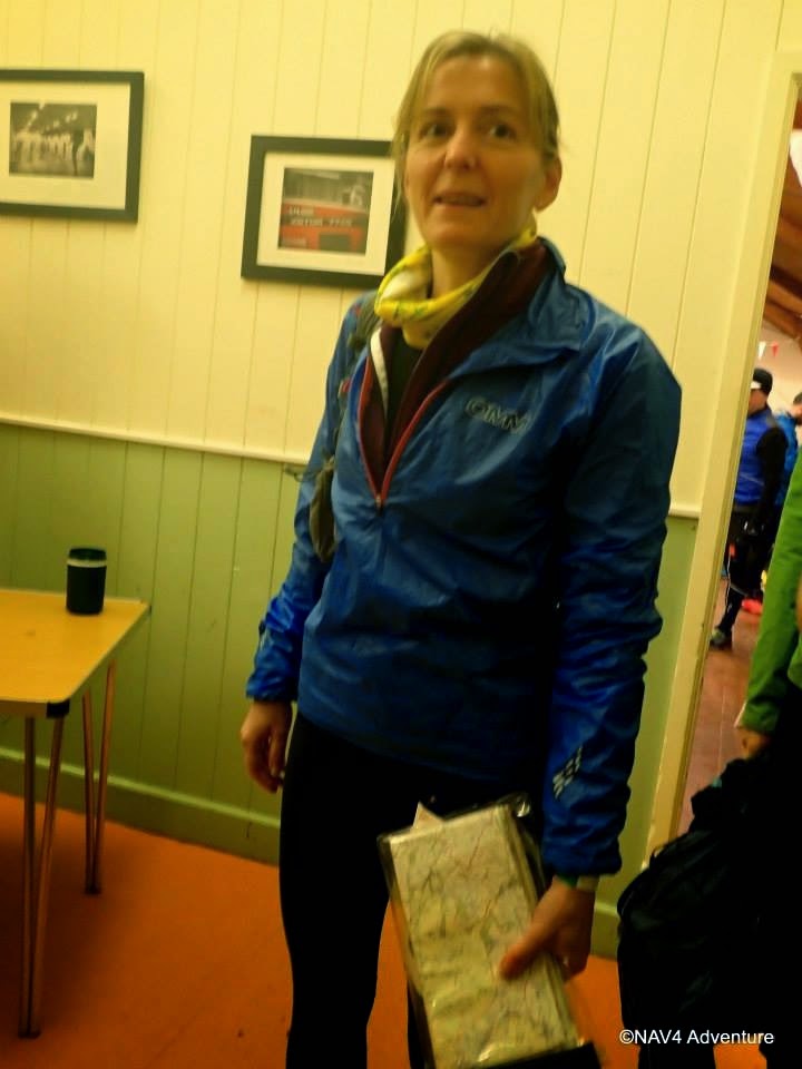
What the hell is that in your hand Zoe? Who do you think you are?
At the start...
Santa's little helper at the Swart Back bridge on the Sticks Climb
Dibbing at Swart Beck - almost sunny - a TdeH first!
Santa (John Bamber) and his elf (Stu Smith) - thanks for the pics guys. Lovely
to see John on the way up to Grisedale Tarn - Zoe thought the beard was part of
a Santa outfit!
Back at the shack. We ran in the last three miles fairly hard hence the pose!


Tuesday, 21 October 2014

100 Miles Sud de France - 10/10/2014

Running down into Pyrenees 200 an hour into the event
For this year's foreign race I picked the new 100 Miles Sud de France race. It's got a very simple premise. Start at the French Athletics Federation's altitude training base at Font-Romeu (that's where Paula Radcliffe lives) and run east along the GR10 trail to the sea. Nice.

My aim was to run with Zoe at a very comfortable pace with a view to getting some tough miles in before the Spine. We'd be relaxed about it and just see how far we could get.

The first 20km were fairly standard for a continental race, nice easy trails and softish ground which let the 324 runners in the field spread out a bit. We passed the altitude training camp after a mile's steady climb and then it was gently downhill through the resort of Pyrenees 2000 and on more nice trails to reach the Citadel (castle) at Mont-Louis. There we joined the GR10, and a bit of up and down led us to Plan ès, the first feed station. To be honest the food at intermediate checkpoints was very disappointing with just a few cakes and so on, and we ended up relying almost wholly on what we were carrying.

Planès marked the start of the mountainous ground. We slowed to a steady walk and started the warm-up climb. This two-parter took us up 400m to a traversing path at the 1,900m level which went along one side of a valley through very rough and boggy pasture and past a heard of cows. We crossed the river and passed an informal aid station at Refuge de Riberola before descending slightly on better ground to 1,600m and the start of the the big climb to Col Mitja. This started easily enough on a good 4x4 track and we spent the time chatting away to a lovely gentleman from Brittany. Just before dark (so about 4.5 hours in) it started to rain. I guessed from those around us that it might be quite heavy and so we put our cags on and continued up into gathering gloom. After a long climb (the top's at about 2,360m, so there was 960m of ascent here) we were heartened by a small group of local supporters who were whooping and banging drums up on the col.

I was pleased I wasn't hanging about up there as we ran steadily down a rough track into the next valley. I felt a little cold, especially as I was waiting for Zoe occasionally as she descends a little more tentatively than me in the dark. Anyway we were soon down at the Refuge de Ras de Carança, where we were able to get inside out of the rain and put our power stretch fleeces on. There was a little food here (although it was only advertised as a water point) and we got some cheesy biscuits and some Genoa cake down as we hiked on.

The next section was a flattish but very rough yomp on sometimes indistinct paths through trees to reach the foot of the climb to Col de Pal. Bottom to top this was a bit less severe than Mitja, with 470m of ascent. At the top of the col there was another group of supporters, so we thanked them and passed on up - this is one of several places where the GR10 climbs to a col and then carries on at high level, sometimes climbing, across a hillside to cross a ridge. The path was good again here and we had soon crossed Serre de Caret and were descending steeply towards the valley. We weren't making great time as Zoe again struggled with the terrain in the darkness. The descent became less steep as we neared the valley bottom and turned to do the final 3 km to the checkpoint at Mantet. As we crossed the river we stopped to take off our cags. The village seemed quite a long way away up the next hill but in reality we were passing the first building in five minutes. We stopped for a moment to photograph a striking black and yellow lizard which we found in the lane. It must have been cold - certainly the lizard didn't seem up for any rapid movements.

The Mantet checkpoint was another where there was supposed to be food, but again there was really only cake and biscuits. Beggars can't be choosers though. We pushed on and started the short climb (250m or so) to the Coll de Mentet. This seemed to zigzag a lot more than on the race map, and dragged on even though we were going quite well again. At the top we passed a marshall and started down a series of tricky paths which repeatedly (and sometimes slightly confusingly) crossed the road, before we finally joined the tarmac for the last few hundred metres to the "Base Vie" (main aid station) in the village of Py. This was at 43.5km and we'd already done 2,220m of ascent (D+) and 2,970m of descent (D-). I checked the cut-off on arrival and we were told 3:30am - "good", I thought, "we've plenty of time to regroup".

We took a while to strip off wet stuff and change socks etc. I dressed my foot as I had a blister (probably from some gravel - otherwise my RaceUltras were supremely comfortable and surprisingly grippy). We ate a bowl of plain penne with a little cheese and had some noodle soup. Yet again though there were no hot drinks. I was seriously in need of a tea or coffee... We were suddenly brought round as the checkpoint lady told us there was ten minutes to the exit cut-off. This was now 3am! I'm not sure how this happened, but basically we had to get the hell out of Dodge without the brief snooze I'd been looking forward to.

We got out PDQ and started the next section, climbing onto and over a ridge on very rough tracks and then picking up a good 4x4 track to climb the final 2km to the Marailles Refuge. I was out on my feet at this stage, falling asleep whilst still walking (or staggering) upwards. Zoe snapped me back round a few times and eventually I popped a Pro Plus and checked the map. Nearly there, so I just kept plodding. There was a Gendarmerie van at the top (quick scan of the chip in our numbers) but more importantly the refuge was very close by. We got in there but I was too tired to eat. Zoe sat in front of a roaring open fire while I went upstairs and lay down for fifteen minutes. I don't think I slept but I did close my eyes and get off my feet for fifteen minutes which helped.

We grabbed a cup of bouillon each and then started off towards the next checkpoint. Pretty much straight away we were on a rising traversing path which alternately crossed boulder fields and then went through sections with lots of wet tree routes and rocks sticking up from the surface. It was impossible to make quick progress. The gradient eased but even on the level we were doing well to make 3-4 km/h. It got light as we crossed a river barely 4km on from the refuge, having been moving for well over an hour.

We then followed the GR10 on a contouring path around the west side of Pic Canigou. The path was up and down, mostly on either very rocky ground or across boulder field, for the next 5km before dropping down in a beautiful but extremely rough corrie. I had another sleepy spell here and had to resort to another Pro Plus in the absence of any other caffeine source. We made slow but steady progress, leapfrogging a nice French guy who was quicker than us on the flat bits and downhills but much slower on the climbs. Eventually we walked onto a decent 4x4 track and reached the Bonne Aigue checkpoint, just as the morning sunshine hit it. We didn't stop.

On from here there was a steep climb up a ridge to regain the height lost down the corrie. I was going well now and set the pace, leading Zoe and the French dude on up. At just above the 2,000m contour we turned and began to traverse right handed again, on familiarly poor ground, eventually reaching a point where we could see a small lake and the French Alpine Club hut at Cortalets in front of us. We'd discussed the time situation on the way over but felt we should press on in the hope the ground would become easier and we could make the cut-off at the next Base Vie at Arles-sur-Tech. I texted our friends who were supporting us to let them know we would be later than anticipated but were still going.

Fifteen minutes later we arrived at the checkpoint. The staff told us we were the last in the race (actually I knew there was at least one guy behind us). There must have been a lot drop out behind us already as we hadn't been passed by many and there were lots behind us descending to Mantet, but maybe they'd fallen foul of the moveable Py cut-off? The staff were keen for us to drop here, promising transport to the finish would be leaving shortly.

I had a brief chat with Zoe. She wasn't really enjoying the terrain and was afraid that we would not be able to do the 22km to Arles in the 4.5 hours we had available before the Arles cut-off and have a meaningful rest / refuel when we got there. I couldn't really see the point of flogging ourselves down to Arles. It was 2,000m of descent more to put in our legs, and we probably wouldn't be in a state to continue even if we got in and out of the checkpoint in time. I could probably have speeded up a fair bit if I'd gone on alone, but I didn't want to abandon Zoe (I'm the French speaker) and so we decided to drop together. We'd covered 66km (4,000m D+ and 3,630m D-) in around 21 hours. Little more than 3km/h, but then that's perfect practise for the Spine Race! What's more there were a lot of positives to take from the event and no real negatives - I'd be able to train again almost immediately, rather than suffering the usual post-hundred 6 week layoff.

There was a bit of a cock up with vehicles etc., and in fact we would probably have been better to run out to Arles as we had to wait nearly four hours for a lift to Argeles, but otherwise the event was well organised and I would come again. Any miscalculation was mine in underestimating the difficulty of the terrain and the effect that would have on Zoe's pace...

We had a great time in France thanks to Keith and Pauline (Mercia stalwarts) who moved out to Foix in Spring and opened their house to us for the week, also supporting us on the event.


Friday, 2 August 2013

Hornindal Rundt - 06/07/2013

Looking fairly composed five minutes before the start!
The advance publicity for this race offered a "38 km fjelløp. 2 900 høgdemeter!" and a "75 km ultrafjelløp. 5 600 høgdemeter". I don't think a lot of translation is required but a fjelløp can be roughly equated to a fell race. I found the event on the UTMB qualifying events list (not so much because I wanted to gain UTMB points but because it's a great way to find events), and entered early this year. The main event of the "season" was the LDWA 100 and this was six weeks later, so I figured there would probably be enough recovery time to get it sufficiently together for a big fell ultra. After all I'd done Brecon 40 and the Tour de Hellvellyn, both at 40 miles and about 10,000' feet of clibing, not to mention last year's CCC at 56 miles and 19,000' so 45 miles and 18,500' should be do-able, right?

I organised to travel over on the Thursday to give Friday to settle in / recover and reccie a small section of the route, then race on Saturday, recover on Sunday and travel home on Monday.

It all went fairly straightforwardly and I arrived in Grodås (the main village in the valley of Hornindal) as planned on Thursday night, and spent Friday doing a gentle reccie of the final section of the 75km full round and registering then attending the race briefing.

Saturday morning dawned dry and hot and we all gathered at the start. There was a delay while some chips which had been wrongly programmed were cleared, but at 09:20 we were off.

The first section headed out of town along a road  before an undulating bit of forest road.
Five minutes in, on the road out of Grodås
Right after the first checkpoint though it ramped right up and a steep rough path led up through the forest to about 2,000' where we came out onto open fell (fjell?). Looking back there was a great view to Hornindalvatnet, Europe's deepest lake
Climbing Middagsfjellert, about 650m up
A more steadily graded section (but still rough underfoot) led to our first summit of the day.
Summit of Middagsfjellert
From the top the descent was initially fairly similar to Scottish fell running conditions, fairly soft underfuut, but rough with lots of rocks and peat hags, but it soon steepened. The next section dropped about 500m steeply down on a very rough, narrow trail which was rocky at times. Pretty soon we were down in the valley and running a 1km out and back to CP3 on an easy forest road. I took the opportunity to walk for a few hundred metres, rehydrate and eat a cereal bar. Another section of forest road took us gently up past some lovely hay meadows towards CP4.
An easier section, the gravel road near Grothaugen between CP3 and CP4
Norwegian barn at Grothaugen. This was the easiest going for 25km.
After CP4 we started the climb that would eventually lead to the high point of the race at Gulkoppen. The first section was a steep climb up through woods to reach a large wet meadow and aother short haul up under power lines to get on the west ridge of the Saetrehornet.
Doesn't look too bad up the power lines onto the west ridge of the Saetrehornet,
but this was rough ground and a faint track which was boggy where it wasn't rocky.
Just onto the Saetrehornet ridge, looking back
I made a bad mistake on the ridge - I was in a fair sized group and I knew there was a checkpoint coming up but I just assumed that I'd see it as everyone stopped to make sure their electonic tallies had registered. Head down and climbing hard I must have gone straight past CP5.
Climbing the Saetrehornet, just after I'd missed CP5. I went up almost as far
as the peak on the right before I realised and double backed.
I continued on for about twenty minutes, covering about 1.5km and 200m more climbing before I realised that I must have missed it. A quick chat with a fellow competitor confirmed that I'd gone past it, so I had the heartbreaking job of running downhill past maybe fifty competitors to get back to the checkpoint and register my tally. I then started back up and had tob try to forget about it. I lost 35 minutes in the end, and probably went a bit too fast on the re-ascent too - never get angry on an ultra, it can lead to some really bad decisions. Anyway I got it back together and went fairly well up to CP6, taking back a few of the many places I'd lost...
Small snowfield just below the 1102m summit of Størehornet.
CP6 at the summit of Størehornet with Niels.
Niels kindly took a picture for me.
At CP6 I took a few pictures and while I was doing that weighed up how things were going. I'd probably gone too quickly up the climb and I was blowing quite hard with my heart racing. I was concerned I wasn't recovering as normal, so despite a brief stop my HR wasn't dropping much. I decided to take it easy and make sure I enjoyed the next few legs and see how things went. Taking it easy wasn't particularly straightforward on the next leg - the last stage of the massive 1,100m climb to Gulkoppen. We could see the snowfield that unlocked the approach to the summit with many tiny figures climbing up it. As we got nearer we passed a guy from the local mountain rescue all kitted up ready with a stretcher! I took a bit of care on the snowfield, which was very steep in the centre section... We were soon up it though and a short jog along the ridge led to the summit.
Tiny figures climbing the final snowfield on the way up Gulkoppen

On the snowfield, this was steeper than it looks!
The gradient on the top section of the snowfield did ease off somewhat!
Checkpoint at the summit of Gulkoppen (1,304m) - the end of a continuous
3,600' climb.
The descent from Gulkoppen was almost as big as the climb, initially with huge open vistas across boilerplate rocks and small snowfields to the peaks in the distance. I went down at a reasonable pace to start with, speeding up and passing people as the oack and snow gave way to mud and bilberries and then to scrubby woodland. There were two out and back sections in Knutsdalen, first downhill through the open birchwood to CP7 at Holskardsaetra. There was a good crowd here and a nice vibe, but I only stopped for long enough to register my tally.
The start of the descent from Gulkoppen gives an idea of the vastness of
these landscapes. 
High mountain lake Holskardvatnet with Holskardhornet (1,247m) behind
Back up past the waterfalls to the end of the out-and-back and I noted a lot of dumped rucksacs which seemed a bit unfair - if you're asked to carry kit to my mind you carry it all the way round. Anyway the route now climbed quite steeply up to the next chackpoint on the Daurmålhornet. The total ascent was only about 300m (the smallest on the whole route) but I felt absolutely spent here and couldn't manage anything more than a slow walk up the hill. It wasn't even that steep or particularly rough by the standards of this route anyway. The Daurmålhornet (890m) is a rocky plateau rally. We crossed the northern edge of it, clipping at the checkpoint by the cairn.

The next leg took us down 120m to another out-and-back, this time starting with an uphill section over rough moor and boulderfields to a cabin by the picturesque lake at Kupa. I was tired but managed to run much of this, drinking loads of clear cold water from the river near the lake outlet and taking five minutes to sit in the shade on the hut's veranda and eat a KitKat and a gel.

We now had a 280m descent over the next 2.6km through scrub and bog to reach a lovely wooden bridge over the river in the bottom of Knutsdalen. I swapped places with a nice local lady who I'd been with on the climb to Daurmålhornet a few times over this section. Finally at about 28.5km we hit the first bit of forest road in 15km. Another 300m and we were at the first manned checkpoint (A), Sandgrova, just a cluster of cabins and a rather disinterested marshall (he may have had a mechanical on his car because his head was under the bonnet - I'm not sure how he logged my time but he did).

Looking up Knutsdalen with peaks in the 1,300m to 1,500m range
Hornindalsrokken from just above manned checkpoint A, with some
 typical race terrain in the foreground.
From Sandgrova the climb up to the next CP was just unbelievable. It started fairly steadily, but ramped up until the slope of the ground around us must have been close to 45°. Even the map shows a section of about 300m horizontally where the climb is 200m vertically. All I could do was grind out 50m or so of climbing then stop and rest for half a minute, then do it all over again, still having problems con. Towards the top I caught up a guy called Mattias and we chatted which helped pass the remainder of the climb. There was a local lad called Rolf with us there too - he couldn't have been any older than 17 and was doing great. The checkpoint was on the top of a hill called Muldsvorhornet.

Crossing the river in Knutsdalen
On the summit of Moldsvorhornet, looking to Hornindalsrokken
Rolf and Mathias at Moldsvorhornet


By now I had decided that given my difficulty with the climbing I'd call it a day at the halfway point rather than risk having problems late on in the event on the exposed section of mountain terrain around Hogenibba where there would be the least amount of light (the Norwegians call the peculiar light when dusk merges into dawn "the grey light"). So having made that decision there was only one thing to do coming off the final summit - belt it down. I had a pretty good descent, taking aorund ten minutes off the competitors who were with me at the top in 4.3km. I reached my final checkpoint at Horndøla bru at 18:08 for a total time of 8:48. I'd done 41km and 3,100m of climbing (25.5 miles and 10,200').

Little Saetra with typical old time huts above upper Hornindal


All done for the day at Horndøla bru


There was hot soup and chocolate milk for the finishers (and for those going on to do the full loop Ultra Fjellop). I got a lift back to Grodas with the Race Organiser and arrived with plenty of time to snack and lounge about, then take pictures of the leading guys finishing the full round. My neighbour in the B&B, Mattias Gärdsback, finished an awesome second and he and his grilfriend Caroline shared dinner with me in the late evening. I popped back out to the finish line to see a few more guys completing the round including another I had chatted to in the B&B before the race, Per-Einar Roth.


Winner, Kristoffer Normark just beyond the end of the final descent

Second place was Mattias Gärdsback, my neighbour in the B&B


I went back in the morning and saw the last finishers come in, three locals, just before the presentation, then had a great afternoon out on the hills which form the last quarter of the full course.


Final finishers, Stian Løkken, Anne Raftevold, and Inger Margerthe Nordskov
after 25 hours 50 minutes out on the 75km course

Brilliant race organisers!

Men's podium

I'll definitely be back to complete the full round.

Lessons learned

I struggled with hydration, drinking a lot of water (all from streams and rivers on route) but I think my salts got out of balance a bit. I forgot to take any salt tablets with me and only managed to buy some Ritz biscuits as a substitute. Although I ate several at one point I don't think they really were as good!
I also didn't really take account of how I was feeling early enough and went too hard on the first climb and descent when I lready felt I was struggling.

And finally I do really need to sort out my health issue which may be underlying the odd off day when I can't seem to control my HR. That's twice I've had a problem, once on the CCC which I put down mostly to being mildly hypothermic but I had very similar problems at Hornindal - maybe it's when there's additional stress (heat, dehydration / salt depletion) as well as the normal ultra running issues.

I did have a great day, and actually a great trip with good runs the day before and after the race too, and a fairly smooth journey in each direction. More details of the race are at: http://www.hornindalrundt.no/

Monday, 15 July 2013

Three Rings of Shap 100k - 15 and 16/06/2013


Image0095
Near the summit of Branstree, above Haweswater
I'd heard about the Three Rings of Shap 100k challenge walk from my friend Roger Lloyd, who'd completed two of the rings in 2011. When Zoe and I discussed the Hundred and she said she'd quite fancy doing it next year (that's not exactly what she said in fairness but never mind...) I checked the entry requirements for next year's Hundred and the first available qualifier was the Three Rings. Given that the others were all on flatter terrain which I might find a little less interesting, and that they were all at the "soft" distance of 50 miles, we decided a week after the Hundred to go for the Three Rings of Shap. You can never say whether you're going to be able to do a Hundred, but 100k to 100 miles is a considerably smaller step up than 50 miles to 100k.

Having registered so close to the event (less than two weeks to go) we didn't have much time for prep other than to book a hotel (the Shap Wells Hotel a few miles away) for the night before and the night after, and to copy A4 maps from my 1:25k OS maps, mark them up, and print the route sheets.

So after a comfy night's sleep, we popped into the Shap Memorial Hall to register (all of one minute to pick up our tallies and let them know we intended to start late) and then back to the hotel for a decent breakfast. We returned to the event centre at about 8:30 and sorted kit, starting at 8:54am.

There were very few behind us (only two runners I think) as we set out on the first ring - a trip out up Wet Sleddale and Mosedale to Branstree and Selside Pike, then down Swindale to Rosgill and back past Shap Abbey to Shap itself. We set a decent rapid walking pace out to the River Lowther and up into Wet Sleddale, climbing above the reservoir with Zoe looking very much the part and doing a lot of the nav work.

Image0092
Across a meadow to the farm in Wet Sleddale - they were liming the field beyond the farm

Image0093
Zoe, looking the part and enjoying it (at Mile 4!)

From road above the reservoir we took a track zigzagging past Sleddale Hall which is abandoned but looks like it may be under restoration. Another 3km took us up to the watershed between Wet Sleddale and Mosedale, where we consulted the map and compass for a few moments to check that the indistinct grass path would lead us down to the bridge in Mosedale. We ran the descent and jogged across the bridge and up to Mosedale Cottage (which has been refurbished fairly recently) where we overtook the first walkers from the main start, a family group of five doing just the first ring.

Image0094
Just before Mosedale Cottage (12km)
The climb to Branstree was relatively straightforward, up a stream to a wall and then along the ridge to the top. Except that I got too near the stream at one point and left my right leg in the most gloopy hole full of brown slop imaginable. Anyway we caught another couple of walkers up at the top and from then on it would be a fairly steady stream for the remainder of the first loop.

We headed along the fenceline to Selside Pike where we caught another few walkers up at the top and from then on it would be a fairly steady stream for the remainder of the first loop.

Image0095
View to Haweswater from between Branstree and Selside Pike
Image0096
Summit of Selside Pike (17km)
Image0097
Pair of walkers near the summit of Selside Pike
From Selside Pike we dropped down across Hobgrumble Gill to a short climb onto Nabs Moor, before descending easy slopes to the top of Forces Falls, the point at which Mosedale runs down into Swindale. The descent from here to the valley of Swindale was beautiful, down a rocky ridge adjacent to a series of waterfalls and plunge pools.

Image0100
Beautiful plunge pools on Swindale Beck

Image0102
View down into Swindale

Image0103
Technical descending into Swindale

Image0104
Zoe running the final section of the descent
A short run along the edge of the beck through moraine led to a lane which turned into the road and led to the first checkpoint at Truss Gap. In a barn by the road were a couple of the Cumbria LDWA stalwarts, logging time, clipping tallies and dispensing superb baked goods. Two currant slices and a piece of cherry cake later and we were on our way up a gentle traversing path to climb above Swindale, passing a farm at Rayside and then recrossing Swindale Beck before joining the road over the River Lowther into Rosgill.

We snuck through a footpath next to an almost abandoned cottage to join a lovely grassy path which ran along the break of the escarpment above the River Lowther, passing close by Shap Abbey to reach the village of Keld, and then followed anothe path through fields past the brilliantly-named "Goggleby Stone" back to Shap and the event centre.

Shap Abbey
Having walked and jogged the first 18 miles and 2,600' of climbing in a bit under 5 hours, we took 25 minutes at the checkpoint to regroup. I redressed my foot which was rubbing quite badly, filled our bottle, swapped the maps and route description and we had a cup of tea.

Duly refreshed we set out on the steady eastward climb which would set us on the way around the second "rivers" ring.  (22 min to start of Zoe's track)

This took us up to Hardendale and over Iron Hill into Reagill and then down to eet the River Livennet at Barnskew. I'd never heard of the Livennet before but it drains quite a significant area north of Crosby Rasenworth Fell between the Lowther and the Lune, and the section we followed was a lovey reach of river. About a third of the way along the river (at about the 8 mile point on the leg) we came to the promised water point...

Image0106
World's most primitive checkpoint - good selection of broken digestives in there, but Zoe
grabbed the only malted milk before I had chance to...
I really liked the minimalist and simplistic approach to resupply here. The next section of the route was really pretty, criss-crossing the River Livennet over a series of small bridges.

Image0107
Stepping stones across the Livennet, about the only place we didn't cross!
Eventually we left the banks of the Livennet and passed through the villages of King's Meaburn and Morland before skirting Cliburn (which looked quite pretty on the descent to the bridge). Leaving the second field after Cliburn there was a big boggy patch (one of very few) and Zoe slipped and saved herself from falling using the stile, which unfortunately was wrapped in barbed wire. We stopped for running repairs with the world's tiniest plaster (the only one left in my first aid kit - must replace them when I use them) and some Micropore. Duly patched up we finished this field section, came out via a farm land onto a road, and then had a real draggy section of a bit over 2km to the checkpoint at Great Strickland.

The checkpoint was in the Strickland Arms (well in the back garden actually). This was at 53.5km: I'm quite glad I didn't realise that at the time, it seemed like we'd already gone a fair way - we reached the checkpoint at 18:16 (09:22 elapsed). We stopped for maybe ten minutes while I patched up my feet again, and partook of the excellent selection of savoury snacks (including mini-pasties - a very welcome first time I've seen these on an event). Just as we were getting ready to leave it started to rain, so we cagged up there and then - I thought it might last a while!

Another 2km of roads led us down and across the River Leith (second of the three rivers this Ring is named for) and on to another of those places where we made a minor navigational error, using the wrong "gate by pylon". Zoe and I had passed a couple of groups of walkers on the road and with a bit of shouted communication we soon sorted it out and found the key bridge over the West Coast Main Line. A zigzag under the motorway led us up to the A6 at Hackthorpe. It was raining on and off, and we wanted to get as far as we could back towards Shap before it set in properly, so I avoided the temptation of another pub, and we headed on uphill through a nature reserve-type area, trending left on unmarked paths through deep undergrowth in the hope that this would bring us out in the right place. We actually came out 200m NE of the gate we'd hoped to be at, but fortunately there was another track through the nettles.

We passed through a gate and a short section of woodland into Lowther deer park. As we came down Round Hill towards Lord Greening's Plantation we could see a big herd of deer off to our left. They seemed fairly unconcerned about the string of walkers spread out over their grazing land. A bit of up and down and a long section with woods on our right led us out of the deer park and across fields to High Knipe. Zoe and I were making good progress, mostly powerhiking but with some running too, and we passed quite a lot of participants on this section.

Shortly after High Knipe Farm, on a section of road, we came to the second unmanned checkpoint on this Ring, at 62km. Again there were biscuits and water. We must have overtaken a good few folks because this time there was a reasonable choice of biscuits left including a chocolate chip cookie!
 
From here we dropped down rapidly to the River Lowther, which we crossed on a fairly bouncy suspension footbridge. We turned and ran upstream with the river on out left for a couple of kilometers to reach Bampton Grange, where we crossed the river and heded along the other side to reach Rosgill - the only point we'd pass twice during the Three Rings.

We passed the cottage we'd been past on the first Ring, then made a second, more serious navigational error, turning left too soon (following someone else who'd done the same thing - never assume the folk in front know where they're going). We sorted it out after a couple of minutes with the map and hopping over two barbed wire fences, continuing uphill towards Shap in increasingly heavy rain. By the top of the next hill it was pouring, and we could see the chap who'd gone too far left was now away over to the right of the route in a field containing the almost aptly-named Thunder Stone. We shouted him, but I don't think he could hear over the rain.

Crossing the lane we made a diagonal beeline across three fields of very wet long pasture which finished off soaking my feet and made sure the repair work I'd done at Strickland would need re-doing at Shap. We followed the Ring One route into Shap from the end of the fields and reached the Hall (70km) at 21:12 (12:18 elapsed time). There weren't too many in the hall this time and we realised quite a few of those there we packing up to go home after two Rings.

We took way too long at the checkpoint really, but I re-dressed my feet from scratch and put new socks and fresh insoles in my shoes to try to keep feet dry for a while. We both ate some proper food too, and changes into a totally fresh set of (dry) clothes. I changed cag from my racing jacket which isn't really ideal for long trips into my mountain jacket which is much better for nights out. We left the hall at dusk, I guess just before 22:00 as the fastest runners were starting to come back in off Ring 3. I was quite pleased to see we hadn't actually been lapped! But I kept remembering the aim here was to ensure Zoe finished and qualified for the 2014 Hundred, and to do so I just needed to keep myself in one piece. So we would be doing relatively little running on the night section!

We started, still in heavy rain, up across the railway and along a stony lane into fields, climbing diagonally to reach a footbridge over the M6. From there we walked through rough fields along the east side of the motorway before I made yet another navigational error and this time decided not to follow the pair in front, but to climb left. Unfortunately it was a hundred yards too soon and we had to drop back down and try again in the next field.

At the top of this climb we crossed the haul road for Hardendale Quarry then followed another haul road down to the hamlet of Oddendale. By now we'd caught up the pair in front, Tony Natale and Andy Carpenter. We passed them on the next section, a long track on a green road gently uphill towards an enclosure called "Potrigg". Just after this we were supposed to fork left, and did so a little too late in the very last vestiges of twilight. Fortunately Tony and Andy shouted us. We then found and followed a nice line across Crosby Ravensworth Fell to reach a critical wall corner. From here the navigation would be straightforward, keeping a wall on our left for 2km as we made a crcuit of the headwaters of the River Livennet.

We then crossed another kilometer of open ground to meet the Orton - Crosby Rasenworth road. I think we were supposed to go straight over here and up past a plantation between this road and the Appleby to Orton road, but we missed it and ended up following the first road uphill to the junction of the two. By now Tony and Andy were in front of us again, and we duly caught and passed them again on the climb to Beacon Hill. We worked together to identify the gate to leave the fell through and dropped down across some fairly indistinct ground into the first of the limestone pavement landscape to try to find the entrance to Great Asby Scar National Nature Reserve.

Once in the reserve we followed a track which curved left after a little while. I'd noted we didn't want to go left when I went through the maps before the event, but went left anyway for some reason. Again Tony and Andy came to the rescue. The rest of the route through the Nature Reserve was straightforward though, and we were fairly soon out onto a farm track which became the road leading to the final manned checkpoint of the event, at Great Asby (86km, arrived at 01:22, time elapsed 16:30).

The checkpoint was brilliant, a gazebo with side panels (is that a tent then?) and a gas heater in the corner of a field. The malt loaf and chees was even better. We stopped ten minutes, and then headed out, passing several other participants on the road down towards Great Asby. These would be the last folks we'd overtake except for Tony and Andy (again!). We hiked up a long farm lane past the entrance to Halligill Farm, and promptly I got confused again on another tricky section. I set a bearing to follow the line of the path marked on the OS, and we ended up in the middle of nowhere at a brand new fence. A hunt around revealed no sign of any stiles. Zoe caught sight of Tony and Andy's headtorches down to the left, and we now realised they'd done the route before, so we made a beeline for them, and caught them up once more in the vivinity of Gaythorne Hall.

We walked together for a while up to a road junction on Coalpit Hill (wonder what they used to do there?) and then down the byway to Bank Head Farm, before we jogged on ahead down into a very sleepy Crosby Ravensworth village. It was now about 3am and just starting to get light as we trotted through the village. The next section was a long slog up a pretty little valley, first on a lane, then on green tracks through fields. We could see Tony and Andy's headtorches some way behind. My torch was off now except to look at the instructions. Zoe was very tired on this section, not so much physically, more just in terms of feeling she needed to sleep. I couldn't persuade her to eat anything or take a ProPlus either. Anyway she rallied as we reached Oddendale. It was her only bad patch really.

From here on back it was a case (largely) of following the outward route, along the quarry road and then around Hardendale Nab, with a slightly different route taking us north of the house at The Nab and down through fields to the motorway bridge. There were some pretty inquisitive horses in the first field and Zoe was a bit worried by them, so we jogged down to the motorway. After the bridge the last two kilometres back into Shap were fairly plain sailing. We arrived back at the Hall at 04:29, 19 hours and 32 minutes after we had started. I have the total distance from GPS as 103.3km.

The hall was almost deserted - there had only been one finisher since 3am. We were checked in and very well looked after with hot quiche making a really satisfacory breakfast! Tony and Andy came in three minutes after us and we were finally able to have a decent chat, having swapped places several times en route. After a while we gathered our stuff together and headed back to the Shap Wells Hotel to get some sleep.

I was pretty satsfied with this event. There wasn't any way our time was likely to set the world on fire, me three weeks after a hundred miler and with sore feet, and Zoe on her first event over 50km. But we finished joint 35th out of 89 starters and 55 finishers, and we achieved the objective of getting Zoe qualified for the Hundred. Not only that but we'd had a great and very varied big day's running and walking and really enjoyed it together.